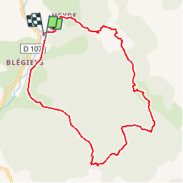
![](/images/other/stat-length.png)
![Tocht Stappen Prads-Haute-Bléone - Heyre et environs - Photo](https://media.geolcdn.com/t/1900/400/ext.pjpeg?maxdim=2&url=https%3A%2F%2Fstatic1.geolcdn.com%2Fsiteimages%2Fupload%2Ffiles%2F1553511878bg_sport_marche.png)
Heyre et environs
y39c43l
Gebruiker
![Lengte](/images/other/stat-length.png)
![Max. hoogte](https://static1.geolcdn.com/siteimages/upload/files/1508320355ic_sort_altitude_max_24dp.png)
![Positief hoogteverschil](https://static1.geolcdn.com/siteimages/upload/files/1508320355ic_sort_den_pos_24dp.png)
![Km-Effort](/images/other/stat-length.png)
![Min. hoogte](https://static1.geolcdn.com/siteimages/upload/files/1508320355ic_sort_altitude_min_24dp.png)
![Negatief hoogteverschil](https://static1.geolcdn.com/siteimages/upload/files/1508320355ic_sort_den_neg_24dp.png)
![Boucle](https://static1.geolcdn.com/siteimages/upload/files/16400158638029165_repeat_loop_refresh_sync_direction_icon.png)
![Stappen](https://static1.geolcdn.com/sitytour/trail-icons/101.png)
4h10
Moeilijkheid : Moeilijk
![Scan deze QR-code om de tocht te openen in de SityTrail-applicatie](https://capi.geolives.com/qq0zvz2zws4bq2lad0pu/sitytour/trails/861688/qr.png?size=200)
Gratisgps-wandelapplicatie
Over ons
Tocht Stappen van 10,4 km beschikbaar op Provence-Alpes-Côte d'Azur, Alpes-de-Haute-Provence, Prads-Haute-Bléone. Deze tocht wordt voorgesteld door y39c43l.
Beschrijving
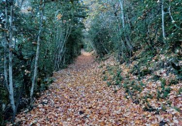
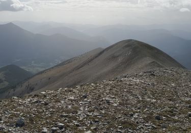
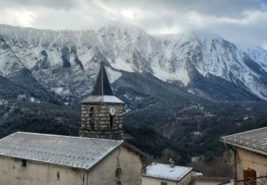
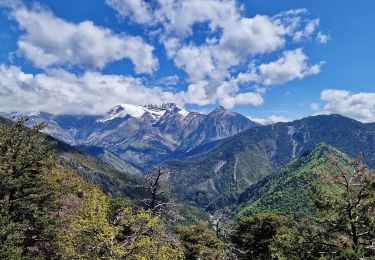
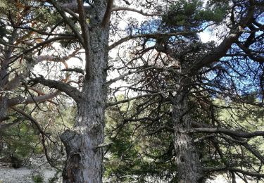
Début de rando sur le dentier Marcel, berger qui décrit sa vie entre les deux guerres. Prolongement par sentier balisé jaune ( endroits peu marqués... ouvrir l’œil!) avec pentes raides, passage avec les mains. Belles vues sur la vallée de Bléone, montagne de Boule Cheval Blanc etc... Pour randonneurs avertis
Plaatsbepaling
Opmerkingen
Wandeltochten in de omgeving
![Tocht Stappen Prads-Haute-Bléone - LA JAVIE , refuge de la Ceriege . S Pierre o n - Photo](https://media.geolcdn.com/t/375/260/c934b9bd-78c9-4a8e-9cc4-7f90d77fa006.jpg&format=jpg&maxdim=2)
![Stappen Stappen](https://static1.geolcdn.com/sitytour/trail-icons/101.png)
Stappen
![](/images/other/stat-length.png)
![](https://static1.geolcdn.com/siteimages/upload/files/16400158638029165_repeat_loop_refresh_sync_direction_icon.png)
![Tocht Stappen Prads-Haute-Bléone - Sentier MARCEL -Boucle 6.4Km) - Photo](https://media.geolcdn.com/t/375/260/ext.jpg?maxdim=2&url=https%3A%2F%2Fstatic1.geolcdn.com%2Fsiteimages%2Fupload%2Ffiles%2F1553511878bg_sport_marche.png)
![Stappen Stappen](https://static1.geolcdn.com/sitytour/trail-icons/101.png)
Stappen
![](/images/other/stat-length.png)
![](https://static1.geolcdn.com/siteimages/upload/files/16400158638029165_repeat_loop_refresh_sync_direction_icon.png)
![Tocht Stappen Prads-Haute-Bléone - Chavailles col du talon mourre frey 1106m 13kms - Photo](https://media.geolcdn.com/t/375/260/140c1b18-7321-43b4-a1fa-abc8373ac657.jpg&format=jpg&maxdim=2)
![Stappen Stappen](https://static1.geolcdn.com/sitytour/trail-icons/101.png)
Stappen
![](/images/other/stat-length.png)
![](https://static1.geolcdn.com/siteimages/upload/files/16400158638029165_repeat_loop_refresh_sync_direction_icon.png)
![Tocht Stappen Prads-Haute-Bléone - Prads-Haute-Bléone heyre chavailles 17k 950m - Photo](https://media.geolcdn.com/t/375/260/50bb1eed-d9a1-4961-a8c7-2ec2dd0405ac.jpg&format=jpg&maxdim=2)
![Stappen Stappen](https://static1.geolcdn.com/sitytour/trail-icons/101.png)
Stappen
![](/images/other/stat-length.png)
![](https://static1.geolcdn.com/siteimages/upload/files/16400158638029165_repeat_loop_refresh_sync_direction_icon.png)
![Tocht Stappen Prads-Haute-Bléone - ON STAPE LE CARTON - Photo](https://media.geolcdn.com/t/375/260/ae7e136f-ff91-4a16-a370-f64d1634afd6.jpg&format=jpg&maxdim=2)
![Stappen Stappen](https://static1.geolcdn.com/sitytour/trail-icons/101.png)
Stappen
![](/images/other/stat-length.png)
![](https://static1.geolcdn.com/siteimages/upload/files/16400158638029165_repeat_loop_refresh_sync_direction_icon.png)
![Tocht Stappen Beaujeu - Sommet Barre des Tremblès Via St Pierre - Photo](https://media.geolcdn.com/t/375/260/f7b3d6d8-88a1-4954-99d9-8e174bc2ae56.jpg&format=jpg&maxdim=2)
![Stappen Stappen](https://static1.geolcdn.com/sitytour/trail-icons/101.png)
Stappen
![](/images/other/stat-length.png)
![](https://static1.geolcdn.com/siteimages/upload/files/16400158638029165_repeat_loop_refresh_sync_direction_icon.png)
![Tocht Stappen Prads-Haute-Bléone - Sentier Marcel 2 - Photo](https://media.geolcdn.com/t/375/260/ext.jpg?maxdim=2&url=https%3A%2F%2Fservices.sitytrail.com%2FGeolivesWS%2FDownloadMedia.ashx%3FTrailID%3D861432%26Media%3Dfix__20171112143844.jpg)
![Stappen Stappen](https://static1.geolcdn.com/sitytour/trail-icons/101.png)
Stappen
![](/images/other/stat-length.png)
![](https://static1.geolcdn.com/siteimages/upload/files/16400158638029165_repeat_loop_refresh_sync_direction_icon.png)
![Tocht Stappen Beaujeu - barre des remblés - Photo](https://media.geolcdn.com/t/375/260/ext.jpg?maxdim=2&url=https%3A%2F%2Fstatic1.geolcdn.com%2Fsiteimages%2Fupload%2Ffiles%2F1553511878bg_sport_marche.png)
![Stappen Stappen](https://static1.geolcdn.com/sitytour/trail-icons/101.png)
Stappen
![](/images/other/stat-length.png)
![](https://static1.geolcdn.com/siteimages/upload/files/16400158638029165_repeat_loop_refresh_sync_direction_icon.png)
![Tocht Stappen Prads-Haute-Bléone - col de la Baisse - Photo](https://media.geolcdn.com/t/375/260/823e5782-a946-411a-b822-dd5a927f8dd8.jpg&format=jpg&maxdim=2)
![Stappen Stappen](https://static1.geolcdn.com/sitytour/trail-icons/101.png)
Stappen
![](/images/other/stat-length.png)
![](https://static1.geolcdn.com/siteimages/upload/files/16400158638029165_repeat_loop_refresh_sync_direction_icon.png)