


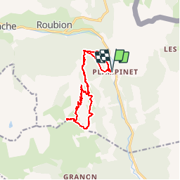

15,5 km | 28 km-effort


Gebruiker


Gratisgps-wandelapplicatie
 SityTrail
IGN / Geografische instituten
SityTrail World
De wereld gaat voor u open
Tocht Stappen van 14,3 km beschikbaar op Provence-Alpes-Côte d'Azur, Hautes-Alpes, Névache. Deze tocht wordt voorgesteld door silvestreclaudine.
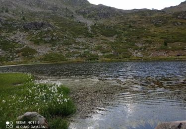
Depart parking de plampinet attention le sentier après le fort de lenlon n'existe pas se diriger vers le petit lac puis descendre vers la bergerie et partir vers la gauche sous les rochers


Stappen

Stappen

Stappen

Stappen

Mountainbike

Stappen

Stappen
Stappen

Stappen