![](/images/other/stat-length.png)
![Tocht Stappen Conques-en-Rouergue - Les Pelies La Vinzelle : boucle rapide - Photo](https://media.geolcdn.com/t/1900/400/ext.pjpeg?maxdim=2&url=https%3A%2F%2Fservices.sitytrail.com%2FGeolivesWS%2FDownloadMedia.ashx%3FTrailID%3D815525%26Media%3D20170822112933.jpg)
Les Pelies La Vinzelle : boucle rapide
lullaby92
Gebruiker
![Lengte](/images/other/stat-length.png)
![Max. hoogte](https://static1.geolcdn.com/siteimages/upload/files/1508320355ic_sort_altitude_max_24dp.png)
![Positief hoogteverschil](https://static1.geolcdn.com/siteimages/upload/files/1508320355ic_sort_den_pos_24dp.png)
![Km-Effort](/images/other/stat-length.png)
![Min. hoogte](https://static1.geolcdn.com/siteimages/upload/files/1508320355ic_sort_altitude_min_24dp.png)
![Negatief hoogteverschil](https://static1.geolcdn.com/siteimages/upload/files/1508320355ic_sort_den_neg_24dp.png)
![Boucle](https://static1.geolcdn.com/siteimages/upload/files/16400158638029165_repeat_loop_refresh_sync_direction_icon.png)
![Stappen](https://static1.geolcdn.com/sitytour/trail-icons/101.png)
3h19
Moeilijkheid : Gemakkelijk
![Scan deze QR-code om de tocht te openen in de SityTrail-applicatie](https://capi.geolives.com/qq0zvz2zws4bq2lad0pu/sitytour/trails/815525/qr.png?size=200)
Gratisgps-wandelapplicatie
Over ons
Tocht Stappen van 5,4 km beschikbaar op Occitanië, Aveyron, Conques-en-Rouergue. Deze tocht wordt voorgesteld door lullaby92.
Beschrijving
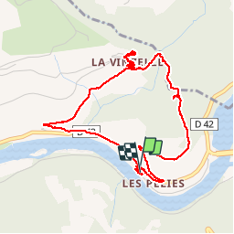
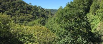
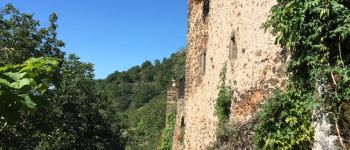
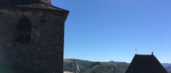
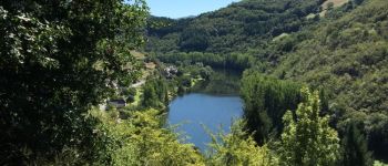
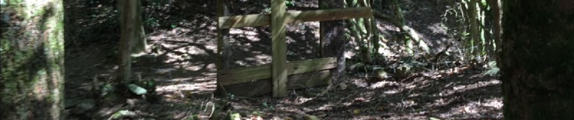
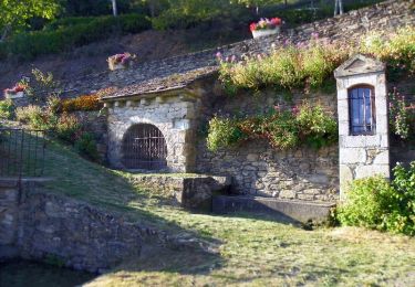
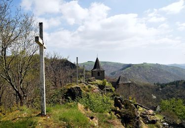
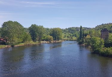
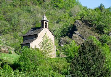
On part du manoir des Pelies , chambre d hôtes et on monte rapidement sur la gauche à travers des prairies a moutons puis des bois de châtaigniers par un tres joli sentier avec vues sur le Lot à flanc de coteau . Au sommet de la montée on redescend à travers bois jusqu'à une Riviere avec quelques petites cascades et vue sur le Clocher de La Vinzelle et sur un vallon qui descend jusqu au Lot auparavant . Par un dernier sentier assez raide on arrive à La Vinzelle tres pittoresque village à 400 m avec maisons à toits de Lauzes et une église avec un original clocher deporté . Magnifiques vues sur les collines prairies et. La Vallee du Lot . Durée 2h agrément 4 étoiles
Plaatsbepaling
Opmerkingen
Wandeltochten in de omgeving
![Tocht Stappen Conques-en-Rouergue - La Vinzelle - Grand Vabre - Photo](https://media.geolcdn.com/t/375/260/ext.jpg?maxdim=2&url=https%3A%2F%2Fservices.sitytrail.com%2FGeolivesWS%2FDownloadMedia.ashx%3FTrailID%3D107259%26Media%3D12139_6.jpg)
![Stappen Stappen](https://static1.geolcdn.com/sitytour/trail-icons/101.png)
Stappen
![](/images/other/stat-length.png)
![](https://static1.geolcdn.com/siteimages/upload/files/16400158638029165_repeat_loop_refresh_sync_direction_icon.png)
![Tocht Te voet Conques-en-Rouergue - TerraTrail 7 - Photo](https://media.geolcdn.com/t/375/260/a3c72d09-9e84-4bb5-99d1-f393f2772e29.jpeg&format=jpg&maxdim=2)
![Te voet Te voet](https://static1.geolcdn.com/sitytour/trail-icons/100.png)
Te voet
![](/images/other/stat-length.png)
![](https://static1.geolcdn.com/siteimages/upload/files/16400158638029165_repeat_loop_refresh_sync_direction_icon.png)
![Tocht Te voet Conques-en-Rouergue - Terra trail 10 - Photo](https://media.geolcdn.com/t/375/260/c1627d11-6231-43ca-9a1f-6c8b11a3fcd5.jpeg&format=jpg&maxdim=2)
![Te voet Te voet](https://static1.geolcdn.com/sitytour/trail-icons/100.png)
Te voet
![](/images/other/stat-length.png)
![](https://static1.geolcdn.com/siteimages/upload/files/16400158638029165_repeat_loop_refresh_sync_direction_icon.png)
![Tocht Stappen Conques-en-Rouergue - Conques Levinhac le Haut Avril 2018 - Photo](https://media.geolcdn.com/t/375/260/ext.jpg?maxdim=2&url=https%3A%2F%2Fservices.sitytrail.com%2FGeolivesWS%2FDownloadMedia.ashx%3FTrailID%3D954999%26Media%3Dfix__20180426142306.jpg)
![Stappen Stappen](https://static1.geolcdn.com/sitytour/trail-icons/101.png)
Stappen
![](/images/other/stat-length.png)
![](https://static1.geolcdn.com/siteimages/upload/files/16400158638029165_repeat_loop_refresh_sync_direction_icon.png)
![Tocht Stappen Conques-en-Rouergue - Conques - Photo](https://media.geolcdn.com/t/375/260/b1ba52c1-bc17-4a66-9751-be2d2d70e0b7.jpg&format=jpg&maxdim=2)
![Stappen Stappen](https://static1.geolcdn.com/sitytour/trail-icons/101.png)
Stappen
![](/images/other/stat-length.png)
![](https://static1.geolcdn.com/siteimages/upload/files/16400158638029165_repeat_loop_refresh_sync_direction_icon.png)
![Tocht Te voet Conques-en-Rouergue - Sentier Conques - Grand-Vabre - Photo](https://media.geolcdn.com/t/375/260/54393b8a-3c65-496a-ad24-69e3b20f1258.jpeg&format=jpg&maxdim=2)
![Te voet Te voet](https://static1.geolcdn.com/sitytour/trail-icons/100.png)
Te voet
![](/images/other/stat-length.png)
![](https://static1.geolcdn.com/siteimages/upload/files/16400158638029165_repeat_loop_refresh_sync_direction_icon.png)
![Tocht Te voet Conques-en-Rouergue - Tieulet - Photo](https://media.geolcdn.com/t/375/260/81ea3ff4-8db3-4406-ab2f-734b1935602f.jpeg&format=jpg&maxdim=2)
![Te voet Te voet](https://static1.geolcdn.com/sitytour/trail-icons/100.png)
Te voet
![](/images/other/stat-length.png)
![](https://static1.geolcdn.com/siteimages/upload/files/16400158638029165_repeat_loop_refresh_sync_direction_icon.png)
![Tocht Te voet Conques-en-Rouergue - Chapelle Sainte-Foy - Photo](https://media.geolcdn.com/t/375/260/434a867d-228b-48bc-b18b-156cab88645d.jpeg&format=jpg&maxdim=2)
![Te voet Te voet](https://static1.geolcdn.com/sitytour/trail-icons/100.png)
Te voet
![](/images/other/stat-length.png)
![](https://static1.geolcdn.com/siteimages/upload/files/16400158638029165_repeat_loop_refresh_sync_direction_icon.png)
![Tocht Stappen Conques-en-Rouergue - Conques - Photo](https://media.geolcdn.com/t/375/260/32cd5116-ab43-4910-8d1a-8e95108c73de.jpg&format=jpg&maxdim=2)
![Stappen Stappen](https://static1.geolcdn.com/sitytour/trail-icons/101.png)
Stappen
![](/images/other/stat-length.png)
![](https://static1.geolcdn.com/siteimages/upload/files/16400158638029165_repeat_loop_refresh_sync_direction_icon.png)
superbe circuit