


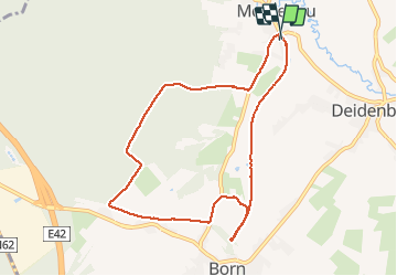

15,3 km | 21 km-effort


Gebruiker


Gratisgps-wandelapplicatie
 SityTrail
IGN / Geografische instituten
SityTrail World
De wereld gaat voor u open
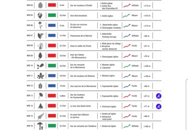
Tocht Stappen van 8,4 km beschikbaar op Wallonië, Luik, Amel. Deze tocht wordt voorgesteld door lucspa.
Le viaduc n'est pas accessible. Le parcours est plaisant. Possibilité de visiter la Montenauer Schinkenräucherei
http://www.montenauer.com/. Le long du RaVel, il y a des panneaux didactiques
Stappen
Stappen
Rolschaatsen
Stappen
Stappen

Stappen
Stappen

Stappen
Stappen