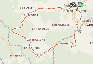
![](/images/other/stat-length.png)
St_Amant_Roche_Savine
jagarnier
Gebruiker GUIDE
![Lengte](/images/other/stat-length.png)
![Max. hoogte](https://static1.geolcdn.com/siteimages/upload/files/1508320355ic_sort_altitude_max_24dp.png)
![Positief hoogteverschil](https://static1.geolcdn.com/siteimages/upload/files/1508320355ic_sort_den_pos_24dp.png)
![Km-Effort](/images/other/stat-length.png)
![Min. hoogte](https://static1.geolcdn.com/siteimages/upload/files/1508320355ic_sort_altitude_min_24dp.png)
![Negatief hoogteverschil](https://static1.geolcdn.com/siteimages/upload/files/1508320355ic_sort_den_neg_24dp.png)
![Boucle](https://static1.geolcdn.com/siteimages/upload/files/16400158638029165_repeat_loop_refresh_sync_direction_icon.png)
![Stappen](https://static1.geolcdn.com/sitytour/trail-icons/101.png)
3h52
Moeilijkheid : Medium
![Scan deze QR-code om de tocht te openen in de SityTrail-applicatie](https://capi.geolives.com/qq0zvz2zws4bq2lad0pu/sitytour/trails/782957/qr.png?size=200)
Gratisgps-wandelapplicatie
Over ons
Tocht Stappen van 12,1 km beschikbaar op Auvergne-Rhône-Alpes, Puy-de-Dôme, Saint-Amant-Roche-Savine. Deze tocht wordt voorgesteld door jagarnier.
Beschrijving
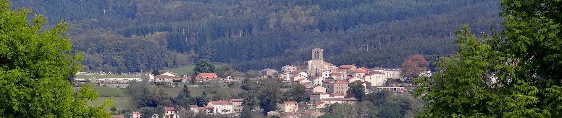
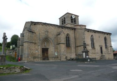
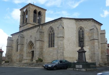
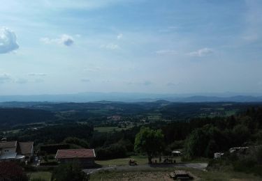
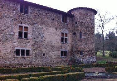
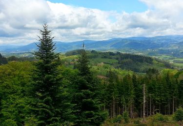
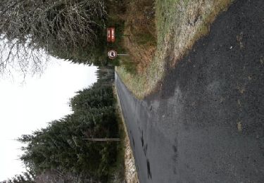
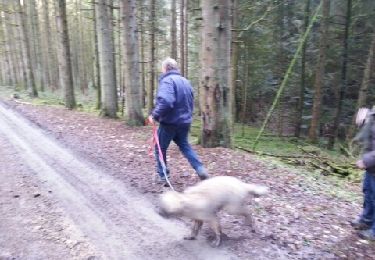
Cette randonnée vous permet de suivre la trace des "Pelharots", chiffonniers qui, de ferme en ferme vendaient leur collecte aux tisserands et papetiers. Au sud du château de Roche-Savine, vous verrez le bassin de Virennes, véritable conservatoire forestier où vous pourrez découvrir différentes essences comme l’épicéa, le hêtre ou encore l’orme.
Plaatsbepaling
Opmerkingen
Wandeltochten in de omgeving
![Tocht Te voet Le Monestier - Les Communaux de l'Achant - Photo](https://media.geolcdn.com/t/375/260/a73fb672-15d5-4615-8c5c-67e052031e7d.jpeg&format=jpg&maxdim=2)
![Te voet Te voet](https://static1.geolcdn.com/sitytour/trail-icons/100.png)
Te voet
![](/images/other/stat-length.png)
![](https://static1.geolcdn.com/siteimages/upload/files/16400158638029165_repeat_loop_refresh_sync_direction_icon.png)
![Tocht Te voet Saint-Amant-Roche-Savine - Roche-Savine - Photo](https://media.geolcdn.com/t/375/260/33e2b6f0-6c8c-409c-ab5f-7717ed153c10.jpeg&format=jpg&maxdim=2)
![Te voet Te voet](https://static1.geolcdn.com/sitytour/trail-icons/100.png)
Te voet
![](/images/other/stat-length.png)
![](https://static1.geolcdn.com/siteimages/upload/files/16400158638029165_repeat_loop_refresh_sync_direction_icon.png)
![Tocht Te voet Fournols - Les Deux-Frères - Photo](https://media.geolcdn.com/t/375/260/d5784189-973d-43a7-a97f-cca4aab8ee4e.jpeg&format=jpg&maxdim=2)
![Te voet Te voet](https://static1.geolcdn.com/sitytour/trail-icons/100.png)
Te voet
![](/images/other/stat-length.png)
![](https://static1.geolcdn.com/siteimages/upload/files/16400158638029165_repeat_loop_refresh_sync_direction_icon.png)
![Tocht Te voet Saint-Ferréol-des-Côtes - Le Ruisseau des Escures - Photo](https://media.geolcdn.com/t/375/260/87b71b99-5b85-450a-a4a0-adf99feb76c1.jpeg&format=jpg&maxdim=2)
![Te voet Te voet](https://static1.geolcdn.com/sitytour/trail-icons/100.png)
Te voet
![](/images/other/stat-length.png)
![](https://static1.geolcdn.com/siteimages/upload/files/16400158638029165_repeat_loop_refresh_sync_direction_icon.png)
![Tocht Te voet Le Monestier - Les Lèches Beurriers - Photo](https://media.geolcdn.com/t/375/260/a73fb672-15d5-4615-8c5c-67e052031e7d.jpeg&format=jpg&maxdim=2)
![Te voet Te voet](https://static1.geolcdn.com/sitytour/trail-icons/100.png)
Te voet
![](/images/other/stat-length.png)
![](https://static1.geolcdn.com/siteimages/upload/files/16400158638029165_repeat_loop_refresh_sync_direction_icon.png)
![Tocht Te voet Saint-Amant-Roche-Savine - Aux Sources de La Dolore - Photo](https://media.geolcdn.com/t/375/260/96be9756-735e-4086-b7cc-0b385685972d.jpeg&format=jpg&maxdim=2)
![Te voet Te voet](https://static1.geolcdn.com/sitytour/trail-icons/100.png)
Te voet
![](/images/other/stat-length.png)
![](https://static1.geolcdn.com/siteimages/upload/files/16400158638029165_repeat_loop_refresh_sync_direction_icon.png)
![Tocht Te voet La Chapelle-Agnon - Le Bois de Pierre Blanche - Photo](https://media.geolcdn.com/t/375/260/96c9609e-eb0f-4aae-a6a7-1fd1cbb0f0be.jpeg&format=jpg&maxdim=2)
![Te voet Te voet](https://static1.geolcdn.com/sitytour/trail-icons/100.png)
Te voet
![](/images/other/stat-length.png)
![](https://static1.geolcdn.com/siteimages/upload/files/16400158638029165_repeat_loop_refresh_sync_direction_icon.png)
![Tocht Stappen Saint-Éloy-la-Glacière - st eloy - chalembel - Photo](https://media.geolcdn.com/t/375/260/ext.jpg?maxdim=2&url=https%3A%2F%2Fservices.sitytrail.com%2FGeolivesWS%2FDownloadMedia.ashx%3FTrailID%3D168345%26Media%3D20130102160138.jpeg)
![Stappen Stappen](https://static1.geolcdn.com/sitytour/trail-icons/101.png)
Stappen
![](/images/other/stat-length.png)
![](https://static1.geolcdn.com/siteimages/upload/files/16400158638029165_repeat_loop_refresh_sync_direction_icon.png)
![Tocht Stappen Le Monestier - Le Monest - Photo](https://media.geolcdn.com/t/375/260/ext.jpg?maxdim=2&url=https%3A%2F%2Fservices.sitytrail.com%2FGeolivesWS%2FDownloadMedia.ashx%3FTrailID%3D168068%26Media%3D20121231125200.jpeg)
![Stappen Stappen](https://static1.geolcdn.com/sitytour/trail-icons/101.png)
Stappen
![](/images/other/stat-length.png)
![](https://static1.geolcdn.com/siteimages/upload/files/16400158638029165_repeat_loop_refresh_sync_direction_icon.png)