13,2 km | 15,5 km-effort
Manche 2
plevier
Gebruiker
Lengte
56 km
Max. hoogte
123 m
Positief hoogteverschil
632 m
Km-Effort
65 km
Min. hoogte
4 m
Negatief hoogteverschil
631 m
Boucle
Neen
Datum van aanmaak :
2017-05-30 00:00:00.0
Laatste wijziging :
2017-05-30 00:00:00.0
4h13
Moeilijkheid : Onbekend
Gratisgps-wandelapplicatie
Over ons
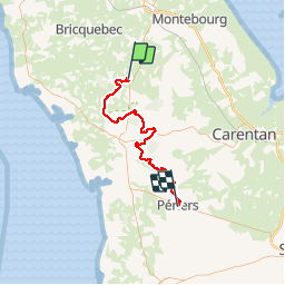
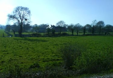
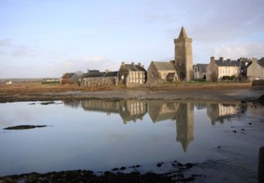
Tocht Mountainbike van 56 km beschikbaar op Normandië, Manche, Saint-Sauveur-le-Vicomte. Deze tocht wordt voorgesteld door plevier.
Beschrijving
Saint Sauveur le vicomte- Periers
Plaatsbepaling
Land:
France
Regio :
Normandië
Departement/Provincie :
Manche
Gemeente :
Saint-Sauveur-le-Vicomte
Locatie:
Unknown
Vertrek:(Dec)
Vertrek:(UTM)
606464 ; 5472037 (30U) N.
Opmerkingen
Wandeltochten in de omgeving
St Sauveur Besneville boucle
Stappen
Gemakkelijk
Saint-Sauveur-le-Vicomte,
Normandië,
Manche,
France
3h 21min
Ja
20240614-St-Sauveur-le-Vicomte
Stappen
Gemakkelijk
Saint-Sauveur-le-Vicomte,
Normandië,
Manche,
France
3,8 km | 4,4 km-effort
1h 58min
Ja
Balade dans le canton de Barbey d''Aurevilly - St Sauveur le Vicomte
Mountainbike
Medium
Saint-Sauveur-le-Vicomte,
Normandië,
Manche,
France
34 km | 40 km-effort
2h 30min
Ja
Sortie en forêt à St Sauveur le Vicomte
Mountainbike
Medium
Saint-Sauveur-le-Vicomte,
Normandië,
Manche,
France
29 km | 34 km-effort
2h 19min
Ja
Entre Saint Sauveur le Vicomte et Portbail
Mountainbike
Moeilijk
Saint-Sauveur-le-Vicomte,
Normandië,
Manche,
France
51 km | 58 km-effort
3h 0min
Ja
foret
Lopen
Medium
Saint-Sauveur-le-Vicomte,
Normandië,
Manche,
France
6,4 km | 7,3 km-effort
1h 0min
Ja
Les trois Monts - Saint Sauveur le Vicomte
Mountainbike
Moeilijk
Saint-Sauveur-le-Vicomte,
Normandië,
Manche,
France
37 km | 44 km-effort
3h 0min
Ja
saint sauveur-Jour 2
Hybride fiets
Gemakkelijk
Saint-Sauveur-le-Vicomte,
Normandië,
Manche,
France
87 km | 96 km-effort
11h 45min
Ja
1er jour Saint Sauveur
Hybride fiets
Zeer moeilijk
Saint-Sauveur-le-Vicomte,
Normandië,
Manche,
France
61 km | 67 km-effort
7h 12min
Ja