![](/images/other/stat-length.png)
![Tocht Stappen Obernai - Le Piémont du Mont Sainte-Odile - Photo](https://media.geolcdn.com/t/1900/400/ext.pjpeg?maxdim=2&url=https%3A%2F%2Fservices.sitytrail.com%2FGeolivesWS%2FDownloadMedia.ashx%3FTrailID%3D742984%26Media%3Dfix__20170430151355.jpg)
Le Piémont du Mont Sainte-Odile
VacheKiri67
Gebruiker
![Lengte](/images/other/stat-length.png)
Lengte
21 km
![Max. hoogte](https://static1.geolcdn.com/siteimages/upload/files/1508320355ic_sort_altitude_max_24dp.png)
Max. hoogte
366 m
![Positief hoogteverschil](https://static1.geolcdn.com/siteimages/upload/files/1508320355ic_sort_den_pos_24dp.png)
Positief hoogteverschil
406 m
![Km-Effort](/images/other/stat-length.png)
Km-Effort
26 km
![Min. hoogte](https://static1.geolcdn.com/siteimages/upload/files/1508320355ic_sort_altitude_min_24dp.png)
Min. hoogte
179 m
![Negatief hoogteverschil](https://static1.geolcdn.com/siteimages/upload/files/1508320355ic_sort_den_neg_24dp.png)
Negatief hoogteverschil
407 m
![Boucle](https://static1.geolcdn.com/siteimages/upload/files/16400158638029165_repeat_loop_refresh_sync_direction_icon.png)
Boucle
Ja
Datum van aanmaak :
2017-04-30 00:00:00.0
Laatste wijziging :
2017-04-30 00:00:00.0
![Stappen](https://static1.geolcdn.com/sitytour/trail-icons/101.png)
5h35
Moeilijkheid : Moeilijk
![Scan deze QR-code om de tocht te openen in de SityTrail-applicatie](https://capi.geolives.com/qq0zvz2zws4bq2lad0pu/sitytour/trails/742984/qr.png?size=200)
Gratisgps-wandelapplicatie
Over ons
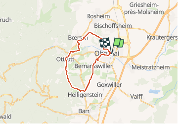
Tocht Stappen van 21 km beschikbaar op Grand Est, Bas-Rhin, Obernai. Deze tocht wordt voorgesteld door VacheKiri67.
Beschrijving
Faite le 30/04/2017 avec notre fils Théo de 12 ans. D'après "Passion Vosges - Autour du Mont Sainte-Odile" N°12 : Le Piémont du Mont Sainte-Odile. Durée indiquée pour le circuit : 5h30.
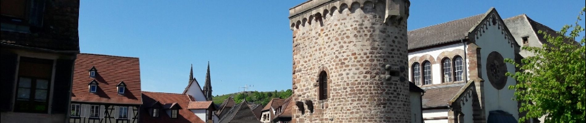
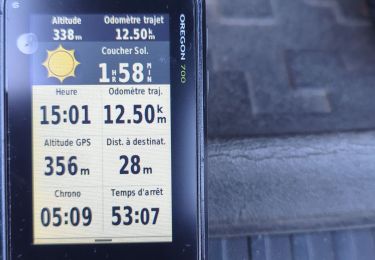
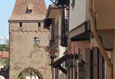
Plaatsbepaling
Land:
France
Regio :
Grand Est
Departement/Provincie :
Bas-Rhin
Gemeente :
Obernai
Locatie:
Unknown
Vertrek:(Dec)
Vertrek:(UTM)
388246 ; 5368713 (32U) N.
Opmerkingen
Wandeltochten in de omgeving
![Tocht Stappen Ottrott - Le Mont Sainte-Odile depuis Otrott - Photo](https://media.geolcdn.com/t/375/260/ext.jpg?maxdim=2&url=https%3A%2F%2Fservices.sitytrail.com%2FGeolivesWS%2FDownloadMedia.ashx%3FTrailID%3D506359%26Media%3Dfix__20151226143401.jpg)
![Stappen Stappen](https://static1.geolcdn.com/sitytour/trail-icons/101.png)
Le Mont Sainte-Odile depuis Otrott
Stappen
Medium
(1)
Ottrott,
Grand Est,
Bas-Rhin,
France
![](/images/other/stat-length.png)
13 km | 20 km-effort
6h 18min
![](https://static1.geolcdn.com/siteimages/upload/files/16400158638029165_repeat_loop_refresh_sync_direction_icon.png)
Ja
![Tocht Stappen Obernai - Obernai gare - Mont St Odile - Photo](https://media.geolcdn.com/t/375/260/ext.jpg?maxdim=2&url=https%3A%2F%2Fservices.sitytrail.com%2FGeolivesWS%2FDownloadMedia.ashx%3FTrailID%3D172386%26Media%3D13734_3.jpg)
![Stappen Stappen](https://static1.geolcdn.com/sitytour/trail-icons/101.png)
Obernai gare - Mont St Odile
Stappen
Moeilijk
(2)
Obernai,
Grand Est,
Bas-Rhin,
France
![](/images/other/stat-length.png)
20 km | 29 km-effort
5h 0min
![](https://static1.geolcdn.com/siteimages/upload/files/16400158638029165_repeat_loop_refresh_sync_direction_icon.png)
Ja
![Tocht Mountainbike Ottrott - Sainte-Odile East-Face - Photo](https://media.geolcdn.com/t/375/260/ext.jpg?maxdim=2&url=https%3A%2F%2Fservices.sitytrail.com%2FGeolivesWS%2FDownloadMedia.ashx%3FTrailID%3D100800%26Media%3D307_1.jpg)
![Mountainbike Mountainbike](https://static1.geolcdn.com/sitytour/trail-icons/202.png)
Sainte-Odile East-Face
Mountainbike
Moeilijk
(1)
Ottrott,
Grand Est,
Bas-Rhin,
France
![](/images/other/stat-length.png)
24 km | 39 km-effort
3h 0min
![](https://static1.geolcdn.com/siteimages/upload/files/16400158638029165_repeat_loop_refresh_sync_direction_icon.png)
Ja
![Tocht Te voet Rosheim - Circuit du Vignoble - Photo](https://media.geolcdn.com/t/375/260/64f74819-d8f8-442d-a77c-41a6b0bb1ddd.jpeg&format=jpg&maxdim=2)
![Te voet Te voet](https://static1.geolcdn.com/sitytour/trail-icons/100.png)
Circuit du Vignoble
Te voet
Gemakkelijk
Rosheim,
Grand Est,
Bas-Rhin,
France
![](/images/other/stat-length.png)
8,8 km | 11,7 km-effort
2h 38min
![](https://static1.geolcdn.com/siteimages/upload/files/16400158638029165_repeat_loop_refresh_sync_direction_icon.png)
Ja
![Tocht Te voet Bischoffsheim - Circuit des Balcons - Photo](https://media.geolcdn.com/t/375/260/d007a4ee-f931-423f-9218-8f137993fa63.jpeg&format=jpg&maxdim=2)
![Te voet Te voet](https://static1.geolcdn.com/sitytour/trail-icons/100.png)
Circuit des Balcons
Te voet
Gemakkelijk
(1)
Bischoffsheim,
Grand Est,
Bas-Rhin,
France
![](/images/other/stat-length.png)
12,4 km | 15,4 km-effort
3h 30min
![](https://static1.geolcdn.com/siteimages/upload/files/16400158638029165_repeat_loop_refresh_sync_direction_icon.png)
Ja
![Tocht Mountainbike Rosheim - schnacker tour le grand 8 circuit magique - Photo](https://media.geolcdn.com/t/375/260/ext.jpg?maxdim=2&url=https%3A%2F%2Fstatic1.geolcdn.com%2Fsiteimages%2Fupload%2Ffiles%2F1524743154velo.jpg)
![Mountainbike Mountainbike](https://static1.geolcdn.com/sitytour/trail-icons/202.png)
schnacker tour le grand 8 circuit magique
Mountainbike
Moeilijk
(1)
Rosheim,
Grand Est,
Bas-Rhin,
France
![](/images/other/stat-length.png)
29 km | 39 km-effort
2h 30min
![](https://static1.geolcdn.com/siteimages/upload/files/16400158638029165_repeat_loop_refresh_sync_direction_icon.png)
Ja
![Tocht Stappen Rosenwiller - 2015-05-17 Marche Gourmande Rosenwiller - Photo](https://media.geolcdn.com/t/375/260/ext.jpg?maxdim=2&url=https%3A%2F%2Fstatic1.geolcdn.com%2Fsiteimages%2Fupload%2Ffiles%2F1553511878bg_sport_marche.png)
![Stappen Stappen](https://static1.geolcdn.com/sitytour/trail-icons/101.png)
2015-05-17 Marche Gourmande Rosenwiller
Stappen
Gemakkelijk
(1)
Rosenwiller,
Grand Est,
Bas-Rhin,
France
![](/images/other/stat-length.png)
8,8 km | 11 km-effort
2h 23min
![](https://static1.geolcdn.com/siteimages/upload/files/16400158638029165_repeat_loop_refresh_sync_direction_icon.png)
Neen
![Tocht Stappen Saint-Nabor - circuit anciennes abbayes - Photo](https://media.geolcdn.com/t/375/260/6e0ec479-8d74-404c-b33f-f5b415513d37.jpg&format=jpg&maxdim=2)
![Stappen Stappen](https://static1.geolcdn.com/sitytour/trail-icons/101.png)
circuit anciennes abbayes
Stappen
Medium
(1)
Saint-Nabor,
Grand Est,
Bas-Rhin,
France
![](/images/other/stat-length.png)
35 km | 43 km-effort
5h 12min
![](https://static1.geolcdn.com/siteimages/upload/files/16400158638029165_repeat_loop_refresh_sync_direction_icon.png)
Neen
![Tocht Elektrische fiets Rosheim - Rosheim Grendelbruch - Photo](https://media.geolcdn.com/t/375/260/1c06d9a5-cf7d-43e6-9bd5-f4af2118cfa5.jpg&format=jpg&maxdim=2)
![Elektrische fiets Elektrische fiets](https://static1.geolcdn.com/sitytour/trail-icons/205.png)
Rosheim Grendelbruch
Elektrische fiets
Medium
Rosheim,
Grand Est,
Bas-Rhin,
France
![](/images/other/stat-length.png)
49 km | 59 km-effort
3h 13min
![](https://static1.geolcdn.com/siteimages/upload/files/16400158638029165_repeat_loop_refresh_sync_direction_icon.png)
Ja
Randonnée assez longue mais sans difficulté. Idéale au printemps pour se refaire les jambes.