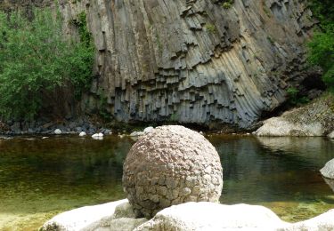
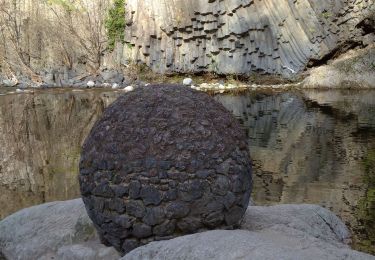
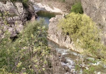
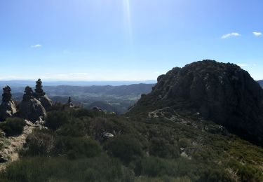
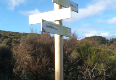
Tocht Stappen Lentillères - de la salamandre a la lande - Photo

de la salamandre a la lande

 Thierry_Garre
Thierry_Garre

Gebruiker

© OpenStreetMap contributors
Lengte
Lengte
6,9 km
Max. hoogte
Max. hoogte
579 m
Positief hoogteverschil
254 m
Km-Effort
Km-Effort  
10,3 km
Min. hoogte
Min. hoogte
349 m
Negatief hoogteverschil
255 m
Boucle
Boucle
Ja
Datum van aanmaak :
2017-04-29 00:00:00.0
Laatste wijziging :
2017-04-29 00:00:00.0

(0 Bericht)

Stappen
Stappen
2h30
Moeilijkheid : Gemakkelijk

Scan deze QR-code om de tocht te openen in de SityTrail-applicatie

Gratisgps-wandelapplicatie

Logo SityTrail SityTrail

IGN / Geografische instituten

SityTrail uit de App Store downloaden SityTrail uit Google Play downloaden

Logo SityTrail SityTrail World

De wereld gaat voor u open

SityTrail uit de App Store downloaden SityTrail uit Google Play downloaden SityTrail op Huawei AppGallery downloaden

Over ons

Tocht Stappen van 6,9 km beschikbaar op Auvergne-Rhône-Alpes, Ardèche, Lentillères. Deze tocht wordt voorgesteld door Thierry_Garre.

Beschrijving

-Descendre du hameau des Imberts en direction du sud est
-traverser la piste
longer la rivière vers le sud
au pont romain suivre la rivière sans la traverser.
-rejoindre et suivre la route jusqu'au pont.
-traverser le pont et suivre la rivière jusqu’à une grande prairie (chevaux)
-au bout de la prairie remonter a droite par un chemin jusqu'au Hameau des Ladets.
suivre la route sur la gauche jusqu'au carrefour.
Reprendre à droite la RD335 jusqu'au col de l'Eyrolle.
Au col prendre la route a gauche vers Valsadoul.
prendre le chemin à droite après la cabane des chasseurs.
Suivre le chemin jusqu'au hameau du village.passer sous le porche.
Apres le porche descendre vers les Imberts par un chemin.

Penser a refermer les barrières derrière vous.

Bonne ballade


Hoogteprofiel

POI's

POI Lentillères - La Salamandre - Photo
Thierry_Garre
LENTILLÈRES 
POI Lentillères - La Salamandre - Photo
Thierry_Garre
LENTILLÈRES 
POI Lentillères - Cascade - Photo
Thierry_Garre
LENTILLÈRES 
POI Lentillères - Cascade - Photo
Thierry_Garre
LENTILLÈRES 
POI Lentillères - Pont Romain - Photo
Thierry_Garre
LENTILLÈRES 
POI Lentillères - Pont Romain - Photo
Thierry_Garre
LENTILLÈRES 
POI Chazeaux - Le gour de la Serre - Photo
Thierry_Garre
POI Chazeaux - Le gour de la Serre - Photo
Thierry_Garre
POI Lentillères - Le chevres l'Eyrolle - Photo
Thierry_Garre
LENTILLÈRES 
POI Lentillères - Le chevres l'Eyrolle - Photo
Thierry_Garre
LENTILLÈRES 
POI Lentillères - Ancienne prison du village - Photo
Thierry_Garre
POI Lentillères - Ancienne prison du village - Photo
Thierry_Garre
POI Lentillères - Point de vue remarquable - Photo
Thierry_Garre
POI Lentillères - Point de vue remarquable - Photo
Thierry_Garre
POI Lentillères - Le moulin - Photo
Thierry_Garre
LENTILLÈRES 
POI Lentillères - Le moulin - Photo
Thierry_Garre
LENTILLÈRES 
POI Lentillères - Le rocher des croix - Photo
Thierry_Garre
LENTILLÈRES 
POI Lentillères - Le fouloir - Photo
Thierry_Garre
LENTILLÈRES 
POI Lentillères - La fabrique - Photo
Thierry_Garre
LENTILLÈRES 
POI Lentillères - Beaume d'oli - Photo
Thierry_Garre
LENTILLÈRES 

Plaatsbepaling

Land:
France
Regio :
Auvergne-Rhône-Alpes
Departement/Provincie :
Ardèche
Gemeente :
Lentillères
Locatie:
Unknown
Vertrek:(Dec)
Vertrek:(UTM)
604189 ; 4940760 (31T) N.

Wandeltochten in de omgeving

Tocht Stappen Jaujac - Jaujac Le Ventapet 14km - Photo
Stappen
GUIDE
thonyc

Stappen

Zeer moeilijk
(1)
Jaujac, Auvergne-Rhône-Alpes, Ardèche, France
13,6 km | 23 km-effort
5h 18min
Ja
Tocht Stappen Fabras - Fabras  - Photo
Stappen
MoiClaude

Stappen

Medium
(1)
Fabras, Auvergne-Rhône-Alpes, Ardèche, France
6,4 km | 9,7 km-effort
1h 49min
Neen
Tocht Stappen Jaujac - 07 jaujac rocher de l aigle - Photo
Stappen
GUIDE
randodyssée

Stappen

Gemakkelijk
(1)
Jaujac, Auvergne-Rhône-Alpes, Ardèche, France
11,2 km | 19,7 km-effort
6h 23min
Ja
Tocht Stappen Jaujac - 07_jaujac_Orgues_9km360m - Photo
Stappen
SyMA

Stappen

Medium
Jaujac, Auvergne-Rhône-Alpes, Ardèche, France
9,1 km | 13,8 km-effort
3h 7min
Ja
Tocht Stappen Fabras - Fabras Jaujac les orgues basaltiques  - Photo
Stappen
GUIDE
Roger Philippe Wallez

Stappen

Zeer moeilijk
Fabras, Auvergne-Rhône-Alpes, Ardèche, France
14,9 km | 22 km-effort
5h 17min
Ja
Tocht Stappen Vals-les-Bains - Tesseaux  - Photo
Stappen
Rudy07

Stappen

Gemakkelijk
(1)
Vals-les-Bains, Auvergne-Rhône-Alpes, Ardèche, France
4 km | 5,7 km-effort
1h 13min
Ja
Tocht Stappen Jaujac - SityTrail - 186740 - jaujac-pic-de-ladenne - Photo
Stappen
Lustou

Stappen

Medium
(1)
Jaujac, Auvergne-Rhône-Alpes, Ardèche, France
4,5 km | 9 km-effort
2h 33min
Neen
Tocht Stappen Lentillères - Crêtes de Lentilleres - Photo
Stappen
pb07

Stappen

Heel gemakkelijk
(1)
Lentillères, Auvergne-Rhône-Alpes, Ardèche, France
12,1 km | 18,9 km-effort
4h 52min
Ja
Tocht Stappen Prades - balade prades avec meyras - Photo
Stappen
raab

Stappen

Medium
(1)
Prades, Auvergne-Rhône-Alpes, Ardèche, France
8,2 km | 11,1 km-effort
2h 14min
Ja


Sluiten
Mijn abonnementen