


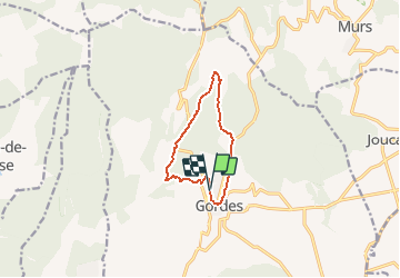

13 km | 17,6 km-effort


Gebruiker


Gratisgps-wandelapplicatie
 SityTrail
IGN / Geografische instituten
SityTrail World
De wereld gaat voor u open
Tocht Stappen van 8,9 km beschikbaar op Provence-Alpes-Côte d'Azur, Vaucluse, Gordes. Deze tocht wordt voorgesteld door Drailloun.
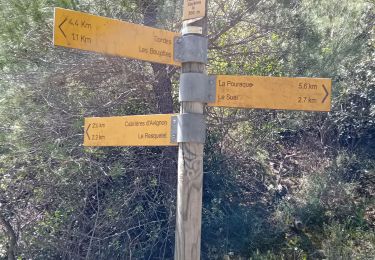
Départ du parking de la Gendarmerie. Après les Dilais, longer les gorges de la Sénancole. Vues plongeantes sur l'Abbaye de Sénanque.

Te voet

Stappen

Mountainbike

Mountainbike

Stappen

Te voet
Stappen
Stappen
Stappen
Belle rando dominicale
belle randonnée avec une très belle vue sur l'abbaye de Senanques mais première moitié dans un sentier difficile car encombré par la végétation