


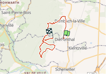

13 km | 18,5 km-effort


Gebruiker


Gratisgps-wandelapplicatie
 SityTrail
IGN / Geografische instituten
SityTrail World
De wereld gaat voor u open
Tocht Stappen van 15,7 km beschikbaar op Grand Est, Bas-Rhin, Dieffenthal. Deze tocht wordt voorgesteld door zazie.
Randonnée pour ados et plus. Enregistrement non terminé suite problème batterie. Depuis la Wolfskirche, redescendre en suivant les panneaux Dieffenthal ou le sentier Murailles et vignes.

Stappen

Stappen
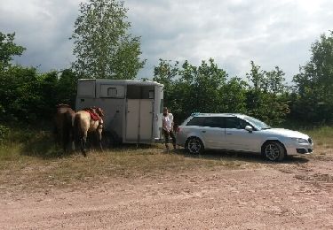
Paard

Stappen

Stappen

Mountainbike

Stappen

Trail
Stappen