![](/images/other/stat-length.png)
![Tocht Stappen Groffliers - rando autour de Berck via la côte. - Photo](https://media.geolcdn.com/t/1900/400/ext.pjpeg?maxdim=2&url=https%3A%2F%2Fservices.sitytrail.com%2FGeolivesWS%2FDownloadMedia.ashx%3FTrailID%3D729575%26Media%3D20170409133836.jpg)
rando autour de Berck via la côte.
choubaka77
Gebruiker
![Lengte](/images/other/stat-length.png)
Lengte
16,9 km
![Max. hoogte](https://static1.geolcdn.com/siteimages/upload/files/1508320355ic_sort_altitude_max_24dp.png)
Max. hoogte
19 m
![Positief hoogteverschil](https://static1.geolcdn.com/siteimages/upload/files/1508320355ic_sort_den_pos_24dp.png)
Positief hoogteverschil
87 m
![Km-Effort](/images/other/stat-length.png)
Km-Effort
18 km
![Min. hoogte](https://static1.geolcdn.com/siteimages/upload/files/1508320355ic_sort_altitude_min_24dp.png)
Min. hoogte
-1 m
![Negatief hoogteverschil](https://static1.geolcdn.com/siteimages/upload/files/1508320355ic_sort_den_neg_24dp.png)
Negatief hoogteverschil
87 m
![Boucle](https://static1.geolcdn.com/siteimages/upload/files/16400158638029165_repeat_loop_refresh_sync_direction_icon.png)
Boucle
Ja
Datum van aanmaak :
2017-04-10 00:00:00.0
Laatste wijziging :
2017-04-10 00:00:00.0
![Stappen](https://static1.geolcdn.com/sitytour/trail-icons/101.png)
3h42
Moeilijkheid : Heel gemakkelijk
![Scan deze QR-code om de tocht te openen in de SityTrail-applicatie](https://capi.geolives.com/qq0zvz2zws4bq2lad0pu/sitytour/trails/729575/qr.png?size=200)
Gratisgps-wandelapplicatie
Over ons
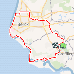
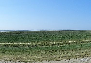
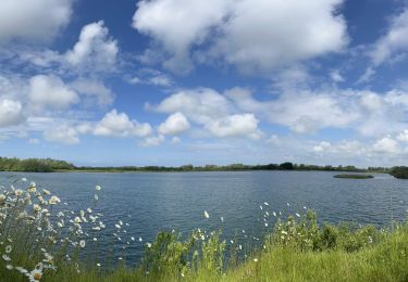
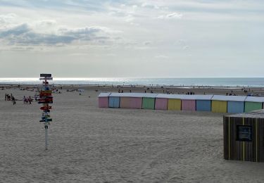
Tocht Stappen van 16,9 km beschikbaar op Hauts-de-France, Pas-de-Calais, Groffliers. Deze tocht wordt voorgesteld door choubaka77.
Beschrijving
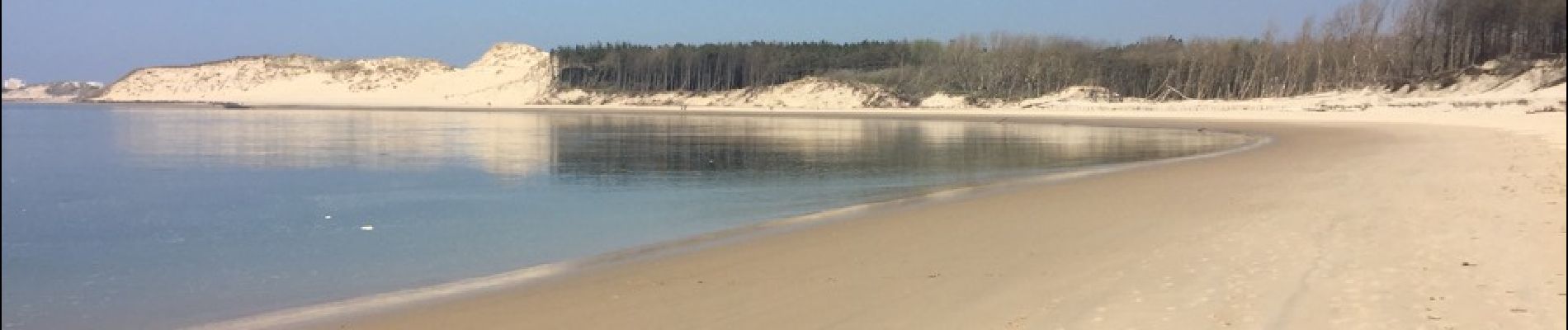
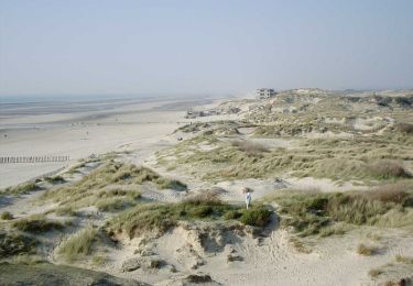
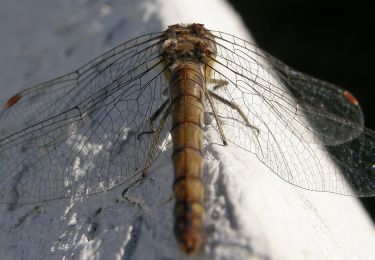
Bord de mer très sympa à la découverte des phoques, attention aux niveau des marées. Ville de Berck et retour moyen mais pas d'autre d'option !
Plaatsbepaling
Land:
France
Regio :
Hauts-de-France
Departement/Provincie :
Pas-de-Calais
Gemeente :
Groffliers
Locatie:
Unknown
Vertrek:(Dec)
Vertrek:(UTM)
401503 ; 5582238 (31U) N.
Opmerkingen
Wandeltochten in de omgeving
![Tocht Stappen Berck - Sentier de la Baie d'Authie - Berck-sur-Mer - Photo](https://media.geolcdn.com/t/375/260/ext.jpg?maxdim=2&url=https%3A%2F%2Fservices.sitytrail.com%2FGeolivesWS%2FDownloadMedia.ashx%3FTrailID%3D109951%26Media%3D5015_2.jpg)
![Stappen Stappen](https://static1.geolcdn.com/sitytour/trail-icons/101.png)
Sentier de la Baie d'Authie - Berck-sur-Mer
Stappen
Medium
(1)
Berck,
Hauts-de-France,
Pas-de-Calais,
France
![](/images/other/stat-length.png)
11,1 km | 12 km-effort
2h 19min
![](https://static1.geolcdn.com/siteimages/upload/files/16400158638029165_repeat_loop_refresh_sync_direction_icon.png)
Ja
![Tocht Stappen Fort-Mahon-Plage - La dune de Royon - Photo](https://media.geolcdn.com/t/375/260/ext.jpg?maxdim=2&url=https%3A%2F%2Fservices.sitytrail.com%2FGeolivesWS%2FDownloadMedia.ashx%3FTrailID%3D108543%26Media%3D1446_1.jpg)
![Stappen Stappen](https://static1.geolcdn.com/sitytour/trail-icons/101.png)
La dune de Royon
Stappen
Medium
(1)
Fort-Mahon-Plage,
Hauts-de-France,
Somme,
France
![](/images/other/stat-length.png)
4,1 km | 4,5 km-effort
1h 30min
![](https://static1.geolcdn.com/siteimages/upload/files/16400158638029165_repeat_loop_refresh_sync_direction_icon.png)
Ja
![Tocht Te voet Rang-du-Fliers - Sentier du Petit Marais - Photo](https://media.geolcdn.com/t/375/260/4d634643-aaf1-4b4f-8e31-f1e446378f6c.jpeg&format=jpg&maxdim=2)
![Te voet Te voet](https://static1.geolcdn.com/sitytour/trail-icons/100.png)
Sentier du Petit Marais
Te voet
Gemakkelijk
Rang-du-Fliers,
Hauts-de-France,
Pas-de-Calais,
France
![](/images/other/stat-length.png)
7,7 km | 8 km-effort
1h 49min
![](https://static1.geolcdn.com/siteimages/upload/files/16400158638029165_repeat_loop_refresh_sync_direction_icon.png)
Neen
![Tocht Te voet Groffliers - Tour de Groffliers - Photo](https://media.geolcdn.com/t/375/260/0dee6b58-3c69-4a3e-8786-fb5f94c93ed2.jpeg&format=jpg&maxdim=2)
![Te voet Te voet](https://static1.geolcdn.com/sitytour/trail-icons/100.png)
Tour de Groffliers
Te voet
Gemakkelijk
Groffliers,
Hauts-de-France,
Pas-de-Calais,
France
![](/images/other/stat-length.png)
12,1 km | 12,7 km-effort
2h 52min
![](https://static1.geolcdn.com/siteimages/upload/files/16400158638029165_repeat_loop_refresh_sync_direction_icon.png)
Neen
![Tocht Elektrische fiets Fort-Mahon-Plage - Tour de la baie D’Authie - Photo](https://media.geolcdn.com/t/375/260/009af033-fc32-419b-94c5-466a83f3fabb.jpeg&format=jpg&maxdim=2)
![Elektrische fiets Elektrische fiets](https://static1.geolcdn.com/sitytour/trail-icons/205.png)
Tour de la baie D’Authie
Elektrische fiets
Fort-Mahon-Plage,
Hauts-de-France,
Somme,
France
![](/images/other/stat-length.png)
50 km | 53 km-effort
3h 57min
![](https://static1.geolcdn.com/siteimages/upload/files/16400158638029165_repeat_loop_refresh_sync_direction_icon.png)
Ja
![Tocht Wegfiets Conchil-le-Temple - Conchil-le-Temple/Fort-Mahon - Photo](https://media.geolcdn.com/t/375/260/ext.jpg?maxdim=2&url=https%3A%2F%2Fstatic1.geolcdn.com%2Fsiteimages%2Fupload%2Ffiles%2F1524743154velo.jpg)
![Wegfiets Wegfiets](https://static1.geolcdn.com/sitytour/trail-icons/201.png)
Conchil-le-Temple/Fort-Mahon
Wegfiets
Gemakkelijk
(1)
Conchil-le-Temple,
Hauts-de-France,
Pas-de-Calais,
France
![](/images/other/stat-length.png)
10,7 km | 11,3 km-effort
1h 0min
![](https://static1.geolcdn.com/siteimages/upload/files/16400158638029165_repeat_loop_refresh_sync_direction_icon.png)
Neen
![Tocht Stappen Berck - Berck sur Mer - Photo](https://media.geolcdn.com/t/375/260/20c2a86f-6e7c-4531-a1f1-89cd3a3b5142.jpg&format=jpg&maxdim=2)
![Stappen Stappen](https://static1.geolcdn.com/sitytour/trail-icons/101.png)
Berck sur Mer
Stappen
Berck,
Hauts-de-France,
Pas-de-Calais,
France
![](/images/other/stat-length.png)
5,6 km | 6 km-effort
1h 45min
![](https://static1.geolcdn.com/siteimages/upload/files/16400158638029165_repeat_loop_refresh_sync_direction_icon.png)
Neen
![Tocht Te voet Verton - Sentier des 100 détours - Photo](https://media.geolcdn.com/t/375/260/193743be-1b33-49a0-81bd-a3d9f96bed3e.jpeg&format=jpg&maxdim=2)
![Te voet Te voet](https://static1.geolcdn.com/sitytour/trail-icons/100.png)
Sentier des 100 détours
Te voet
Gemakkelijk
Verton,
Hauts-de-France,
Pas-de-Calais,
France
![](/images/other/stat-length.png)
12,3 km | 13,6 km-effort
3h 4min
![](https://static1.geolcdn.com/siteimages/upload/files/16400158638029165_repeat_loop_refresh_sync_direction_icon.png)
Ja
![Tocht Stappen Waben - Le Tour de Groffliers à pied - Photo](https://media.geolcdn.com/t/375/260/ext.jpg?maxdim=2&url=https%3A%2F%2Fservices.sitytrail.com%2FGeolivesWS%2FDownloadMedia.ashx%3FTrailID%3D112284%26Media%3D10292_6.jpg)
![Stappen Stappen](https://static1.geolcdn.com/sitytour/trail-icons/101.png)
Le Tour de Groffliers à pied
Stappen
Medium
Waben,
Hauts-de-France,
Pas-de-Calais,
France
![](/images/other/stat-length.png)
11,9 km | 12,5 km-effort
2h 55min
![](https://static1.geolcdn.com/siteimages/upload/files/16400158638029165_repeat_loop_refresh_sync_direction_icon.png)
Ja