12,1 km | 16,4 km-effort
chabanne P. C
micheletissier
Gebruiker
Lengte
13,9 km
Max. hoogte
546 m
Positief hoogteverschil
381 m
Km-Effort
18,9 km
Min. hoogte
421 m
Negatief hoogteverschil
361 m
Boucle
Ja
Datum van aanmaak :
2017-04-08 00:00:00.0
Laatste wijziging :
2017-04-08 00:00:00.0
2h40
Moeilijkheid : Onbekend
Gratisgps-wandelapplicatie
Over ons
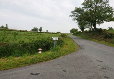
Tocht Noords wandelen van 13,9 km beschikbaar op Nieuw-Aquitanië, Creuse, Saint-Sulpice-le-Dunois. Deze tocht wordt voorgesteld door micheletissier.
Plaatsbepaling
Land:
France
Regio :
Nieuw-Aquitanië
Departement/Provincie :
Creuse
Gemeente :
Saint-Sulpice-le-Dunois
Locatie:
Unknown
Vertrek:(Dec)
Vertrek:(UTM)
400401 ; 5125931 (31T) N.
Opmerkingen
Wandeltochten in de omgeving
saint sulpice le dunois
Stappen
Heel gemakkelijk
Saint-Sulpice-le-Dunois,
Nieuw-Aquitanië,
Creuse,
France
2h 22min
Ja
la celle dunoise 8 mai
Noords wandelen
Heel gemakkelijk
(1)
La Celle-Dunoise,
Nieuw-Aquitanië,
Creuse,
France
15 km | 19,4 km-effort
3h 35min
Ja
chabanne
Noords wandelen
Heel gemakkelijk
(1)
Dun-le-Palestel,
Nieuw-Aquitanië,
Creuse,
France
13,4 km | 18,1 km-effort
2h 32min
Ja
Circuit de Bussière Dunoise (N°4)
Stappen
Moeilijk
Bussière-Dunoise,
Nieuw-Aquitanië,
Creuse,
France
12 km | 14,6 km-effort
3h 0min
Ja
Circuit de Bussière-Dunoise (N°3)
Stappen
Medium
(1)
Bussière-Dunoise,
Nieuw-Aquitanië,
Creuse,
France
11 km | 15,2 km-effort
2h 40min
Ja
Circuit de Bussière-Dunoise
Stappen
Gemakkelijk
Bussière-Dunoise,
Nieuw-Aquitanië,
Creuse,
France
7,8 km | 10,5 km-effort
2h 0min
Ja
poteau de jalletat
Noords wandelen
Heel gemakkelijk
Bussière-Dunoise,
Nieuw-Aquitanië,
Creuse,
France
10,5 km | 0 m-effort
2h 8min
Neen
Espace VTT FFC des Monts de Guéret - Circuit N° 28
Mountainbike
Zeer moeilijk
Bussière-Dunoise,
Nieuw-Aquitanië,
Creuse,
France
24 km | 31 km-effort
2h 10min
Ja
Espace VTT FFC des Monts de Guéret - Circuit N° 27
Mountainbike
Moeilijk
Bussière-Dunoise,
Nieuw-Aquitanië,
Creuse,
France
24 km | 33 km-effort
2h 10min
Ja