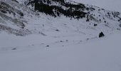

Eyne Orri de Baix

jpipacific
Gebruiker

Lengte
9,7 km

Max. hoogte
2029 m

Positief hoogteverschil
427 m

Km-Effort
15,4 km

Min. hoogte
1601 m

Negatief hoogteverschil
426 m
Boucle
Ja
Datum van aanmaak :
2017-04-01 00:00:00.0
Laatste wijziging :
2017-04-01 00:00:00.0
3h14
Moeilijkheid : Medium

Gratisgps-wandelapplicatie
Over ons
Tocht Sneeuwschoenen van 9,7 km beschikbaar op Occitanië, Pyrénées-Orientales, Eyne. Deze tocht wordt voorgesteld door jpipacific.
Beschrijving
De magnifiques points de vue sur Fond Romeu et la chaîne des montagnes de derrière La Calme. Le chemin monte tout le temps mais pas trop.
Plaatsbepaling
Land:
France
Regio :
Occitanië
Departement/Provincie :
Pyrénées-Orientales
Gemeente :
Eyne
Locatie:
Unknown
Vertrek:(Dec)
Vertrek:(UTM)
424503 ; 4702357 (31T) N.
Opmerkingen
Wandeltochten in de omgeving
Eyne,col de Nuria,pic d'Eyne,Torre d'Eyne,Eyne.


Stappen
Zeer moeilijk
(1)
Eyne,
Occitanië,
Pyrénées-Orientales,
France

24 km | 43 km-effort
8h 44min
Ja
pic dels moros


Sneeuwschoenen
Medium
(1)
Font-Romeu-Odeillo-Via,
Occitanië,
Pyrénées-Orientales,
France

12,6 km | 19,4 km-effort
4h 46min
Ja
Font Romeu Egat


Stappen
Medium
(2)
Font-Romeu-Odeillo-Via,
Occitanië,
Pyrénées-Orientales,
France

2,5 km | 3,4 km-effort
44min
Ja
Pic dels Moros avec Pierre


Sneeuwschoenen
Medium
(1)
Font-Romeu-Odeillo-Via,
Occitanië,
Pyrénées-Orientales,
France

10,5 km | 15,9 km-effort
4h 4min
Ja
étang de Planès


Stappen
Medium
(2)
Planès,
Occitanië,
Pyrénées-Orientales,
France

10,8 km | 19,6 km-effort
3h 54min
Neen
La croix d'Egat


Stappen
Gemakkelijk
(1)
Égat,
Occitanië,
Pyrénées-Orientales,
France

7,1 km | 10,4 km-effort
2h 2min
Ja
Le Cambre d'Ase


Stappen
Moeilijk
(1)
Eyne,
Occitanië,
Pyrénées-Orientales,
France

8,9 km | 22 km-effort
4h 0min
Ja

Espace VTT FFC Pyrénées Catalanes - Circuit n° 6 - Forêt d'Egat


Mountainbike
Medium
(2)
Font-Romeu-Odeillo-Via,
Occitanië,
Pyrénées-Orientales,
France

7,6 km | 10,1 km-effort
1h 0min
Ja
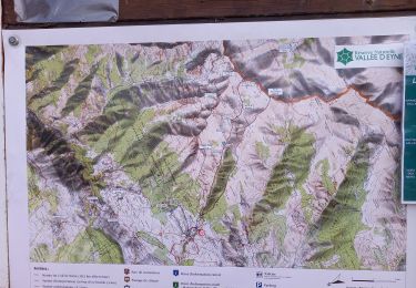
Vallée d'Eyne


Stappen
Medium
Eyne,
Occitanië,
Pyrénées-Orientales,
France

10,7 km | 17,6 km-effort
4h 40min
Ja


 SityTrail


