![](/images/other/stat-length.png)
![Tocht Stappen Correns - Correns rando 22.03 17 - Photo](https://media.geolcdn.com/t/1900/400/ext.pjpeg?maxdim=2&url=https%3A%2F%2Fservices.sitytrail.com%2FGeolivesWS%2FDownloadMedia.ashx%3FTrailID%3D719220%26Media%3Dfix__20170322101404.jpg)
Correns rando 22.03 17
Sugg
Gebruiker
![Lengte](/images/other/stat-length.png)
Lengte
15,4 km
![Max. hoogte](https://static1.geolcdn.com/siteimages/upload/files/1508320355ic_sort_altitude_max_24dp.png)
Max. hoogte
380 m
![Positief hoogteverschil](https://static1.geolcdn.com/siteimages/upload/files/1508320355ic_sort_den_pos_24dp.png)
Positief hoogteverschil
320 m
![Km-Effort](/images/other/stat-length.png)
Km-Effort
19,7 km
![Min. hoogte](https://static1.geolcdn.com/siteimages/upload/files/1508320355ic_sort_altitude_min_24dp.png)
Min. hoogte
160 m
![Negatief hoogteverschil](https://static1.geolcdn.com/siteimages/upload/files/1508320355ic_sort_den_neg_24dp.png)
Negatief hoogteverschil
320 m
![Boucle](https://static1.geolcdn.com/siteimages/upload/files/16400158638029165_repeat_loop_refresh_sync_direction_icon.png)
Boucle
Ja
Datum van aanmaak :
2019-03-22 16:58:32.799
Laatste wijziging :
2019-03-22 16:58:32.892
![Stappen](https://static1.geolcdn.com/sitytour/trail-icons/101.png)
4h15
Moeilijkheid : Gemakkelijk
![Scan deze QR-code om de tocht te openen in de SityTrail-applicatie](https://capi.geolives.com/qq0zvz2zws4bq2lad0pu/sitytour/trails/719220/qr.png?size=200)
Gratisgps-wandelapplicatie
Over ons
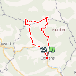
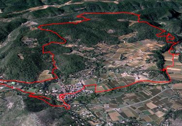
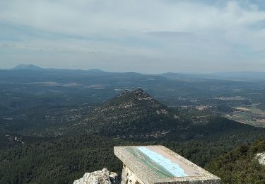
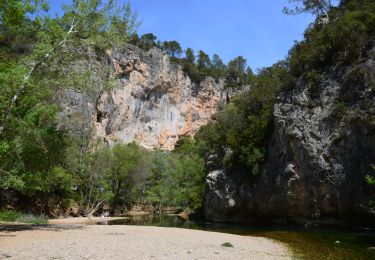
Tocht Stappen van 15,4 km beschikbaar op Provence-Alpes-Côte d'Azur, Var, Correns. Deze tocht wordt voorgesteld door Sugg.
Beschrijving
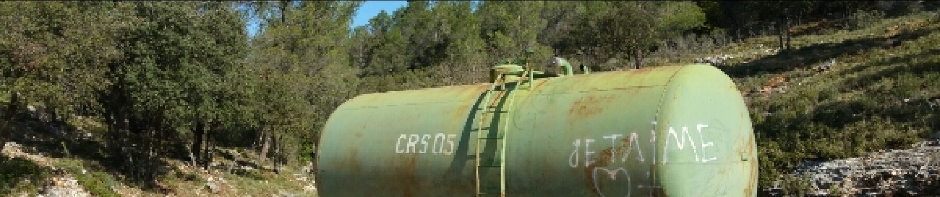
Rando réelle avec Restons en Forme Draguignan. Nous irons au gué en 171 à l'issue et en voiture pour les anniversaires.
Plaatsbepaling
Land:
France
Regio :
Provence-Alpes-Côte d'Azur
Departement/Provincie :
Var
Gemeente :
Correns
Locatie:
Unknown
Vertrek:(Dec)
Vertrek:(UTM)
263994 ; 4819283 (32T) N.
Opmerkingen
Wandeltochten in de omgeving
![Tocht Stappen Correns - Le patrimoine - l'Argens - Le village - Photo](https://media.geolcdn.com/t/375/260/405a713c-9f67-402a-9b2f-998d4bced48b.jpg&format=jpg&maxdim=2)
![Stappen Stappen](https://static1.geolcdn.com/sitytour/trail-icons/101.png)
Le patrimoine - l'Argens - Le village
Stappen
Gemakkelijk
(2)
Correns,
Provence-Alpes-Côte d'Azur,
Var,
France
![](/images/other/stat-length.png)
14,2 km | 18,1 km-effort
6h 0min
![](https://static1.geolcdn.com/siteimages/upload/files/16400158638029165_repeat_loop_refresh_sync_direction_icon.png)
Ja
![Tocht Stappen Cotignac - Tour du gros Bessillon - Photo](https://media.geolcdn.com/t/375/260/779808d6-cf2d-4575-a137-1a82d1025a08.jpg&format=jpg&maxdim=2)
![Stappen Stappen](https://static1.geolcdn.com/sitytour/trail-icons/101.png)
Tour du gros Bessillon
Stappen
Medium
Cotignac,
Provence-Alpes-Côte d'Azur,
Var,
France
![](/images/other/stat-length.png)
14,3 km | 21 km-effort
4h 31min
![](https://static1.geolcdn.com/siteimages/upload/files/16400158638029165_repeat_loop_refresh_sync_direction_icon.png)
Ja
![Stappen Stappen](https://static1.geolcdn.com/sitytour/trail-icons/101.png)
Correns - Val Obscur - Rive de l'Argens - Grotte aux Fées - Châteauvert - Val...
Stappen
Medium
Correns,
Provence-Alpes-Côte d'Azur,
Var,
France
![](/images/other/stat-length.png)
21 km | 27 km-effort
4h 57min
![](https://static1.geolcdn.com/siteimages/upload/files/16400158638029165_repeat_loop_refresh_sync_direction_icon.png)
Ja
![Tocht Stappen Correns - Correns-18-03-22 - Photo](https://media.geolcdn.com/t/375/260/09a33764-10f5-4925-96d0-198bf65221a1.jpg&format=jpg&maxdim=2)
![Stappen Stappen](https://static1.geolcdn.com/sitytour/trail-icons/101.png)
Correns-18-03-22
Stappen
Medium
Correns,
Provence-Alpes-Côte d'Azur,
Var,
France
![](/images/other/stat-length.png)
11,9 km | 14,9 km-effort
4h 10min
![](https://static1.geolcdn.com/siteimages/upload/files/16400158638029165_repeat_loop_refresh_sync_direction_icon.png)
Ja
![Tocht Mountainbike Correns - Correns à faire - Photo](https://media.geolcdn.com/t/375/260/6347d8bc-2d08-4062-9163-62c8d555de14.jpg&format=jpg&maxdim=2)
![Mountainbike Mountainbike](https://static1.geolcdn.com/sitytour/trail-icons/202.png)
Correns à faire
Mountainbike
Medium
Correns,
Provence-Alpes-Côte d'Azur,
Var,
France
![](/images/other/stat-length.png)
25 km | 32 km-effort
2h 55min
![](https://static1.geolcdn.com/siteimages/upload/files/16400158638029165_repeat_loop_refresh_sync_direction_icon.png)
Ja
![Tocht Mountainbike Correns - Correns fait - Photo](https://media.geolcdn.com/t/375/260/fe3c3b00-1fdc-4b15-9762-f76acb0abcaa.jpg&format=jpg&maxdim=2)
![Mountainbike Mountainbike](https://static1.geolcdn.com/sitytour/trail-icons/202.png)
Correns fait
Mountainbike
Medium
Correns,
Provence-Alpes-Côte d'Azur,
Var,
France
![](/images/other/stat-length.png)
26 km | 34 km-effort
2h 55min
![](https://static1.geolcdn.com/siteimages/upload/files/16400158638029165_repeat_loop_refresh_sync_direction_icon.png)
Ja
![Tocht Stappen Correns - Correns - Le val Sourn - Photo](https://media.geolcdn.com/t/375/260/ext.jpg?maxdim=2&url=https%3A%2F%2Fstatic1.geolcdn.com%2Fsiteimages%2Fupload%2Ffiles%2F1553511878bg_sport_marche.png)
![Stappen Stappen](https://static1.geolcdn.com/sitytour/trail-icons/101.png)
Correns - Le val Sourn
Stappen
Medium
(1)
Correns,
Provence-Alpes-Côte d'Azur,
Var,
France
![](/images/other/stat-length.png)
11,2 km | 15,2 km-effort
3h 16min
![](https://static1.geolcdn.com/siteimages/upload/files/16400158638029165_repeat_loop_refresh_sync_direction_icon.png)
Ja
![Tocht Stappen Correns - Correns reco Bernard 20.03.17 - Photo](https://media.geolcdn.com/t/375/260/ext.jpg?maxdim=2&url=https%3A%2F%2Fservices.sitytrail.com%2FGeolivesWS%2FDownloadMedia.ashx%3FTrailID%3D717809%26Media%3Dfix__20170320110319.jpg)
![Stappen Stappen](https://static1.geolcdn.com/sitytour/trail-icons/101.png)
Correns reco Bernard 20.03.17
Stappen
Medium
Correns,
Provence-Alpes-Côte d'Azur,
Var,
France
![](/images/other/stat-length.png)
16,5 km | 21 km-effort
4h 34min
![](https://static1.geolcdn.com/siteimages/upload/files/16400158638029165_repeat_loop_refresh_sync_direction_icon.png)
Ja
![Tocht Stappen Le Val - Montée du Cuit - Photo](https://media.geolcdn.com/t/375/260/ext.jpg?maxdim=2&url=https%3A%2F%2Fstatic1.geolcdn.com%2Fsiteimages%2Fupload%2Ffiles%2F1553511878bg_sport_marche.png)
![Stappen Stappen](https://static1.geolcdn.com/sitytour/trail-icons/101.png)
Montée du Cuit
Stappen
Medium
(1)
Le Val,
Provence-Alpes-Côte d'Azur,
Var,
France
![](/images/other/stat-length.png)
7,3 km | 11 km-effort
1h 50min
![](https://static1.geolcdn.com/siteimages/upload/files/16400158638029165_repeat_loop_refresh_sync_direction_icon.png)
Ja