![](/images/other/stat-length.png)
![Tocht Stappen Baren - Grande boucle Baren - Photo](https://media.geolcdn.com/t/1900/400/ext.pjpeg?maxdim=2&url=https%3A%2F%2Fstatic1.geolcdn.com%2Fsiteimages%2Fupload%2Ffiles%2F1553511878bg_sport_marche.png)
Grande boucle Baren
Rouzier
Gebruiker
![Lengte](/images/other/stat-length.png)
Lengte
13,4 km
![Max. hoogte](https://static1.geolcdn.com/siteimages/upload/files/1508320355ic_sort_altitude_max_24dp.png)
Max. hoogte
2141 m
![Positief hoogteverschil](https://static1.geolcdn.com/siteimages/upload/files/1508320355ic_sort_den_pos_24dp.png)
Positief hoogteverschil
1350 m
![Km-Effort](/images/other/stat-length.png)
Km-Effort
31 km
![Min. hoogte](https://static1.geolcdn.com/siteimages/upload/files/1508320355ic_sort_altitude_min_24dp.png)
Min. hoogte
857 m
![Negatief hoogteverschil](https://static1.geolcdn.com/siteimages/upload/files/1508320355ic_sort_den_neg_24dp.png)
Negatief hoogteverschil
1347 m
![Boucle](https://static1.geolcdn.com/siteimages/upload/files/16400158638029165_repeat_loop_refresh_sync_direction_icon.png)
Boucle
Ja
Datum van aanmaak :
2017-03-14 00:00:00.0
Laatste wijziging :
2017-03-14 00:00:00.0
![Stappen](https://static1.geolcdn.com/sitytour/trail-icons/101.png)
6h17
Moeilijkheid : Moeilijk
![Scan deze QR-code om de tocht te openen in de SityTrail-applicatie](https://capi.geolives.com/qq0zvz2zws4bq2lad0pu/sitytour/trails/714205/qr.png?size=200)
Gratisgps-wandelapplicatie
Over ons
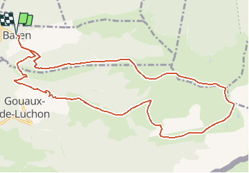
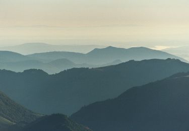
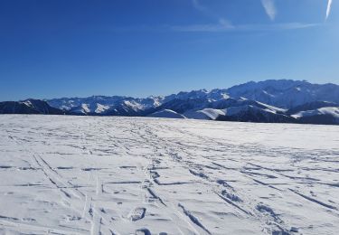
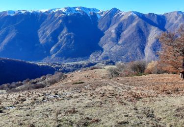
Tocht Stappen van 13,4 km beschikbaar op Occitanië, Haute-Garonne, Baren. Deze tocht wordt voorgesteld door Rouzier.
Beschrijving
Baren,Crête de Sarrat Médan,Maillot des Clots,Pic de Burat,Pic de Bassioues,Cabane du Mouscadé,Cabane de Salode,Granges d'Echart,Gouaux,Baren.
Plaatsbepaling
Land:
France
Regio :
Occitanië
Departement/Provincie :
Haute-Garonne
Gemeente :
Baren
Locatie:
Unknown
Vertrek:(Dec)
Vertrek:(UTM)
305506 ; 4749004 (31T) N.
Opmerkingen
Wandeltochten in de omgeving
![Tocht Stappen Baren - mail de la Pique 01 2018 - Photo](https://media.geolcdn.com/t/375/260/ext.jpg?maxdim=2&url=https%3A%2F%2Fservices.sitytrail.com%2FGeolivesWS%2FDownloadMedia.ashx%3FTrailID%3D893844%26Media%3Dfix__20180118101934.jpg)
![Stappen Stappen](https://static1.geolcdn.com/sitytour/trail-icons/101.png)
mail de la Pique 01 2018
Stappen
Heel gemakkelijk
(1)
Baren,
Occitanië,
Haute-Garonne,
France
![](/images/other/stat-length.png)
7,6 km | 19,1 km-effort
4h 55min
![](https://static1.geolcdn.com/siteimages/upload/files/16400158638029165_repeat_loop_refresh_sync_direction_icon.png)
Ja
![Tocht Stappen Artigue - ARTIGUE - Gouaux de Luchon - chemin forestier - Photo](https://media.geolcdn.com/t/375/260/ext.jpg?maxdim=2&url=https%3A%2F%2Fstatic1.geolcdn.com%2Fsiteimages%2Fupload%2Ffiles%2F1553511878bg_sport_marche.png)
![Stappen Stappen](https://static1.geolcdn.com/sitytour/trail-icons/101.png)
ARTIGUE - Gouaux de Luchon - chemin forestier
Stappen
Medium
(1)
Artigue,
Occitanië,
Haute-Garonne,
France
![](/images/other/stat-length.png)
13,7 km | 23 km-effort
3h 21min
![](https://static1.geolcdn.com/siteimages/upload/files/16400158638029165_repeat_loop_refresh_sync_direction_icon.png)
Ja
![Tocht Stappen Artigue - Artigue pic de Bacanere - Photo](https://media.geolcdn.com/t/375/260/0674b2f2-ba98-48ee-8365-d627d97b03e5.jpg&format=jpg&maxdim=2)
![Stappen Stappen](https://static1.geolcdn.com/sitytour/trail-icons/101.png)
Artigue pic de Bacanere
Stappen
Zeer moeilijk
Artigue,
Occitanië,
Haute-Garonne,
France
![](/images/other/stat-length.png)
15,1 km | 29 km-effort
6h 31min
![](https://static1.geolcdn.com/siteimages/upload/files/16400158638029165_repeat_loop_refresh_sync_direction_icon.png)
Ja
![Tocht Stappen Artigue - Artigue par la cabane du plan Bosc et la cabane de Saunères - Photo](https://media.geolcdn.com/t/375/260/3c7be430-12b7-4318-be61-25352c65f0e4.jpg&format=jpg&maxdim=2)
![Stappen Stappen](https://static1.geolcdn.com/sitytour/trail-icons/101.png)
Artigue par la cabane du plan Bosc et la cabane de Saunères
Stappen
Moeilijk
Artigue,
Occitanië,
Haute-Garonne,
France
![](/images/other/stat-length.png)
10,5 km | 18,3 km-effort
4h 10min
![](https://static1.geolcdn.com/siteimages/upload/files/16400158638029165_repeat_loop_refresh_sync_direction_icon.png)
Ja
![Tocht Stappen Baren - Mail de la Pique depuis Baren - Photo](https://media.geolcdn.com/t/375/260/574d7441-59c2-4f23-a4a5-6c5993228bb5.jpg&format=jpg&maxdim=2)
![Stappen Stappen](https://static1.geolcdn.com/sitytour/trail-icons/101.png)
Mail de la Pique depuis Baren
Stappen
Moeilijk
Baren,
Occitanië,
Haute-Garonne,
France
![](/images/other/stat-length.png)
9,8 km | 23 km-effort
6h 43min
![](https://static1.geolcdn.com/siteimages/upload/files/16400158638029165_repeat_loop_refresh_sync_direction_icon.png)
Ja
![Tocht Stappen Artigue - 2022-02-26 Artigue - cabane de peyrehitte - mont Majou - luchonais - Photo](https://media.geolcdn.com/t/375/260/d3d7c3f2-a654-4693-9bbc-04b518c9f33d.jpg&format=jpg&maxdim=2)
![Stappen Stappen](https://static1.geolcdn.com/sitytour/trail-icons/101.png)
2022-02-26 Artigue - cabane de peyrehitte - mont Majou - luchonais
Stappen
Moeilijk
Artigue,
Occitanië,
Haute-Garonne,
France
![](/images/other/stat-length.png)
12 km | 22 km-effort
3h 33min
![](https://static1.geolcdn.com/siteimages/upload/files/16400158638029165_repeat_loop_refresh_sync_direction_icon.png)
Ja
![Tocht Te voet Artigue - Pic de Bacanère - Photo](https://media.geolcdn.com/t/375/260/d3d1e888-9968-464e-9026-b2d9b302e4f2.jpeg&format=jpg&maxdim=2)
![Te voet Te voet](https://static1.geolcdn.com/sitytour/trail-icons/100.png)
Pic de Bacanère
Te voet
Gemakkelijk
Artigue,
Occitanië,
Haute-Garonne,
France
![](/images/other/stat-length.png)
8,3 km | 18,3 km-effort
4h 9min
![](https://static1.geolcdn.com/siteimages/upload/files/16400158638029165_repeat_loop_refresh_sync_direction_icon.png)
Neen
![Tocht Stappen Artigue - Le Montmajou en boucle depuis Artigue - Photo](https://media.geolcdn.com/t/375/260/d4ed0c6e-db25-4793-b91a-c4c505fd2eaf.jpg&format=jpg&maxdim=2)
![Stappen Stappen](https://static1.geolcdn.com/sitytour/trail-icons/101.png)
Le Montmajou en boucle depuis Artigue
Stappen
Medium
Artigue,
Occitanië,
Haute-Garonne,
France
![](/images/other/stat-length.png)
11,1 km | 23 km-effort
6h 7min
![](https://static1.geolcdn.com/siteimages/upload/files/16400158638029165_repeat_loop_refresh_sync_direction_icon.png)
Ja
![Tocht Stappen Gouaux-de-Luchon - cabane de Salode en boucle depuis Gouaux de Luchon - Photo](https://media.geolcdn.com/t/375/260/6c022396-4143-4bb6-8bdc-61ed03ba18b5.jpg&format=jpg&maxdim=2)
![Stappen Stappen](https://static1.geolcdn.com/sitytour/trail-icons/101.png)
cabane de Salode en boucle depuis Gouaux de Luchon
Stappen
Gemakkelijk
Gouaux-de-Luchon,
Occitanië,
Haute-Garonne,
France
![](/images/other/stat-length.png)
8,2 km | 16,9 km-effort
5h 20min
![](https://static1.geolcdn.com/siteimages/upload/files/16400158638029165_repeat_loop_refresh_sync_direction_icon.png)
Ja