


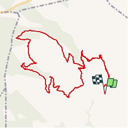

16,5 km | 24 km-effort


Gebruiker


Gratisgps-wandelapplicatie
 SityTrail
IGN / Geografische instituten
SityTrail World
De wereld gaat voor u open
Tocht Stappen van 15,3 km beschikbaar op Provence-Alpes-Côte d'Azur, Var, La Cadière-d'Azur. Deze tocht wordt voorgesteld door GILOU440.
ENTRE 1 ET 2 LE SENTIER N EST PAS EVIDENT A SUIVRE ENSUITE çA VA MIEUX.
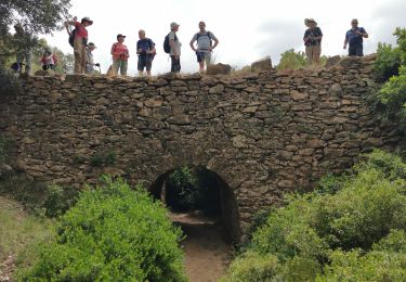
CHEMIN DES FOURS A CADE
FAIT LE 20 01 2017


Stappen

Stappen

Stappen

Stappen

Stappen

Noords wandelen
Noords wandelen

Stappen
Stappen