


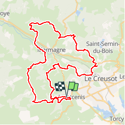

9,4 km | 11,2 km-effort


Gebruiker


Gratisgps-wandelapplicatie
 SityTrail
IGN / Geografische instituten
SityTrail World
De wereld gaat voor u open
Tocht Mountainbike van 45 km beschikbaar op Bourgondië-Franche-Comté, Saône-et-Loire, Montcenis. Deze tocht wordt voorgesteld door rocco58.
Randonnée sympathique sur les villages à côté du Creusot. De jolis points de vue sur le parcours vous attendent.
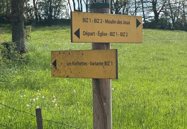
Stappen

Mountainbike

Stappen
Stappen
Elektrische fiets
Stappen

sport
Stappen
Stappen