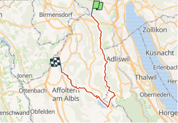
![](/images/other/stat-length.png)
![Tocht Andere activiteiten Stallikon - Albiskette-Classic: Uetliberg Albispass Türlersee - Photo](https://media.geolcdn.com/t/1900/400/ext.pjpeg?maxdim=2&url=https%3A%2F%2Fstatic1.geolcdn.com%2Fsiteimages%2Fupload%2Ffiles%2F1545311037marcheuse_200dpi.jpg)
Albiskette-Classic: Uetliberg Albispass Türlersee
NicolasEngelke
Gebruiker
![Lengte](/images/other/stat-length.png)
![Max. hoogte](https://static1.geolcdn.com/siteimages/upload/files/1508320355ic_sort_altitude_max_24dp.png)
![Positief hoogteverschil](https://static1.geolcdn.com/siteimages/upload/files/1508320355ic_sort_den_pos_24dp.png)
![Km-Effort](/images/other/stat-length.png)
![Min. hoogte](https://static1.geolcdn.com/siteimages/upload/files/1508320355ic_sort_altitude_min_24dp.png)
![Negatief hoogteverschil](https://static1.geolcdn.com/siteimages/upload/files/1508320355ic_sort_den_neg_24dp.png)
![Boucle](https://static1.geolcdn.com/siteimages/upload/files/16400158638029165_repeat_loop_refresh_sync_direction_icon.png)
![Andere activiteiten](https://static1.geolcdn.com/sitytour/trail-icons/900.png)
5h05
Moeilijkheid : Gemakkelijk
![Scan deze QR-code om de tocht te openen in de SityTrail-applicatie](https://capi.geolives.com/qq0zvz2zws4bq2lad0pu/sitytour/trails/679389/qr.png?size=200)
Gratisgps-wandelapplicatie
Over ons
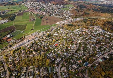
Tocht Andere activiteiten van 20 km beschikbaar op Zürich, Bezirk Affoltern, Stallikon. Deze tocht wordt voorgesteld door NicolasEngelke.
Beschrijving
Wir starteten auf dem Uetliberg und folgten dem Gratweg bis zur Albis-Passhöhe. Dort stiegen wir ab zum Türlersee, umrundeten
diesen bis zum Nordufer, von wo wir auf den Aeugsterberg aufstiegen und via den
Bisliker und Hedinger Weiher unser Ziel Hedingen erreichen.
Von dort bringt uns die S5 nach Zürich oder Zug resp. die S14 nach Zürich.
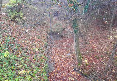
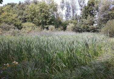
Diese Route bietet neben unzähligen Weit- und Tiefblicken schöne Passagen
entlang von drei kleineren stehenden Gewässern.
Plaatsbepaling
Opmerkingen
Wandeltochten in de omgeving
![Tocht Stappen Zürich - Uetliberg - Albispass - Türlersee - Photo](https://media.geolcdn.com/t/375/260/ext.jpg?maxdim=2&url=https%3A%2F%2Fstatic1.geolcdn.com%2Fsiteimages%2Fupload%2Ffiles%2F1553511878bg_sport_marche.png)
![Stappen Stappen](https://static1.geolcdn.com/sitytour/trail-icons/101.png)
Stappen
![](/images/other/stat-length.png)
![](https://static1.geolcdn.com/siteimages/upload/files/16400158638029165_repeat_loop_refresh_sync_direction_icon.png)
![Tocht Te voet Adliswil - Ober Leimbach - Waldi - Fixme - Photo](https://media.geolcdn.com/t/375/260/4b7b0b47-a069-40d5-8e4c-3d56220d8276.jpeg&format=jpg&maxdim=2)
![Te voet Te voet](https://static1.geolcdn.com/sitytour/trail-icons/100.png)
Te voet
![](/images/other/stat-length.png)
![](https://static1.geolcdn.com/siteimages/upload/files/16400158638029165_repeat_loop_refresh_sync_direction_icon.png)
![Tocht Te voet Zürich - Rigiblick - Stettbach Bahnhof - Photo](https://media.geolcdn.com/t/375/260/454baeef-2017-489f-b0cc-d51ac7dc03f1.jpeg&format=jpg&maxdim=2)
![Te voet Te voet](https://static1.geolcdn.com/sitytour/trail-icons/100.png)
Te voet
![](/images/other/stat-length.png)
![](https://static1.geolcdn.com/siteimages/upload/files/16400158638029165_repeat_loop_refresh_sync_direction_icon.png)
![Tocht Te voet Adliswil - Adliswil (Bahnhof) - Thalwil (Bahnhof) - Photo](https://media.geolcdn.com/t/375/260/1b61ea50-0c39-417f-b21d-594d58f81a4c.jpeg&format=jpg&maxdim=2)
![Te voet Te voet](https://static1.geolcdn.com/sitytour/trail-icons/100.png)
Te voet
![](/images/other/stat-length.png)
![](https://static1.geolcdn.com/siteimages/upload/files/16400158638029165_repeat_loop_refresh_sync_direction_icon.png)
![Tocht Te voet Stallikon - Uitikon Waldegg Station - Uetliberg Kulm - Photo](https://media.geolcdn.com/t/375/260/dev_a758ce6b-60a2-4471-b639-3fd48e07adc6.jpeg&format=jpg&maxdim=2)
![Te voet Te voet](https://static1.geolcdn.com/sitytour/trail-icons/100.png)
Te voet
![](/images/other/stat-length.png)
![](https://static1.geolcdn.com/siteimages/upload/files/16400158638029165_repeat_loop_refresh_sync_direction_icon.png)
![Tocht Te voet Uitikon - Birmensdorf - Ringlikon - Photo](https://media.geolcdn.com/t/375/260/1c3d2f09-512b-49d3-aedf-b21de5c9fc70.jpeg&format=jpg&maxdim=2)
![Te voet Te voet](https://static1.geolcdn.com/sitytour/trail-icons/100.png)
Te voet
![](/images/other/stat-length.png)
![](https://static1.geolcdn.com/siteimages/upload/files/16400158638029165_repeat_loop_refresh_sync_direction_icon.png)
![Tocht Te voet Uitikon - Birmensdorf - Ringlikon Haltestelle - Photo](https://media.geolcdn.com/t/375/260/b2488650-92af-45a4-8c3f-0ddfecd0423e.jpeg&format=jpg&maxdim=2)
![Te voet Te voet](https://static1.geolcdn.com/sitytour/trail-icons/100.png)
Te voet
![](/images/other/stat-length.png)
![](https://static1.geolcdn.com/siteimages/upload/files/16400158638029165_repeat_loop_refresh_sync_direction_icon.png)
![Tocht Te voet Wettswil am Albis - Birmensdorf - Wettswil - Photo](https://media.geolcdn.com/t/375/260/6876b5bc-0e6c-4b4c-b57e-4dd6d3c1fb20.jpeg&format=jpg&maxdim=2)
![Te voet Te voet](https://static1.geolcdn.com/sitytour/trail-icons/100.png)
Te voet
![](/images/other/stat-length.png)
![](https://static1.geolcdn.com/siteimages/upload/files/16400158638029165_repeat_loop_refresh_sync_direction_icon.png)
![Tocht Te voet Urdorf - Urdorf Weihermatt - Uitikon - Photo](https://media.geolcdn.com/t/375/260/dev_76fd71d7-8c51-4ea8-87fa-2e5274c6d931.jpeg&format=jpg&maxdim=2)
![Te voet Te voet](https://static1.geolcdn.com/sitytour/trail-icons/100.png)
Te voet
![](/images/other/stat-length.png)
![](https://static1.geolcdn.com/siteimages/upload/files/16400158638029165_repeat_loop_refresh_sync_direction_icon.png)