![](/images/other/stat-length.png)
![Tocht Noords wandelen Ger - MN-6-GER-Guichot - Photo](https://media.geolcdn.com/t/1900/400/ext.pjpeg?maxdim=2&url=https%3A%2F%2Fstatic1.geolcdn.com%2Fsiteimages%2Fupload%2Ffiles%2F1545311037marcheuse_200dpi.jpg)
MN-6-GER-Guichot
cromignon
Gebruiker
![Lengte](/images/other/stat-length.png)
Lengte
12,1 km
![Max. hoogte](https://static1.geolcdn.com/siteimages/upload/files/1508320355ic_sort_altitude_max_24dp.png)
Max. hoogte
450 m
![Positief hoogteverschil](https://static1.geolcdn.com/siteimages/upload/files/1508320355ic_sort_den_pos_24dp.png)
Positief hoogteverschil
73 m
![Km-Effort](/images/other/stat-length.png)
Km-Effort
13,1 km
![Min. hoogte](https://static1.geolcdn.com/siteimages/upload/files/1508320355ic_sort_altitude_min_24dp.png)
Min. hoogte
408 m
![Negatief hoogteverschil](https://static1.geolcdn.com/siteimages/upload/files/1508320355ic_sort_den_neg_24dp.png)
Negatief hoogteverschil
79 m
![Boucle](https://static1.geolcdn.com/siteimages/upload/files/16400158638029165_repeat_loop_refresh_sync_direction_icon.png)
Boucle
Ja
Datum van aanmaak :
2016-12-26 00:00:00.0
Laatste wijziging :
2016-12-26 00:00:00.0
![Noords wandelen](https://static1.geolcdn.com/sitytour/trail-icons/102.png)
2h00
Moeilijkheid : Gemakkelijk
![Scan deze QR-code om de tocht te openen in de SityTrail-applicatie](https://capi.geolives.com/qq0zvz2zws4bq2lad0pu/sitytour/trails/676514/qr.png?size=200)
Gratisgps-wandelapplicatie
Over ons
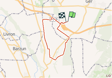
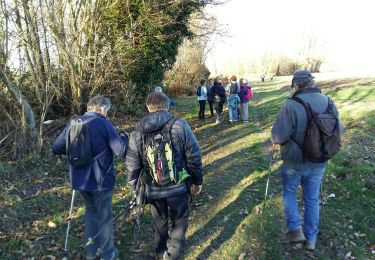
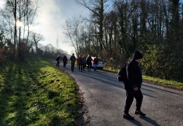
Tocht Noords wandelen van 12,1 km beschikbaar op Nieuw-Aquitanië, Pyrénées-Atlantiques, Ger. Deze tocht wordt voorgesteld door cromignon.
Beschrijving
Circuit de MN-6 du club LPC de GER(64); une partie étant en bot=rdure de champ, à éviter durant la période de culture du maïs
Plaatsbepaling
Land:
France
Regio :
Nieuw-Aquitanië
Departement/Provincie :
Pyrénées-Atlantiques
Gemeente :
Ger
Locatie:
Unknown
Vertrek:(Dec)
Vertrek:(UTM)
737433 ; 4791159 (30T) N.
Opmerkingen
Wandeltochten in de omgeving
![Tocht Stappen Ger - Le plateau de Ger en Béarn - Photo](https://media.geolcdn.com/t/375/260/ext.jpg?maxdim=2&url=https%3A%2F%2Fservices.sitytrail.com%2FGeolivesWS%2FDownloadMedia.ashx%3FTrailID%3D173157%26Media%3D14730_6.jpg)
![Stappen Stappen](https://static1.geolcdn.com/sitytour/trail-icons/101.png)
Le plateau de Ger en Béarn
Stappen
Medium
(2)
Ger,
Nieuw-Aquitanië,
Pyrénées-Atlantiques,
France
![](/images/other/stat-length.png)
23 km | 28 km-effort
6h 30min
![](https://static1.geolcdn.com/siteimages/upload/files/16400158638029165_repeat_loop_refresh_sync_direction_icon.png)
Ja
![Tocht Stappen Ger - GER MANAS balisage creation 3055925 - Photo](https://media.geolcdn.com/t/375/260/0b80a463-657d-43ac-92af-f7d1a1bb8bc0.jpg&format=jpg&maxdim=2)
![Stappen Stappen](https://static1.geolcdn.com/sitytour/trail-icons/101.png)
GER MANAS balisage creation 3055925
Stappen
Gemakkelijk
(1)
Ger,
Nieuw-Aquitanië,
Pyrénées-Atlantiques,
France
![](/images/other/stat-length.png)
2,7 km | 3,1 km-effort
55min
![](https://static1.geolcdn.com/siteimages/upload/files/16400158638029165_repeat_loop_refresh_sync_direction_icon.png)
Ja
![Tocht Stappen Luquet - Lac de Gabas - Luquet - Photo](https://media.geolcdn.com/t/375/260/ext.jpg?maxdim=2&url=https%3A%2F%2Fservices.sitytrail.com%2FGeolivesWS%2FDownloadMedia.ashx%3FTrailID%3D109816%26Media%3D4780_1.jpg)
![Stappen Stappen](https://static1.geolcdn.com/sitytour/trail-icons/101.png)
Lac de Gabas - Luquet
Stappen
Medium
(1)
Luquet,
Occitanië,
Hautes-Pyrénées,
France
![](/images/other/stat-length.png)
9,3 km | 11,1 km-effort
2h 0min
![](https://static1.geolcdn.com/siteimages/upload/files/16400158638029165_repeat_loop_refresh_sync_direction_icon.png)
Ja
![Tocht Noords wandelen Ger - Mn2 Ger menhir - Photo](https://media.geolcdn.com/t/375/260/ext.jpg?maxdim=2&url=https%3A%2F%2Fstatic1.geolcdn.com%2Fsiteimages%2Fupload%2Ffiles%2F1545311037marcheuse_200dpi.jpg)
![Noords wandelen Noords wandelen](https://static1.geolcdn.com/sitytour/trail-icons/102.png)
Mn2 Ger menhir
Noords wandelen
Heel gemakkelijk
(1)
Ger,
Nieuw-Aquitanië,
Pyrénées-Atlantiques,
France
![](/images/other/stat-length.png)
9,8 km | 10,9 km-effort
2h 13min
![](https://static1.geolcdn.com/siteimages/upload/files/16400158638029165_repeat_loop_refresh_sync_direction_icon.png)
Ja
![Tocht Noords wandelen Livron - Livron capsus Barzun plateau capbat - Photo](https://media.geolcdn.com/t/375/260/9a56fbc8-0c1c-4031-b592-3ae60048f079.jpg&format=jpg&maxdim=2)
![Noords wandelen Noords wandelen](https://static1.geolcdn.com/sitytour/trail-icons/102.png)
Livron capsus Barzun plateau capbat
Noords wandelen
Heel gemakkelijk
Livron,
Nieuw-Aquitanië,
Pyrénées-Atlantiques,
France
![](/images/other/stat-length.png)
9,6 km | 11,8 km-effort
1h 53min
![](https://static1.geolcdn.com/siteimages/upload/files/16400158638029165_repeat_loop_refresh_sync_direction_icon.png)
Ja
![Tocht Stappen Ger - GER la galette de ses reines et rois le 4/01/2023](https://media.geolcdn.com/t/375/260/43223241-d771-4d9e-a914-255a5e44dd1f.jpg&format=jpg&maxdim=2)
![Stappen Stappen](https://static1.geolcdn.com/sitytour/trail-icons/101.png)
GER la galette de ses reines et rois le 4/01/2023 "3505757"
Stappen
Gemakkelijk
Ger,
Nieuw-Aquitanië,
Pyrénées-Atlantiques,
France
![](/images/other/stat-length.png)
5 km | 5,5 km-effort
1h 30min
![](https://static1.geolcdn.com/siteimages/upload/files/16400158638029165_repeat_loop_refresh_sync_direction_icon.png)
Ja
![Tocht Mountainbike Ger - RSlac deponsonbois du poey2022 - Photo](https://media.geolcdn.com/t/375/260/df3a122f-42e0-4ba7-b482-515e230b5b03.jpg&format=jpg&maxdim=2)
![Mountainbike Mountainbike](https://static1.geolcdn.com/sitytour/trail-icons/202.png)
RSlac deponsonbois du poey2022
Mountainbike
Gemakkelijk
Ger,
Nieuw-Aquitanië,
Pyrénées-Atlantiques,
France
![](/images/other/stat-length.png)
5,7 km | 6,3 km-effort
32min
![](https://static1.geolcdn.com/siteimages/upload/files/16400158638029165_repeat_loop_refresh_sync_direction_icon.png)
Ja
![Tocht Noords wandelen Ibos - MN1 serre Caute BOIS DE BROUHENA - Photo](https://media.geolcdn.com/t/375/260/ext.jpg?maxdim=2&url=https%3A%2F%2Fstatic1.geolcdn.com%2Fsiteimages%2Fupload%2Ffiles%2F1545311037marcheuse_200dpi.jpg)
![Noords wandelen Noords wandelen](https://static1.geolcdn.com/sitytour/trail-icons/102.png)
MN1 serre Caute BOIS DE BROUHENA
Noords wandelen
Heel gemakkelijk
(1)
Ibos,
Occitanië,
Hautes-Pyrénées,
France
![](/images/other/stat-length.png)
11,5 km | 14 km-effort
2h 32min
![](https://static1.geolcdn.com/siteimages/upload/files/16400158638029165_repeat_loop_refresh_sync_direction_icon.png)
Ja
![Tocht Stappen Ger - RS ger tunnel 2022 - Photo](https://media.geolcdn.com/t/375/260/0dc4fd57-e3e8-42e4-9003-9eab28529877.jpg&format=jpg&maxdim=2)
![Stappen Stappen](https://static1.geolcdn.com/sitytour/trail-icons/101.png)
RS ger tunnel 2022
Stappen
Gemakkelijk
Ger,
Nieuw-Aquitanië,
Pyrénées-Atlantiques,
France
![](/images/other/stat-length.png)
5,1 km | 5,5 km-effort
1h 39min
![](https://static1.geolcdn.com/siteimages/upload/files/16400158638029165_repeat_loop_refresh_sync_direction_icon.png)
Ja