


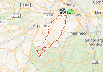

16 km | 17,9 km-effort

Gebruiker


Gratisgps-wandelapplicatie
 SityTrail
IGN / Geografische instituten
SityTrail World
De wereld gaat voor u open
Tocht Mountainbike van 48 km beschikbaar op Île-de-France, Essonne, Bondoufle. Deze tocht wordt voorgesteld door Lucquiaud.
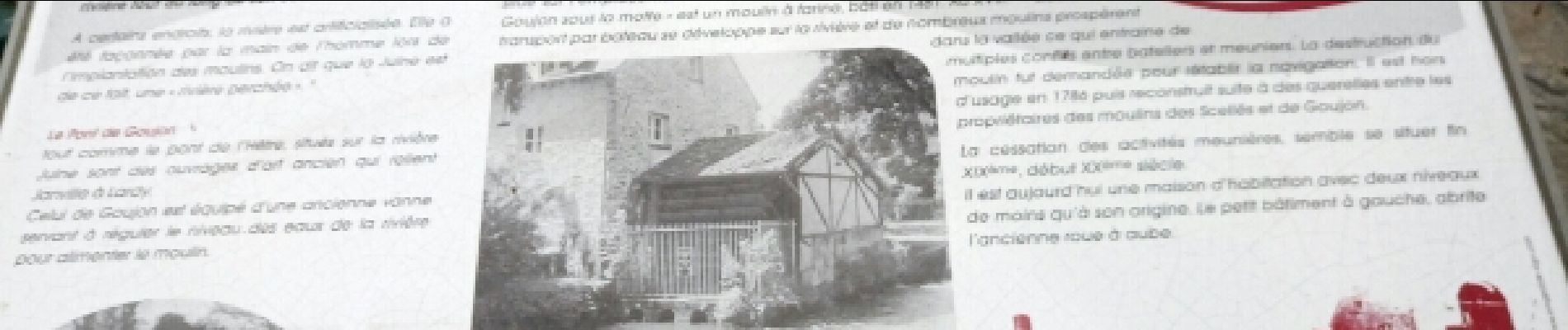
rando devant le château de Chamarande (détour possible), château de Gillevoisin, Tour de Pocancy et cabane ILEX, moulin de Goujon pour finir sur la Juine


Stappen

Mountainbike
Mountainbike
Mountainbike
Stappen
Te voet


sport
Mountainbike
Mountainbike