![](/images/other/stat-length.png)
![Tocht Andere activiteiten ORMOY-VILLERS - Picardie - Ligne 227 - Ormoy-Villers - Mareuil-sur-Ourcq - Photo](https://media.geolcdn.com/t/1900/400/ext.pjpeg?maxdim=2&url=https%3A%2F%2Fstatic1.geolcdn.com%2Fsiteimages%2Fupload%2Ffiles%2F1545311037marcheuse_200dpi.jpg)
Picardie - Ligne 227 - Ormoy-Villers - Mareuil-sur-Ourcq
mich54
Gebruiker
![Lengte](/images/other/stat-length.png)
![Max. hoogte](https://static1.geolcdn.com/siteimages/upload/files/1508320355ic_sort_altitude_max_24dp.png)
![Positief hoogteverschil](https://static1.geolcdn.com/siteimages/upload/files/1508320355ic_sort_den_pos_24dp.png)
![Km-Effort](/images/other/stat-length.png)
![Min. hoogte](https://static1.geolcdn.com/siteimages/upload/files/1508320355ic_sort_altitude_min_24dp.png)
![Negatief hoogteverschil](https://static1.geolcdn.com/siteimages/upload/files/1508320355ic_sort_den_neg_24dp.png)
![Boucle](https://static1.geolcdn.com/siteimages/upload/files/16400158638029165_repeat_loop_refresh_sync_direction_icon.png)
![Andere activiteiten](https://static1.geolcdn.com/sitytour/trail-icons/900.png)
5m
Moeilijkheid : Onbekend
![Scan deze QR-code om de tocht te openen in de SityTrail-applicatie](https://capi.geolives.com/qq0zvz2zws4bq2lad0pu/sitytour/trails/664946/qr.png?size=200)
Gratisgps-wandelapplicatie
Over ons
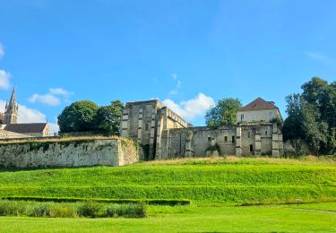
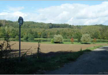
Tocht Andere activiteiten van 22 km beschikbaar op Hauts-de-France, Oise. Deze tocht wordt voorgesteld door mich54.
Beschrijving
La ligne d'Ormoy-Villers à Mareuil-sur-Ourcq est une ligne ferroviaire française, d'une longueur de 21,5 kilomètres.
Ligne à voie unique ouverte en 1894 par la Compagnie des chemins de fer du Nord. Cette transversale relie la ligne de La Plaine à Hirson et Anor (frontière), constituant l'axe de Paris-Nord à Laon, à la ligne de Trilport à Bazoches, axe de Paris-Est à Reims. Comme de nombreuses lignes secondaires, elle est fermée au trafic de voyageurs en 1939, puis partiellement déferrée. Le tronçon entre Ormoy-Villers et Betz voit subsister un faible trafic de marchandises, jusqu'aux années 1980. Depuis 2005, la totalité de la ligne est définitivement fermée.
Elle constitue la ligne no 2270001 du réseau ferré national.(Source Wikipédia)
Plaatsbepaling
Opmerkingen
Wandeltochten in de omgeving
![Tocht Stappen Versigny - SM_DROIZELLES_ 8Km - Photo](https://media.geolcdn.com/t/375/260/f65b74ad-26ab-4b6b-97d1-92bea4466b40.jpg&format=jpg&maxdim=2)
![Stappen Stappen](https://static1.geolcdn.com/sitytour/trail-icons/101.png)
Stappen
![](/images/other/stat-length.png)
![](https://static1.geolcdn.com/siteimages/upload/files/16400158638029165_repeat_loop_refresh_sync_direction_icon.png)
![Tocht Stappen Péroy-les-Gombries - SM_PEROY-LES-GOMBRIES_8.4KM - Photo](https://media.geolcdn.com/t/375/260/1ec4a825-3b6c-44d9-9b96-15f24dcd8ce5.jpg&format=jpg&maxdim=2)
![Stappen Stappen](https://static1.geolcdn.com/sitytour/trail-icons/101.png)
Stappen
![](/images/other/stat-length.png)
![](https://static1.geolcdn.com/siteimages/upload/files/16400158638029165_repeat_loop_refresh_sync_direction_icon.png)
![Tocht Stappen Auger-Saint-Vincent - SM_AUGER-Saint-VINCENT_8.8Km - Photo](https://media.geolcdn.com/t/375/260/0fa42189-56de-41a9-ac5a-5c591c7c2e51.jpg&format=jpg&maxdim=2)
![Stappen Stappen](https://static1.geolcdn.com/sitytour/trail-icons/101.png)
Stappen
![](/images/other/stat-length.png)
![](https://static1.geolcdn.com/siteimages/upload/files/16400158638029165_repeat_loop_refresh_sync_direction_icon.png)
![Tocht Te voet Crépy-en-Valois - Boucle 24 km Crépy en Valois - Duvy - Trumily - Rocquemont - Photo](https://media.geolcdn.com/t/375/260/280ca2ce-af52-47b9-81c4-4fc64d53f4f3.jpg&format=jpg&maxdim=2)
![Te voet Te voet](https://static1.geolcdn.com/sitytour/trail-icons/100.png)
Te voet
![](/images/other/stat-length.png)
![](https://static1.geolcdn.com/siteimages/upload/files/16400158638029165_repeat_loop_refresh_sync_direction_icon.png)
![Tocht Stappen Ormoy-Villers - Geocache Ancienne sablière - Photo](https://media.geolcdn.com/t/375/260/ext.jpg?maxdim=2&url=https%3A%2F%2Fstatic1.geolcdn.com%2Fsiteimages%2Fupload%2Ffiles%2F1553511878bg_sport_marche.png)
![Stappen Stappen](https://static1.geolcdn.com/sitytour/trail-icons/101.png)
Stappen
![](/images/other/stat-length.png)
![](https://static1.geolcdn.com/siteimages/upload/files/16400158638029165_repeat_loop_refresh_sync_direction_icon.png)
![Tocht Fiets Boissy-Fresnoy - Voie verte du Valois - Photo](https://media.geolcdn.com/t/375/260/ext.jpg?maxdim=2&url=https%3A%2F%2Fservices.sitytrail.com%2FGeolivesWS%2FDownloadMedia.ashx%3FTrailID%3D838150%26Media%3D63399dab-15c4-4e3e-b52f-4ba03efd3015.JPG)
![Fiets Fiets](https://static1.geolcdn.com/sitytour/trail-icons/200.png)
Fiets
![](/images/other/stat-length.png)
![](https://static1.geolcdn.com/siteimages/upload/files/16400158638029165_repeat_loop_refresh_sync_direction_icon.png)
![Tocht Motor Crépy-en-Valois - Randoguide - Photo](https://media.geolcdn.com/t/375/260/ext.jpg?maxdim=2&url=https%3A%2F%2Fstatic1.geolcdn.com%2Fsiteimages%2Fupload%2Ffiles%2F15247431544x4.jpg)
![Motor Motor](https://static1.geolcdn.com/sitytour/trail-icons/400.png)
Motor
![](/images/other/stat-length.png)
![](https://static1.geolcdn.com/siteimages/upload/files/16400158638029165_repeat_loop_refresh_sync_direction_icon.png)
![Tocht Stappen - SM_ROSIERES-NORD_8.6Km - Photo](https://media.geolcdn.com/t/375/260/cdc8e3b3-f714-4b51-ae55-8d263b9a3239.jpg&format=jpg&maxdim=2)
![Stappen Stappen](https://static1.geolcdn.com/sitytour/trail-icons/101.png)
Stappen
![](/images/other/stat-length.png)
![](https://static1.geolcdn.com/siteimages/upload/files/16400158638029165_repeat_loop_refresh_sync_direction_icon.png)
![Tocht Hybride fiets Lévignen - Voie verte de Valois - Photo](https://media.geolcdn.com/t/375/260/efdd8419-a69a-438b-b463-1c8a8473c49d.jpg&format=jpg&maxdim=2)
![Hybride fiets Hybride fiets](https://static1.geolcdn.com/sitytour/trail-icons/203.png)
Hybride fiets
![](/images/other/stat-length.png)
![](https://static1.geolcdn.com/siteimages/upload/files/16400158638029165_repeat_loop_refresh_sync_direction_icon.png)