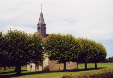
8,6 km | 9,1 km-effort
Francheville Iton Voie Romaine 16.4 Km
ODDAD78
Gebruiker
Lengte
16,4 km
Max. hoogte
207 m
Positief hoogteverschil
100 m
Km-Effort
17,8 km
Min. hoogte
176 m
Negatief hoogteverschil
102 m
Boucle
Ja
Datum van aanmaak :
2019-04-13 16:34:30.641
Laatste wijziging :
2019-04-13 16:34:30.672
3h54
Moeilijkheid : Gemakkelijk
Gratisgps-wandelapplicatie
Over ons
Tocht Stappen van 16,4 km beschikbaar op Normandië, Eure, Verneuil d'Avre et d'Iton. Deze tocht wordt voorgesteld door ODDAD78.
Beschrijving
Offre touristique de l'Office de Tourisme Normandie Sud - Verneuil sur Avre
Plaatsbepaling
Land:
France
Regio :
Normandië
Departement/Provincie :
Eure
Gemeente :
Verneuil d'Avre et d'Iton
Locatie:
Unknown
Vertrek:(Dec)
Vertrek:(UTM)
342102 ; 5406097 (31U) N.
Opmerkingen
Wandeltochten in de omgeving
Circuit des chemins des Isles - Cintray
Stappen
Medium
(2)
Breteuil,
Normandië,
Eure,
France
2h 10min
Ja
Cintray Chemin des Isles 8.2 Km
Stappen
Gemakkelijk
(1)
Breteuil,
Normandië,
Eure,
France
8,2 km | 8,7 km-effort
1h 56min
Ja
Circuit de Malicorne - Francheville
Stappen
Gemakkelijk
Verneuil d'Avre et d'Iton,
Normandië,
Eure,
France
4,4 km | 4,6 km-effort
1h 4min
Ja
La Voie Romaine - Francheville
Stappen
Moeilijk
Verneuil d'Avre et d'Iton,
Normandië,
Eure,
France
16,1 km | 17,3 km-effort
4h 0min
Ja
Circuit du Pré Saulé - Bourth
Stappen
Gemakkelijk
Bourth,
Normandië,
Eure,
France
5,5 km | 6,2 km-effort
1h 19min
Ja
Bourth Circuit Pré Saul 5.5 Km
Stappen
Gemakkelijk
Bourth,
Normandië,
Eure,
France
5,5 km | 6,2 km-effort
1h 21min
Ja
Circuit des Passerelles - Cintray
Stappen
Gemakkelijk
Breteuil,
Normandië,
Eure,
France
2,8 km | 3,1 km-effort
45min
Ja
Laguéroulde
Mountainbike
Moeilijk
Breteuil,
Normandië,
Eure,
France
63 km | 69 km-effort
3h 30min
Ja
Bourth et ses alentours
Stappen
Medium
Bourth,
Normandië,
Eure,
France
10,3 km | 11,3 km-effort
2h 33min
Ja