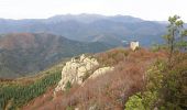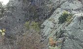

Tours de Cabrens

jcmartin
Gebruiker

Lengte
12 km

Max. hoogte
1313 m

Positief hoogteverschil
564 m

Km-Effort
19,6 km

Min. hoogte
783 m

Negatief hoogteverschil
565 m
Boucle
Ja
Datum van aanmaak :
2016-11-04 00:00:00.0
Laatste wijziging :
2016-11-04 00:00:00.0
4h14
Moeilijkheid : Medium

Gratisgps-wandelapplicatie
Over ons
Tocht Stappen van 12 km beschikbaar op Occitanië, Pyrénées-Orientales, Lamanère. Deze tocht wordt voorgesteld door jcmartin.
Beschrijving
a certains endroits le sentier balisé est un peu différent du tracé de la carte IGN mais pas de soucis il suffit de suivre le balisage qui est très bien fait
Plaatsbepaling
Land:
France
Regio :
Occitanië
Departement/Provincie :
Pyrénées-Orientales
Gemeente :
Lamanère
Locatie:
Unknown
Vertrek:(Dec)
Vertrek:(UTM)
460450 ; 4689873 (31T) N.
Opmerkingen
Wandeltochten in de omgeving

lamanere-coral_T


Stappen
Heel gemakkelijk
Lamanère,
Occitanië,
Pyrénées-Orientales,
France

14,9 km | 25 km-effort
5h 18min
Ja
Lamanere_PuigDeComaNegra_T


Stappen
Heel gemakkelijk
(1)
Lamanère,
Occitanië,
Pyrénées-Orientales,
France

15,9 km | 28 km-effort
5h 48min
Ja
serralongue Tours de Cabrens_T


Stappen
Medium
Serralongue,
Occitanië,
Pyrénées-Orientales,
France

13,3 km | 22 km-effort
4h 39min
Ja
5 et 6 rando sur 2 jours


Stappen
Zeer moeilijk
Prats-de-Mollo-la-Preste,
Occitanië,
Pyrénées-Orientales,
France

32 km | 49 km-effort
9h 39min
Ja

Lamanere


Stappen
Medium
Lamanère,
Occitanië,
Pyrénées-Orientales,
France

16,4 km | 26 km-effort
5h 20min
Ja
Espace VTT FFC Haut Vallespir - circuit n° 17 - Raid Transfrontalier


Mountainbike
Zeer moeilijk
Prats-de-Mollo-la-Preste,
Occitanië,
Pyrénées-Orientales,
France

41 km | 64 km-effort
4h 30min
Ja
Espace VTT FFC Haut Vallespir - circuit n° 11 - De Serralongue à Falgos


Mountainbike
Moeilijk
Serralongue,
Occitanië,
Pyrénées-Orientales,
France

28 km | 39 km-effort
2h 30min
Ja
Espace VTT FFC Haut Vallespir - circuit n° 3 - La Chapelle Ste Marguerite de ...


Mountainbike
Gemakkelijk
Prats-de-Mollo-la-Preste,
Occitanië,
Pyrénées-Orientales,
France

12,6 km | 17 km-effort
1h 15min
Ja
2


Stappen
Moeilijk
Lamanère,
Occitanië,
Pyrénées-Orientales,
France

16,7 km | 27 km-effort
5h 2min
Ja


 SityTrail


