


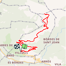

12,9 km | 27 km-effort


Gebruiker


Gratisgps-wandelapplicatie
 SityTrail
IGN / Geografische instituten
SityTrail World
De wereld gaat voor u open
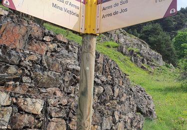
Tocht Stappen van 31 km beschikbaar op Catalonië, Lerida, Vilamòs. Deze tocht wordt voorgesteld door dawed311.
Longue course pouvant être raccourcie en montant la piste forestière (4x4 fortement recommandé). Le panorama au sommet mérite le déplacement. Le retour, sur la longue piste forestière semble interminable.

Stappen
Stappen

Stappen
Stappen
Stappen
Stappen
Stappen