![](/images/other/stat-length.png)
![Tocht Stappen Labastide-d'Armagnac - circuit de la chapelle de geou - Photo](https://media.geolcdn.com/t/1900/400/ext.pjpeg?maxdim=2&url=https%3A%2F%2Fservices.sitytrail.com%2FGeolivesWS%2FDownloadMedia.ashx%3FTrailID%3D649366%26Media%3Dfix__20161022151628.jpg)
circuit de la chapelle de geou
papiou
Gebruiker
![Lengte](/images/other/stat-length.png)
Lengte
8,6 km
![Max. hoogte](https://static1.geolcdn.com/siteimages/upload/files/1508320355ic_sort_altitude_max_24dp.png)
Max. hoogte
111 m
![Positief hoogteverschil](https://static1.geolcdn.com/siteimages/upload/files/1508320355ic_sort_den_pos_24dp.png)
Positief hoogteverschil
65 m
![Km-Effort](/images/other/stat-length.png)
Km-Effort
9,5 km
![Min. hoogte](https://static1.geolcdn.com/siteimages/upload/files/1508320355ic_sort_altitude_min_24dp.png)
Min. hoogte
89 m
![Negatief hoogteverschil](https://static1.geolcdn.com/siteimages/upload/files/1508320355ic_sort_den_neg_24dp.png)
Negatief hoogteverschil
64 m
![Boucle](https://static1.geolcdn.com/siteimages/upload/files/16400158638029165_repeat_loop_refresh_sync_direction_icon.png)
Boucle
Ja
Datum van aanmaak :
2016-10-22 00:00:00.0
Laatste wijziging :
2016-10-22 00:00:00.0
![Stappen](https://static1.geolcdn.com/sitytour/trail-icons/101.png)
2h16
Moeilijkheid : Heel gemakkelijk
![Scan deze QR-code om de tocht te openen in de SityTrail-applicatie](https://capi.geolives.com/qq0zvz2zws4bq2lad0pu/sitytour/trails/649366/qr.png?size=200)
Gratisgps-wandelapplicatie
Over ons
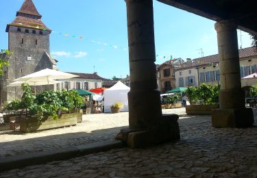
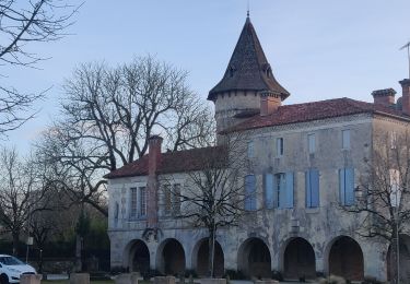
Tocht Stappen van 8,6 km beschikbaar op Nieuw-Aquitanië, Landes, Labastide-d'Armagnac. Deze tocht wordt voorgesteld door papiou.
Beschrijving
faite avec 2 enfants de 7 et 5 ans. Rdv place à côté cimetière et rejoindre rue qui longe château. poursuivre en suivant fléchage très bien visible
Plaatsbepaling
Land:
France
Regio :
Nieuw-Aquitanië
Departement/Provincie :
Landes
Gemeente :
Labastide-d'Armagnac
Locatie:
Unknown
Vertrek:(Dec)
Vertrek:(UTM)
725587 ; 4872297 (30T) N.
Opmerkingen
Wandeltochten in de omgeving
![Tocht Te voet Labastide-d'Armagnac - Itinerie d'Armagnac - Photo](https://media.geolcdn.com/t/375/260/c1a4d39d-6d66-48d2-bd86-49fc0c53b012.jpeg&format=jpg&maxdim=2)
![Te voet Te voet](https://static1.geolcdn.com/sitytour/trail-icons/100.png)
Itinerie d'Armagnac
Te voet
Gemakkelijk
Labastide-d'Armagnac,
Nieuw-Aquitanië,
Landes,
France
![](/images/other/stat-length.png)
12,3 km | 14,8 km-effort
3h 21min
![](https://static1.geolcdn.com/siteimages/upload/files/16400158638029165_repeat_loop_refresh_sync_direction_icon.png)
Neen
![Tocht Hybride fiets Le Frêche - le freche Mont de Marsan - Photo](https://media.geolcdn.com/t/375/260/b1ca82d7-7be6-4db0-a13f-2bc75a5bb968.jpg&format=jpg&maxdim=2)
![Hybride fiets Hybride fiets](https://static1.geolcdn.com/sitytour/trail-icons/203.png)
le freche Mont de Marsan
Hybride fiets
Gemakkelijk
Le Frêche,
Nieuw-Aquitanië,
Landes,
France
![](/images/other/stat-length.png)
50 km | 57 km-effort
3h 22min
![](https://static1.geolcdn.com/siteimages/upload/files/16400158638029165_repeat_loop_refresh_sync_direction_icon.png)
Ja
![Tocht Stappen Labastide-d'Armagnac - Labastide d'Armagnac : La ronde des quatre châteaux - Photo](https://media.geolcdn.com/t/375/260/5443c25d-a588-4f52-b866-a702c95ea945.jpg&format=jpg&maxdim=2)
![Stappen Stappen](https://static1.geolcdn.com/sitytour/trail-icons/101.png)
Labastide d'Armagnac : La ronde des quatre châteaux
Stappen
Medium
Labastide-d'Armagnac,
Nieuw-Aquitanië,
Landes,
France
![](/images/other/stat-length.png)
13,1 km | 15,7 km-effort
2h 50min
![](https://static1.geolcdn.com/siteimages/upload/files/16400158638029165_repeat_loop_refresh_sync_direction_icon.png)
Ja
![Tocht Stappen Saint-Justin - Saint Justin boucle de l'église de Douzevieille - Photo](https://media.geolcdn.com/t/375/260/5db9b261-5962-497e-bf9d-aa57a6bbf44e.jpg&format=jpg&maxdim=2)
![Stappen Stappen](https://static1.geolcdn.com/sitytour/trail-icons/101.png)
Saint Justin boucle de l'église de Douzevieille
Stappen
Heel gemakkelijk
(1)
Saint-Justin,
Nieuw-Aquitanië,
Landes,
France
![](/images/other/stat-length.png)
10,1 km | 11,3 km-effort
2h 16min
![](https://static1.geolcdn.com/siteimages/upload/files/16400158638029165_repeat_loop_refresh_sync_direction_icon.png)
Ja
![Tocht Stappen Labastide-d'Armagnac - La Bastide d'Armagnac, la ronde des chateaux - 6.5 - Photo](https://media.geolcdn.com/t/375/260/ext.jpg?maxdim=2&url=https%3A%2F%2Fstatic1.geolcdn.com%2Fsiteimages%2Fupload%2Ffiles%2F1553511878bg_sport_marche.png)
![Stappen Stappen](https://static1.geolcdn.com/sitytour/trail-icons/101.png)
La Bastide d'Armagnac, la ronde des chateaux - 6.5
Stappen
Gemakkelijk
(1)
Labastide-d'Armagnac,
Nieuw-Aquitanië,
Landes,
France
![](/images/other/stat-length.png)
6,5 km | 7,9 km-effort
2h 0min
![](https://static1.geolcdn.com/siteimages/upload/files/16400158638029165_repeat_loop_refresh_sync_direction_icon.png)
Ja
![Tocht Stappen Labastide-d'Armagnac - La Bastide d'Armagnac, la ronde des chateaux - 8.7 - Photo](https://media.geolcdn.com/t/375/260/ext.jpg?maxdim=2&url=https%3A%2F%2Fstatic1.geolcdn.com%2Fsiteimages%2Fupload%2Ffiles%2F1553511878bg_sport_marche.png)
![Stappen Stappen](https://static1.geolcdn.com/sitytour/trail-icons/101.png)
La Bastide d'Armagnac, la ronde des chateaux - 8.7
Stappen
Gemakkelijk
Labastide-d'Armagnac,
Nieuw-Aquitanië,
Landes,
France
![](/images/other/stat-length.png)
8,7 km | 10,3 km-effort
2h 0min
![](https://static1.geolcdn.com/siteimages/upload/files/16400158638029165_repeat_loop_refresh_sync_direction_icon.png)
Ja
![Tocht Stappen Labastide-d'Armagnac - La Bastide d'Armagnac, la ronde des chateaux - 11 - Photo](https://media.geolcdn.com/t/375/260/ext.jpg?maxdim=2&url=https%3A%2F%2Fstatic1.geolcdn.com%2Fsiteimages%2Fupload%2Ffiles%2F1553511878bg_sport_marche.png)
![Stappen Stappen](https://static1.geolcdn.com/sitytour/trail-icons/101.png)
La Bastide d'Armagnac, la ronde des chateaux - 11
Stappen
Medium
Labastide-d'Armagnac,
Nieuw-Aquitanië,
Landes,
France
![](/images/other/stat-length.png)
11,1 km | 13,5 km-effort
2h 10min
![](https://static1.geolcdn.com/siteimages/upload/files/16400158638029165_repeat_loop_refresh_sync_direction_icon.png)
Ja
![Tocht Stappen Saint-Justin - boucle d Douzevielle 1 - Photo](https://media.geolcdn.com/t/375/260/ext.jpg?maxdim=2&url=https%3A%2F%2Fstatic1.geolcdn.com%2Fsiteimages%2Fupload%2Ffiles%2F1553511878bg_sport_marche.png)
![Stappen Stappen](https://static1.geolcdn.com/sitytour/trail-icons/101.png)
boucle d Douzevielle 1
Stappen
Heel gemakkelijk
Saint-Justin,
Nieuw-Aquitanië,
Landes,
France
![](/images/other/stat-length.png)
9,8 km | 11 km-effort
2h 35min
![](https://static1.geolcdn.com/siteimages/upload/files/16400158638029165_repeat_loop_refresh_sync_direction_icon.png)
Ja
![Tocht Stappen Saint-Justin - boucle de Douzevielle - Photo](https://media.geolcdn.com/t/375/260/ext.jpg?maxdim=2&url=https%3A%2F%2Fstatic1.geolcdn.com%2Fsiteimages%2Fupload%2Ffiles%2F1553511878bg_sport_marche.png)
![Stappen Stappen](https://static1.geolcdn.com/sitytour/trail-icons/101.png)
boucle de Douzevielle
Stappen
Heel gemakkelijk
(1)
Saint-Justin,
Nieuw-Aquitanië,
Landes,
France
![](/images/other/stat-length.png)
9,8 km | 11 km-effort
2h 21min
![](https://static1.geolcdn.com/siteimages/upload/files/16400158638029165_repeat_loop_refresh_sync_direction_icon.png)
Ja
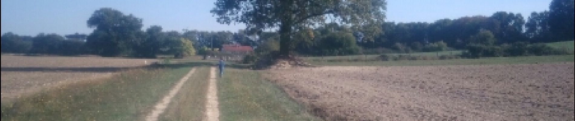
Randonnée tres agréable dans un paysage champêtre illuminé par le jaune des colzas en fleur.