![](/images/other/stat-length.png)
![Tocht Stappen Saint-Prix - Manu-161010 - Morvan-MontBeuvray - Photo](https://media.geolcdn.com/t/1900/400/ext.pjpeg?maxdim=2&url=https%3A%2F%2Fservices.sitytrail.com%2FGeolivesWS%2FDownloadMedia.ashx%3FTrailID%3D644938%26Media%3D09959136-f7f3-4997-acd5-8efd013a05f6.jpg)
Manu-161010 - Morvan-MontBeuvray
randodan
Gebruiker
![Lengte](/images/other/stat-length.png)
![Max. hoogte](https://static1.geolcdn.com/siteimages/upload/files/1508320355ic_sort_altitude_max_24dp.png)
![Positief hoogteverschil](https://static1.geolcdn.com/siteimages/upload/files/1508320355ic_sort_den_pos_24dp.png)
![Km-Effort](/images/other/stat-length.png)
![Min. hoogte](https://static1.geolcdn.com/siteimages/upload/files/1508320355ic_sort_altitude_min_24dp.png)
![Negatief hoogteverschil](https://static1.geolcdn.com/siteimages/upload/files/1508320355ic_sort_den_neg_24dp.png)
![Boucle](https://static1.geolcdn.com/siteimages/upload/files/16400158638029165_repeat_loop_refresh_sync_direction_icon.png)
![Stappen](https://static1.geolcdn.com/sitytour/trail-icons/101.png)
6h30
Moeilijkheid : Gemakkelijk
![Scan deze QR-code om de tocht te openen in de SityTrail-applicatie](https://capi.geolives.com/qq0zvz2zws4bq2lad0pu/sitytour/trails/644938/qr.png?size=200)
Gratisgps-wandelapplicatie
Over ons
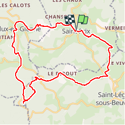
Tocht Stappen van 22 km beschikbaar op Bourgondië-Franche-Comté, Saône-et-Loire, Saint-Prix. Deze tocht wordt voorgesteld door randodan.
Beschrijving
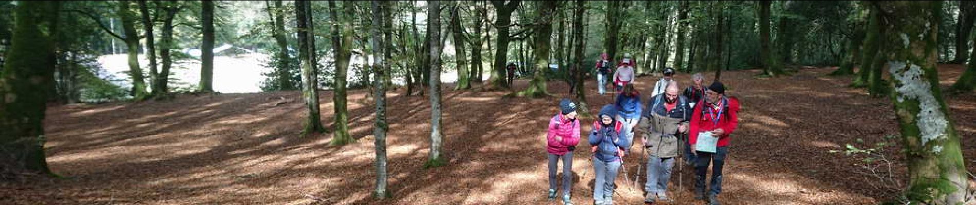
2016 - Le Morvan avec Manureva<br>
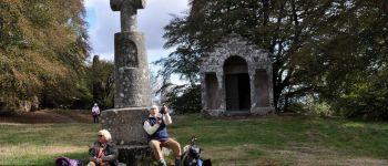
- 10 octobre : Mont Beuvray -<br>
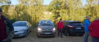
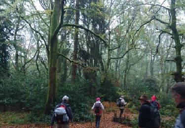
Glagla ce matin, les pare-brises sont tout givrés !<br>
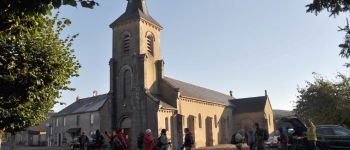
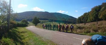
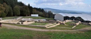
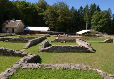
9h15, départ de Saint-Prix . 10h30, Glux-en-Glenne, on a déjà 300 m de dénivelé positif dans les pattes . 11h15, altitude 550 m, on attaque le Mont Beuvray . Au passage, petite pause-visite du site archéologique.<br>
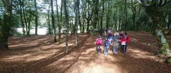
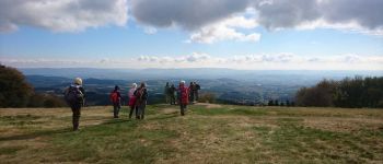
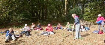
Midi et quart, en haut du Mont Beuvray, 810 m . Un quart d'heure plus tard, nous sortons le pique-nique dans un coin à l'abri du vent et bien ensoleillé.<br>
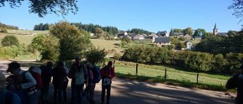
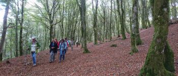
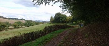
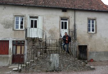
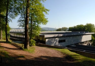
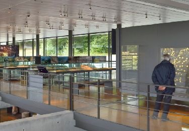
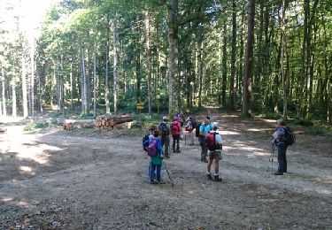
Une heure vingt, il est temps de repartir . Descendons par le versant Est et la Porte du Rebout . Petite pause devant le Musée de la civilisation celtique de Bibracte, puis c'est la descente tranquille jusqu'à La Boutière . La montée, n'était-ce pas que le matin ? Que nenni ! C'est reparti pour 150 m, mais ce seront heureusement les derniers.<br>
16h40, de retour aux voitures . Une belle mais fraîche journée.
POI's
Plaatsbepaling
Opmerkingen
Wandeltochten in de omgeving
![Tocht Stappen Saint-Léger-sous-Beuvray - la chataigneraie - Photo](https://media.geolcdn.com/t/375/260/ext.jpg?maxdim=2&url=https%3A%2F%2Fservices.sitytrail.com%2FGeolivesWS%2FDownloadMedia.ashx%3FTrailID%3D239817%26Media%3Dfix__20140101161454.jpg)
![Stappen Stappen](https://static1.geolcdn.com/sitytour/trail-icons/101.png)
Stappen
![](/images/other/stat-length.png)
![](https://static1.geolcdn.com/siteimages/upload/files/16400158638029165_repeat_loop_refresh_sync_direction_icon.png)
![Tocht Te voet Saint-Léger-sous-Beuvray - La Ronde des Mineurs - Photo](https://media.geolcdn.com/t/375/260/a21296b5-fe07-4dc1-ad66-369a57535514.jpeg&format=jpg&maxdim=2)
![Te voet Te voet](https://static1.geolcdn.com/sitytour/trail-icons/100.png)
Te voet
![](/images/other/stat-length.png)
![](https://static1.geolcdn.com/siteimages/upload/files/16400158638029165_repeat_loop_refresh_sync_direction_icon.png)
![Tocht Stappen Saint-Léger-sous-Beuvray - Des manoirs en seigneuries - Photo](https://media.geolcdn.com/t/375/260/ext.jpg?maxdim=2&url=https%3A%2F%2Fstatic1.geolcdn.com%2Fsiteimages%2Fupload%2Ffiles%2F1553511878bg_sport_marche.png)
![Stappen Stappen](https://static1.geolcdn.com/sitytour/trail-icons/101.png)
Stappen
![](/images/other/stat-length.png)
![](https://static1.geolcdn.com/siteimages/upload/files/16400158638029165_repeat_loop_refresh_sync_direction_icon.png)
![Tocht Te voet Glux-en-Glenne - Le Tour des Remparts - Photo](https://media.geolcdn.com/t/375/260/356b82fe-9dc7-42bc-bd73-49d8d265e0b7.jpeg&format=jpg&maxdim=2)
![Te voet Te voet](https://static1.geolcdn.com/sitytour/trail-icons/100.png)
Te voet
![](/images/other/stat-length.png)
![](https://static1.geolcdn.com/siteimages/upload/files/16400158638029165_repeat_loop_refresh_sync_direction_icon.png)
![Tocht Te voet Glux-en-Glenne - Le Chemin de Maraude - Photo](https://media.geolcdn.com/t/375/260/662d015d-77c7-428d-beda-141723d605da.jpeg&format=jpg&maxdim=2)
![Te voet Te voet](https://static1.geolcdn.com/sitytour/trail-icons/100.png)
Te voet
![](/images/other/stat-length.png)
![](https://static1.geolcdn.com/siteimages/upload/files/16400158638029165_repeat_loop_refresh_sync_direction_icon.png)
![Tocht Stappen Saint-Léger-sous-Beuvray - 181007 SVG - Photo](https://media.geolcdn.com/t/375/260/ext.jpg?maxdim=2&url=https%3A%2F%2Fservices.sitytrail.com%2FGeolivesWS%2FDownloadMedia.ashx%3FTrailID%3D1078183%26Media%3Dfix__20181007132858.jpg)
![Stappen Stappen](https://static1.geolcdn.com/sitytour/trail-icons/101.png)
Stappen
![](/images/other/stat-length.png)
![](https://static1.geolcdn.com/siteimages/upload/files/16400158638029165_repeat_loop_refresh_sync_direction_icon.png)
![Tocht Stappen Saint-Léger-sous-Beuvray - 181007 EnCours-2 - Photo](https://media.geolcdn.com/t/375/260/ext.jpg?maxdim=2&url=https%3A%2F%2Fservices.sitytrail.com%2FGeolivesWS%2FDownloadMedia.ashx%3FTrailID%3D1078178%26Media%3Dfix__20181007132858.jpg)
![Stappen Stappen](https://static1.geolcdn.com/sitytour/trail-icons/101.png)
Stappen
![](/images/other/stat-length.png)
![](https://static1.geolcdn.com/siteimages/upload/files/16400158638029165_repeat_loop_refresh_sync_direction_icon.png)
![Tocht Stappen La Grande-Verrière - 181006 SVG - Photo](https://media.geolcdn.com/t/375/260/ext.jpg?maxdim=2&url=https%3A%2F%2Fservices.sitytrail.com%2FGeolivesWS%2FDownloadMedia.ashx%3FTrailID%3D1078176%26Media%3Dfix__20181006142833.jpg)
![Stappen Stappen](https://static1.geolcdn.com/sitytour/trail-icons/101.png)
Stappen
![](/images/other/stat-length.png)
![](https://static1.geolcdn.com/siteimages/upload/files/16400158638029165_repeat_loop_refresh_sync_direction_icon.png)
![Tocht Stappen La Grande-Verrière - 181006 EnCours-2 - Photo](https://media.geolcdn.com/t/375/260/ext.jpg?maxdim=2&url=https%3A%2F%2Fservices.sitytrail.com%2FGeolivesWS%2FDownloadMedia.ashx%3FTrailID%3D1078169%26Media%3Dfix__20181006142833.jpg)
![Stappen Stappen](https://static1.geolcdn.com/sitytour/trail-icons/101.png)
Stappen
![](/images/other/stat-length.png)
![](https://static1.geolcdn.com/siteimages/upload/files/16400158638029165_repeat_loop_refresh_sync_direction_icon.png)