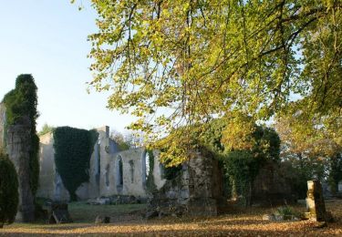
Tocht Mountainbike Rembercourt-sur-Mad - Rembercourt 2016 - Photo
 PhilippeC54
PhilippeC54

Gebruiker

© OpenStreetMap contributors
Lengte
Lengte
33 km
Max. hoogte
Max. hoogte
321 m
Positief hoogteverschil
710 m
Km-Effort
Km-Effort  
43 km
Min. hoogte
Min. hoogte
190 m
Negatief hoogteverschil
712 m
Boucle
Boucle
Ja
Datum van aanmaak :
2016-10-12 00:00:00.0
Laatste wijziging :
2016-10-12 00:00:00.0

(1 Bericht)

Mountainbike
Mountainbike
3h25
Moeilijkheid : Medium

Scan deze QR-code om de tocht te openen in de SityTrail-applicatie

Gratisgps-wandelapplicatie

Logo SityTrail SityTrail

IGN / Geografische instituten

SityTrail uit de App Store downloaden SityTrail uit Google Play downloaden

Logo SityTrail SityTrail World

De wereld gaat voor u open

SityTrail uit de App Store downloaden SityTrail uit Google Play downloaden SityTrail op Huawei AppGallery downloaden

Over ons

Tocht Mountainbike van 33 km beschikbaar op Grand Est, Meurthe-et-Moselle, Rembercourt-sur-Mad. Deze tocht wordt voorgesteld door PhilippeC54.

Hoogteprofiel

Plaatsbepaling

Land:
France
Regio :
Grand Est
Departement/Provincie :
Meurthe-et-Moselle
Gemeente :
Rembercourt-sur-Mad
Locatie:
Unknown
Vertrek:(Dec)
Vertrek:(UTM)
712565 ; 5430059 (31U) N.

Opmerkingen

Gelieve in te loggen om een commentaar of een beoordeling achter te laten


beau parcours physique avec quelques passages techniques.


Wandeltochten in de omgeving

Tocht Stappen Villecey-sur-Mad - Les aîtres médiévaux - Photo
Stappen
fraxin

Stappen

Gemakkelijk
(1)
Villecey-sur-Mad, Grand Est, Meurthe-et-Moselle, France
17,2 km | 21 km-effort
4h 0min
Ja
Tocht Fiets Jaulny - La vallée du Rupt de Mad - Circuit n° 14 - Jaulny - Photo
Fiets
tracegps

Fiets

Gemakkelijk
Jaulny, Grand Est, Meurthe-et-Moselle, France
19,1 km | 22 km-effort
1h 0min
Ja
Tocht Fiets Thiaucourt-Regniéville - Les paysages de l'Histoire (option Flirey) - Circuit n° 13 - Photo
Fiets
tracegps

Fiets

Moeilijk
Thiaucourt-Regniéville, Grand Est, Meurthe-et-Moselle, France
60 km | 68 km-effort
3h 0min
Ja
Tocht Fiets Thiaucourt-Regniéville - Les paysages de l'Histoire - Circuit n° 13 - Thiaucourt Regniéville - Photo
Fiets
tracegps

Fiets

Medium
Thiaucourt-Regniéville, Grand Est, Meurthe-et-Moselle, France
49 km | 56 km-effort
2h 30min
Ja
Tocht Stappen Prény - Cabane Vautrin - Photo
Stappen
bitiba

Stappen

Medium
Prény, Grand Est, Meurthe-et-Moselle, France
5,6 km | 6,7 km-effort
1h 32min
Ja
Tocht Stappen Waville - 6 jumelles  - Photo
Stappen
kikkko

Stappen

Medium
Waville, Grand Est, Meurthe-et-Moselle, France
6,9 km | 9 km-effort
2h 2min
Ja
Tocht Paardrijden Jaulny - Jaulny Ancy sur Moselle  - Photo
Paardrijden
claude-aei

Paardrijden

Moeilijk
Jaulny, Grand Est, Meurthe-et-Moselle, France
27 km | 37 km-effort
4h 53min
Neen
Tocht Stappen Thiaucourt-Regniéville - Thiaucourt viaduc Bouillonville - Photo
Stappen
kikkko

Stappen

Moeilijk
Thiaucourt-Regniéville, Grand Est, Meurthe-et-Moselle, France
10 km | 12,3 km-effort
2h 47min
Ja
Tocht Mountainbike Thiaucourt-Regniéville - Thiaucourt Jaulny Rembercourt - Photo
Mountainbike
kikkko

Mountainbike

Gemakkelijk
Thiaucourt-Regniéville, Grand Est, Meurthe-et-Moselle, France
16,9 km | 21 km-effort
1h 36min
Ja


Sluiten
Mijn abonnementen