![](/images/other/stat-length.png)
![Tocht Stappen Saint-Martin-d'Ardèche - Sauze Ardeche AR Gorges - Photo](https://media.geolcdn.com/t/1900/400/ext.pjpeg?maxdim=2&url=https%3A%2F%2Fservices.sitytrail.com%2FGeolivesWS%2FDownloadMedia.ashx%3FTrailID%3D633350%26Media%3Dfix__20160919121717.jpg)
Sauze Ardeche AR Gorges
kephas
Gebruiker
![Lengte](/images/other/stat-length.png)
Lengte
12,4 km
![Max. hoogte](https://static1.geolcdn.com/siteimages/upload/files/1508320355ic_sort_altitude_max_24dp.png)
Max. hoogte
167 m
![Positief hoogteverschil](https://static1.geolcdn.com/siteimages/upload/files/1508320355ic_sort_den_pos_24dp.png)
Positief hoogteverschil
531 m
![Km-Effort](/images/other/stat-length.png)
Km-Effort
19,5 km
![Min. hoogte](https://static1.geolcdn.com/siteimages/upload/files/1508320355ic_sort_altitude_min_24dp.png)
Min. hoogte
48 m
![Negatief hoogteverschil](https://static1.geolcdn.com/siteimages/upload/files/1508320355ic_sort_den_neg_24dp.png)
Negatief hoogteverschil
531 m
![Boucle](https://static1.geolcdn.com/siteimages/upload/files/16400158638029165_repeat_loop_refresh_sync_direction_icon.png)
Boucle
Ja
Datum van aanmaak :
2016-09-19 00:00:00.0
Laatste wijziging :
2016-09-19 00:00:00.0
![Stappen](https://static1.geolcdn.com/sitytour/trail-icons/101.png)
4h05
Moeilijkheid : Medium
![Scan deze QR-code om de tocht te openen in de SityTrail-applicatie](https://capi.geolives.com/qq0zvz2zws4bq2lad0pu/sitytour/trails/633350/qr.png?size=200)
Gratisgps-wandelapplicatie
Over ons
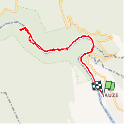
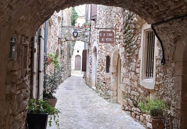
Tocht Stappen van 12,4 km beschikbaar op Auvergne-Rhône-Alpes, Ardèche, Saint-Martin-d'Ardèche. Deze tocht wordt voorgesteld door kephas.
Beschrijving
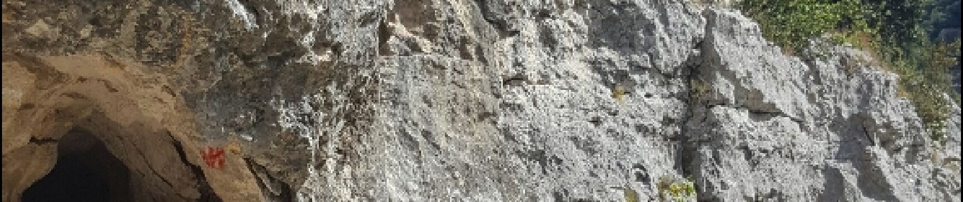
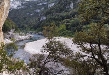
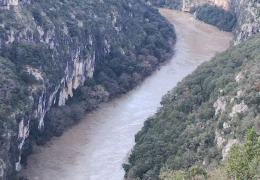
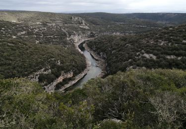
Aller et retour dans les gorges de L'Ardèche.
Des passages aménagés avec échelles.
Ne pas effectuer les jours de pluie, roches glissantes
Plaatsbepaling
Land:
France
Regio :
Auvergne-Rhône-Alpes
Departement/Provincie :
Ardèche
Gemeente :
Saint-Martin-d'Ardèche
Locatie:
Unknown
Vertrek:(Dec)
Vertrek:(UTM)
623869 ; 4907656 (31T) N.
Opmerkingen
Wandeltochten in de omgeving
![Tocht Stappen Saint-Martin-d'Ardèche - GR4 Aigueze - Photo](https://media.geolcdn.com/t/375/260/ext.jpg?maxdim=2&url=https%3A%2F%2Fservices.sitytrail.com%2FGeolivesWS%2FDownloadMedia.ashx%3FTrailID%3D325544%26Media%3Dfix__20140709163308.jpg)
![Stappen Stappen](https://static1.geolcdn.com/sitytour/trail-icons/101.png)
GR4 Aigueze
Stappen
Medium
(1)
Saint-Martin-d'Ardèche,
Auvergne-Rhône-Alpes,
Ardèche,
France
![](/images/other/stat-length.png)
12,6 km | 17 km-effort
4h 39min
![](https://static1.geolcdn.com/siteimages/upload/files/16400158638029165_repeat_loop_refresh_sync_direction_icon.png)
Ja
![Tocht Stappen Aiguèze - 30 aigueze ribeirol - Photo](https://media.geolcdn.com/t/375/260/a5de248d-2217-49e5-9c57-d3e37cd5f6c4.jpg&format=jpg&maxdim=2)
![Stappen Stappen](https://static1.geolcdn.com/sitytour/trail-icons/101.png)
30 aigueze ribeirol
Stappen
Moeilijk
Aiguèze,
Occitanië,
Gard,
France
![](/images/other/stat-length.png)
10,7 km | 16,4 km-effort
6h 26min
![](https://static1.geolcdn.com/siteimages/upload/files/16400158638029165_repeat_loop_refresh_sync_direction_icon.png)
Ja
![Tocht Stappen Saint-Martin-d'Ardèche - Aigueze rocher de Castelviel - Photo](https://media.geolcdn.com/t/375/260/416d7ebd-2359-4463-8249-a90d2272e98d.jpg&format=jpg&maxdim=2)
![Stappen Stappen](https://static1.geolcdn.com/sitytour/trail-icons/101.png)
Aigueze rocher de Castelviel
Stappen
Gemakkelijk
Saint-Martin-d'Ardèche,
Auvergne-Rhône-Alpes,
Ardèche,
France
![](/images/other/stat-length.png)
12,5 km | 16,8 km-effort
4h 11min
![](https://static1.geolcdn.com/siteimages/upload/files/16400158638029165_repeat_loop_refresh_sync_direction_icon.png)
Ja
![Tocht Stappen Saint-Martin-d'Ardèche - Sauze bivouac de Gournier - Photo](https://media.geolcdn.com/t/375/260/baac8ebe-8937-4db4-b6c4-7e0bd115b9f1.jpg&format=jpg&maxdim=2)
![Stappen Stappen](https://static1.geolcdn.com/sitytour/trail-icons/101.png)
Sauze bivouac de Gournier
Stappen
Medium
Saint-Martin-d'Ardèche,
Auvergne-Rhône-Alpes,
Ardèche,
France
![](/images/other/stat-length.png)
14,9 km | 25 km-effort
4h 3min
![](https://static1.geolcdn.com/siteimages/upload/files/16400158638029165_repeat_loop_refresh_sync_direction_icon.png)
Neen
![Tocht Stappen Saint-Martin-d'Ardèche - 07 st martin d ardeche gorge ardeche - Photo](https://media.geolcdn.com/t/375/260/fdc113c1-1a01-412d-be10-a6b4f2c87d8a.jpg&format=jpg&maxdim=2)
![Stappen Stappen](https://static1.geolcdn.com/sitytour/trail-icons/101.png)
07 st martin d ardeche gorge ardeche
Stappen
Medium
Saint-Martin-d'Ardèche,
Auvergne-Rhône-Alpes,
Ardèche,
France
![](/images/other/stat-length.png)
17,2 km | 25 km-effort
6h 36min
![](https://static1.geolcdn.com/siteimages/upload/files/16400158638029165_repeat_loop_refresh_sync_direction_icon.png)
Ja
![Tocht Stappen Aiguèze - Aigueze - Photo](https://media.geolcdn.com/t/375/260/e7b8de9a-d915-48ca-baac-0319f593dc54.jpg&format=jpg&maxdim=2)
![Stappen Stappen](https://static1.geolcdn.com/sitytour/trail-icons/101.png)
![Tocht Stappen Saint-Martin-d'Ardèche - Saint Martin d’Ardéche - Photo](https://media.geolcdn.com/t/375/260/b543bd48-15f1-4b47-a933-7d4f79f7128e.jpg&format=jpg&maxdim=2)
![Stappen Stappen](https://static1.geolcdn.com/sitytour/trail-icons/101.png)
Saint Martin d’Ardéche
Stappen
Moeilijk
Saint-Martin-d'Ardèche,
Auvergne-Rhône-Alpes,
Ardèche,
France
![](/images/other/stat-length.png)
12,6 km | 16,8 km-effort
5h 3min
![](https://static1.geolcdn.com/siteimages/upload/files/16400158638029165_repeat_loop_refresh_sync_direction_icon.png)
Neen
![Tocht Te voet Aiguèze - FR-PR 24 - Photo](https://media.geolcdn.com/t/375/260/adb231a8-9d03-4c90-9261-a3c9f3c8fd1c.jpeg&format=jpg&maxdim=2)
![Te voet Te voet](https://static1.geolcdn.com/sitytour/trail-icons/100.png)
![Tocht Stappen Aiguèze - aigueze - Photo](https://media.geolcdn.com/t/375/260/9a8e66bd-28b9-4786-9840-dbf6e6fca8cf.jpg&format=jpg&maxdim=2)
![Stappen Stappen](https://static1.geolcdn.com/sitytour/trail-icons/101.png)
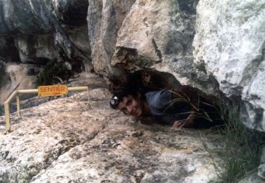
Parcours difficile pour sportif confirmé. Ne pas faire seul en cas de canicule.