![](/images/other/stat-length.png)
![Tocht Stappen Canéjan - bois de l'eau Bourde. - Photo](https://media.geolcdn.com/t/1900/400/ext.pjpeg?maxdim=2&url=https%3A%2F%2Fservices.sitytrail.com%2FGeolivesWS%2FDownloadMedia.ashx%3FTrailID%3D619200%26Media%3D20160822190151.jpg)
bois de l'eau Bourde.
sandrineh
Gebruiker
![Lengte](/images/other/stat-length.png)
Lengte
5 km
![Max. hoogte](https://static1.geolcdn.com/siteimages/upload/files/1508320355ic_sort_altitude_max_24dp.png)
Max. hoogte
44 m
![Positief hoogteverschil](https://static1.geolcdn.com/siteimages/upload/files/1508320355ic_sort_den_pos_24dp.png)
Positief hoogteverschil
38 m
![Km-Effort](/images/other/stat-length.png)
Km-Effort
5,5 km
![Min. hoogte](https://static1.geolcdn.com/siteimages/upload/files/1508320355ic_sort_altitude_min_24dp.png)
Min. hoogte
33 m
![Negatief hoogteverschil](https://static1.geolcdn.com/siteimages/upload/files/1508320355ic_sort_den_neg_24dp.png)
Negatief hoogteverschil
37 m
![Boucle](https://static1.geolcdn.com/siteimages/upload/files/16400158638029165_repeat_loop_refresh_sync_direction_icon.png)
Boucle
Ja
Datum van aanmaak :
2016-08-22 00:00:00.0
Laatste wijziging :
2016-08-22 00:00:00.0
![Stappen](https://static1.geolcdn.com/sitytour/trail-icons/101.png)
1h37
Moeilijkheid : Heel gemakkelijk
![Scan deze QR-code om de tocht te openen in de SityTrail-applicatie](https://capi.geolives.com/qq0zvz2zws4bq2lad0pu/sitytour/trails/619200/qr.png?size=200)
Gratisgps-wandelapplicatie
Over ons
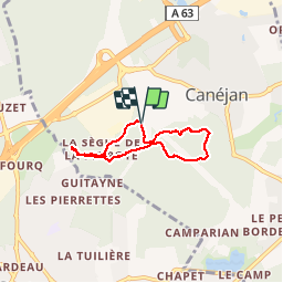
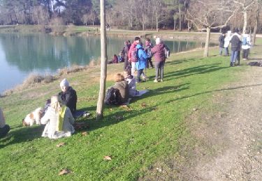
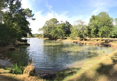
Tocht Stappen van 5 km beschikbaar op Nieuw-Aquitanië, Gironde, Canéjan. Deze tocht wordt voorgesteld door sandrineh.
Beschrijving
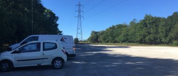
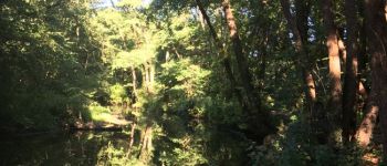
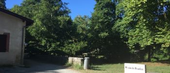
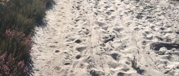
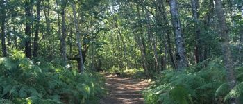
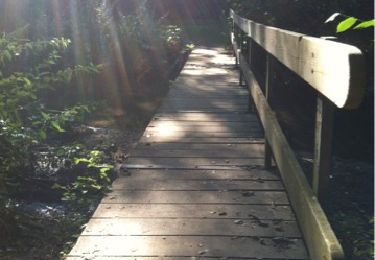
Promenade entre marécage et forêt de Landes. Très agréable quand il fait chaud car il y fait frais. Par contre des moustiques en fin de journée du fait de l'eau et du marécage.
Plaatsbepaling
Land:
France
Regio :
Nieuw-Aquitanië
Departement/Provincie :
Gironde
Gemeente :
Canéjan
Locatie:
Unknown
Vertrek:(Dec)
Vertrek:(UTM)
684753 ; 4958880 (30T) N.
Opmerkingen
Wandeltochten in de omgeving
![Tocht Stappen Canéjan - promenade dans les sous bois de canejean. - Photo](https://media.geolcdn.com/t/375/260/ext.jpg?maxdim=2&url=https%3A%2F%2Fservices.sitytrail.com%2FGeolivesWS%2FDownloadMedia.ashx%3FTrailID%3D142254%26Media%3D20120729182629.jpg)
![Stappen Stappen](https://static1.geolcdn.com/sitytour/trail-icons/101.png)
promenade dans les sous bois de canejean.
Stappen
Heel gemakkelijk
(1)
Canéjan,
Nieuw-Aquitanië,
Gironde,
France
![](/images/other/stat-length.png)
10,6 km | 11,7 km-effort
2h 53min
![](https://static1.geolcdn.com/siteimages/upload/files/16400158638029165_repeat_loop_refresh_sync_direction_icon.png)
Ja
![Tocht Stappen Pessac - bourghail - Photo](https://media.geolcdn.com/t/375/260/54a8f206-54b2-441d-8f94-6216cdd347dd.jpg&format=jpg&maxdim=2)
![Stappen Stappen](https://static1.geolcdn.com/sitytour/trail-icons/101.png)
bourghail
Stappen
Gemakkelijk
(1)
Pessac,
Nieuw-Aquitanië,
Gironde,
France
![](/images/other/stat-length.png)
4,6 km | 4,9 km-effort
2h 16min
![](https://static1.geolcdn.com/siteimages/upload/files/16400158638029165_repeat_loop_refresh_sync_direction_icon.png)
Ja
![Tocht Stappen Canéjan - Balade à Gradignan - Photo](https://media.geolcdn.com/t/375/260/ext.jpg?maxdim=2&url=https%3A%2F%2Fstatic1.geolcdn.com%2Fsiteimages%2Fupload%2Ffiles%2F1553511878bg_sport_marche.png)
![Stappen Stappen](https://static1.geolcdn.com/sitytour/trail-icons/101.png)
Balade à Gradignan
Stappen
Heel gemakkelijk
(1)
Canéjan,
Nieuw-Aquitanië,
Gironde,
France
![](/images/other/stat-length.png)
3,8 km | 4,2 km-effort
1h 2min
![](https://static1.geolcdn.com/siteimages/upload/files/16400158638029165_repeat_loop_refresh_sync_direction_icon.png)
Neen
![Tocht Noords wandelen Pessac - Le Bourgailh 2024-10-20 reco - Photo](https://media.geolcdn.com/t/375/260/fd0705c7-40d4-42d6-8e85-ce97a605d44b.jpg&format=jpg&maxdim=2)
![Noords wandelen Noords wandelen](https://static1.geolcdn.com/sitytour/trail-icons/102.png)
Le Bourgailh 2024-10-20 reco
Noords wandelen
Medium
(1)
Pessac,
Nieuw-Aquitanië,
Gironde,
France
![](/images/other/stat-length.png)
7,4 km | 8,1 km-effort
2h 6min
![](https://static1.geolcdn.com/siteimages/upload/files/16400158638029165_repeat_loop_refresh_sync_direction_icon.png)
Ja
![Tocht Auto Gradignan - Le 11 juillet 2023 - Photo](https://media.geolcdn.com/t/375/260/87e0a106-2a86-4b2a-a940-ea4eb287eaa2.jpg&format=jpg&maxdim=2)
![Auto Auto](https://static1.geolcdn.com/sitytour/trail-icons/401.png)
Le 11 juillet 2023
Auto
Gradignan,
Nieuw-Aquitanië,
Gironde,
France
![](/images/other/stat-length.png)
41 km | 45 km-effort
4h 20min
![](https://static1.geolcdn.com/siteimages/upload/files/16400158638029165_repeat_loop_refresh_sync_direction_icon.png)
Ja
![Tocht Noords wandelen Cestas - Reco Pinoche 22/12/2021 - Photo](https://media.geolcdn.com/t/375/260/394645c5-e9f2-4d90-9213-8cd8a9b2049d.jpg&format=jpg&maxdim=2)
![Noords wandelen Noords wandelen](https://static1.geolcdn.com/sitytour/trail-icons/102.png)
Reco Pinoche 22/12/2021
Noords wandelen
Heel gemakkelijk
Cestas,
Nieuw-Aquitanië,
Gironde,
France
![](/images/other/stat-length.png)
11,8 km | 13 km-effort
2h 58min
![](https://static1.geolcdn.com/siteimages/upload/files/16400158638029165_repeat_loop_refresh_sync_direction_icon.png)
Ja
![Tocht Stappen Canéjan - lac vert - Photo](https://media.geolcdn.com/t/375/260/ext.jpg?maxdim=2&url=https%3A%2F%2Fstatic1.geolcdn.com%2Fsiteimages%2Fupload%2Ffiles%2F1553511878bg_sport_marche.png)
![Stappen Stappen](https://static1.geolcdn.com/sitytour/trail-icons/101.png)
lac vert
Stappen
Heel gemakkelijk
(1)
Canéjan,
Nieuw-Aquitanië,
Gironde,
France
![](/images/other/stat-length.png)
8,3 km | 9,4 km-effort
2h 16min
![](https://static1.geolcdn.com/siteimages/upload/files/16400158638029165_repeat_loop_refresh_sync_direction_icon.png)
Neen
![Tocht Andere activiteiten Gradignan - rando - Photo](https://media.geolcdn.com/t/375/260/ext.jpg?maxdim=2&url=https%3A%2F%2Fservices.sitytrail.com%2FGeolivesWS%2FDownloadMedia.ashx%3FTrailID%3D1090086%26Media%3Dfix__20181230152029.jpg)
![Andere activiteiten Andere activiteiten](https://static1.geolcdn.com/sitytour/trail-icons/900.png)
rando
Andere activiteiten
Heel gemakkelijk
Gradignan,
Nieuw-Aquitanië,
Gironde,
France
![](/images/other/stat-length.png)
13,5 km | 15 km-effort
3h 4min
![](https://static1.geolcdn.com/siteimages/upload/files/16400158638029165_repeat_loop_refresh_sync_direction_icon.png)
Ja
![Tocht Stappen Cestas - entre Montsalut et les sources - Photo](https://media.geolcdn.com/t/375/260/ext.jpg?maxdim=2&url=https%3A%2F%2Fservices.sitytrail.com%2FGeolivesWS%2FDownloadMedia.ashx%3FTrailID%3D622592%26Media%3D20160828173202.jpg)
![Stappen Stappen](https://static1.geolcdn.com/sitytour/trail-icons/101.png)
entre Montsalut et les sources
Stappen
Heel gemakkelijk
Cestas,
Nieuw-Aquitanië,
Gironde,
France
![](/images/other/stat-length.png)
4,6 km | 5,1 km-effort
1h 43min
![](https://static1.geolcdn.com/siteimages/upload/files/16400158638029165_repeat_loop_refresh_sync_direction_icon.png)
Neen