Tocht Stappen Perrogney-les-Fontaines - voisines.52 - Photo
 gimbretb
gimbretb

Gebruiker

© OpenStreetMap contributors
Lengte
Lengte
11,7 km
Max. hoogte
Max. hoogte
493 m
Positief hoogteverschil
171 m
Km-Effort
Km-Effort  
14 km
Min. hoogte
Min. hoogte
431 m
Negatief hoogteverschil
171 m
Boucle
Boucle
Ja
Datum van aanmaak :
2016-06-10 00:00:00.0
Laatste wijziging :
2016-06-10 00:00:00.0

(0 Bericht)

Stappen
Stappen
3h06
Moeilijkheid : Onbekend

Scan deze QR-code om de tocht te openen in de SityTrail-applicatie

Gratisgps-wandelapplicatie

Logo SityTrail SityTrail

IGN / Geografische instituten

SityTrail uit de App Store downloaden SityTrail uit Google Play downloaden

Logo SityTrail SityTrail World

De wereld gaat voor u open

SityTrail uit de App Store downloaden SityTrail uit Google Play downloaden SityTrail op Huawei AppGallery downloaden

Over ons

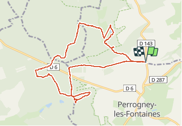
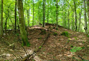
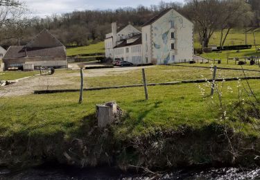
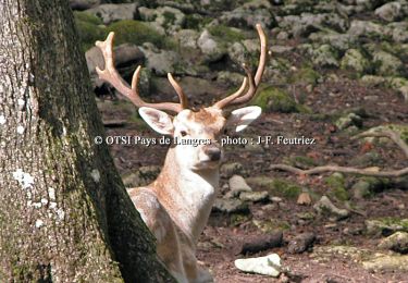
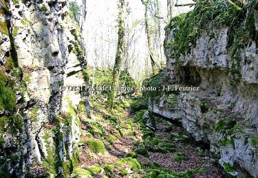
Tocht Stappen van 11,7 km beschikbaar op Grand Est, Haute-Marne, Perrogney-les-Fontaines. Deze tocht wordt voorgesteld door gimbretb.

Beschrijving

Voisines - Haute Marne: sources de la Suize et du Rognon.

Hoogteprofiel

Plaatsbepaling

Land:
France
Regio :
Grand Est
Departement/Provincie :
Haute-Marne
Gemeente :
Perrogney-les-Fontaines
Locatie:
Unknown
Vertrek:(Dec)
Vertrek:(UTM)
664754 ; 5298878 (31T) N.

Wandeltochten in de omgeving

Tocht Stappen Perrogney-les-Fontaines - sur les hauts: Sommets de Haute Marne - Photo
Stappen
Nicole SIMONNET

Stappen

Medium
Perrogney-les-Fontaines, Grand Est, Haute-Marne, France
15,1 km | 18,9 km-effort
5h 42min
Ja
Tocht Noords wandelen Perrancey-les-Vieux-Moulins - domaine de Montauban  - Photo
Noords wandelen
avier

Noords wandelen

Heel gemakkelijk
Perrancey-les-Vieux-Moulins, Grand Est, Haute-Marne, France
31 km | 35 km-effort
2h 25min
Neen
Tocht Fiets Flagey - Boucle 4 autour de la Voie Verte - Flagey - Photo
Fiets
tracegps

Fiets

Medium
Flagey, Grand Est, Haute-Marne, France
19,3 km | 24 km-effort
1h 15min
Ja
Tocht Stappen Noidant-le-Rocheux - Sentier Vosges-Pyrénées - de Noidant le Rocheux à Auberive - Photo
Stappen
tracegps

Stappen

Moeilijk
Noidant-le-Rocheux, Grand Est, Haute-Marne, France
21 km | 25 km-effort
5h 30min
Neen
Tocht Mountainbike Noidant-le-Rocheux - Lacs et falaises de la Mouche - Photo
Mountainbike
tracegps

Mountainbike

Moeilijk
(1)
Noidant-le-Rocheux, Grand Est, Haute-Marne, France
16,3 km | 20 km-effort
2h 0min
Ja
Tocht Stappen Noidant-le-Rocheux - Lacs et falaises de la Mouche - Photo
Stappen
tracegps

Stappen

Moeilijk
Noidant-le-Rocheux, Grand Est, Haute-Marne, France
16,3 km | 20 km-effort
5h 0min
Ja
Tocht Mountainbike Noidant-le-Rocheux - Mougeanne - Photo
Mountainbike
lionel.marcoux

Mountainbike

Medium
Noidant-le-Rocheux, Grand Est, Haute-Marne, France
70 km | 85 km-effort
4h 43min
Ja
Tocht Elektrische fiets Brennes - entre Bennett et Melville - Photo
Elektrische fiets
zombie52

Elektrische fiets

Heel gemakkelijk
Brennes, Grand Est, Haute-Marne, France
28 km | 31 km-effort
1h 29min
Neen
Tocht Mountainbike Voisines - fS-rmnlBlfI - Photo
Mountainbike
ampory

Mountainbike

Moeilijk
Voisines, Grand Est, Haute-Marne, France
53 km | 65 km-effort
4h 10min
Ja


Sluiten
Mijn abonnementen