![](/images/other/stat-length.png)
![Tocht Noords wandelen Mantes-la-Jolie - ile l Aumône 10/06/2016 - Photo](https://media.geolcdn.com/t/1900/400/ext.pjpeg?maxdim=2&url=https%3A%2F%2Fservices.sitytrail.com%2FGeolivesWS%2FDownloadMedia.ashx%3FTrailID%3D582308%26Media%3Dfix__20160610122027.jpg)
ile l Aumône 10/06/2016
microb
Gebruiker
![Lengte](/images/other/stat-length.png)
Lengte
8,3 km
![Max. hoogte](https://static1.geolcdn.com/siteimages/upload/files/1508320355ic_sort_altitude_max_24dp.png)
Max. hoogte
26 m
![Positief hoogteverschil](https://static1.geolcdn.com/siteimages/upload/files/1508320355ic_sort_den_pos_24dp.png)
Positief hoogteverschil
60 m
![Km-Effort](/images/other/stat-length.png)
Km-Effort
9,1 km
![Min. hoogte](https://static1.geolcdn.com/siteimages/upload/files/1508320355ic_sort_altitude_min_24dp.png)
Min. hoogte
15 m
![Negatief hoogteverschil](https://static1.geolcdn.com/siteimages/upload/files/1508320355ic_sort_den_neg_24dp.png)
Negatief hoogteverschil
57 m
![Boucle](https://static1.geolcdn.com/siteimages/upload/files/16400158638029165_repeat_loop_refresh_sync_direction_icon.png)
Boucle
Ja
Datum van aanmaak :
2018-06-03 00:00:00.0
Laatste wijziging :
2018-06-03 00:00:00.0
![Noords wandelen](https://static1.geolcdn.com/sitytour/trail-icons/102.png)
2h20
Moeilijkheid : Gemakkelijk
![Scan deze QR-code om de tocht te openen in de SityTrail-applicatie](https://capi.geolives.com/qq0zvz2zws4bq2lad0pu/sitytour/trails/582308/qr.png?size=200)
Gratisgps-wandelapplicatie
Over ons
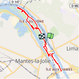
Tocht Noords wandelen van 8,3 km beschikbaar op Île-de-France, Yvelines, Mantes-la-Jolie. Deze tocht wordt voorgesteld door microb.
Beschrijving
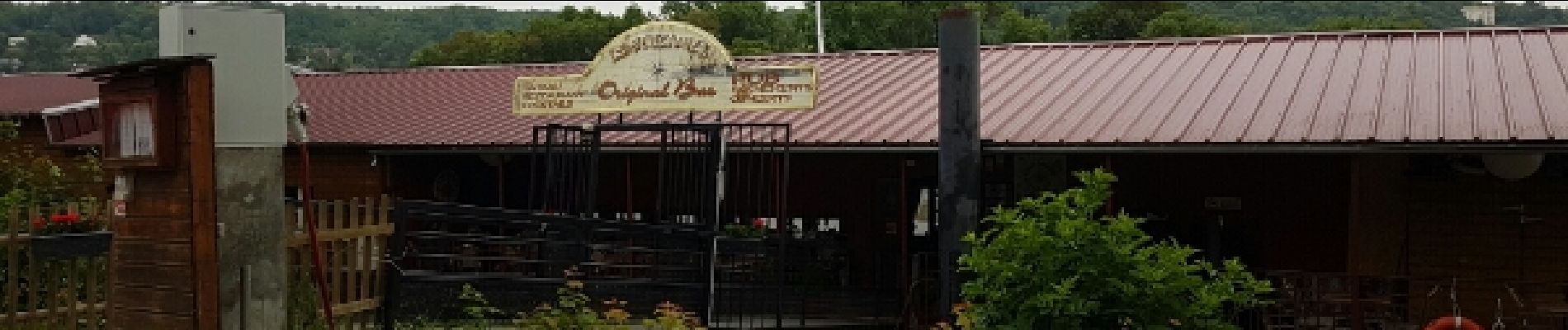
Sortie Marche nordique L'ile l'Aumône - L'ile de Limay, Déjeuner au restaurant péniche "Le Boucanier"
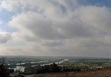
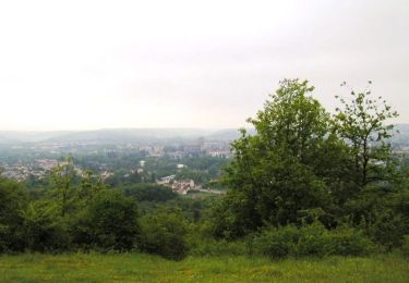
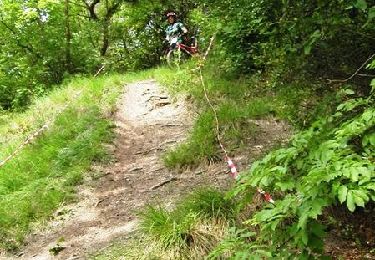
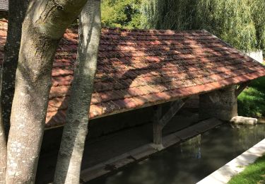
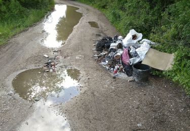
Plaatsbepaling
Land:
France
Regio :
Île-de-France
Departement/Provincie :
Yvelines
Gemeente :
Mantes-la-Jolie
Locatie:
Unknown
Vertrek:(Dec)
Vertrek:(UTM)
406474 ; 5427788 (31U) N.
Opmerkingen
Wandeltochten in de omgeving
![Tocht Stappen Limay - De Limay à Dennemont - Photo](https://media.geolcdn.com/t/375/260/ext.jpg?maxdim=2&url=https%3A%2F%2Fservices.sitytrail.com%2FGeolivesWS%2FDownloadMedia.ashx%3FTrailID%3D100989%26Media%3D488_5.jpg)
![Stappen Stappen](https://static1.geolcdn.com/sitytour/trail-icons/101.png)
De Limay à Dennemont
Stappen
Medium
(1)
Limay,
Île-de-France,
Yvelines,
France
![](/images/other/stat-length.png)
10,9 km | 14,7 km-effort
1h 30min
![](https://static1.geolcdn.com/siteimages/upload/files/16400158638029165_repeat_loop_refresh_sync_direction_icon.png)
Ja
![Tocht Mountainbike Saint-Martin-la-Garenne - La Garennoise 2005-47km - Photo](https://media.geolcdn.com/t/375/260/ext.jpg?maxdim=2&url=https%3A%2F%2Fservices.sitytrail.com%2FGeolivesWS%2FDownloadMedia.ashx%3FTrailID%3D100976%26Media%3D475_1.jpg)
![Mountainbike Mountainbike](https://static1.geolcdn.com/sitytour/trail-icons/202.png)
La Garennoise 2005-47km
Mountainbike
Moeilijk
(2)
Saint-Martin-la-Garenne,
Île-de-France,
Yvelines,
France
![](/images/other/stat-length.png)
47 km | 60 km-effort
3h 30min
![](https://static1.geolcdn.com/siteimages/upload/files/16400158638029165_repeat_loop_refresh_sync_direction_icon.png)
Ja
![Tocht Mountainbike Mantes-la-Ville - mantelavilloise 2013 40km - Photo](https://media.geolcdn.com/t/375/260/ext.jpg?maxdim=2&url=https%3A%2F%2Fstatic1.geolcdn.com%2Fsiteimages%2Fupload%2Ffiles%2F1524743154velo.jpg)
![Mountainbike Mountainbike](https://static1.geolcdn.com/sitytour/trail-icons/202.png)
mantelavilloise 2013 40km
Mountainbike
Moeilijk
(2)
Mantes-la-Ville,
Île-de-France,
Yvelines,
France
![](/images/other/stat-length.png)
41 km | 52 km-effort
4h 50min
![](https://static1.geolcdn.com/siteimages/upload/files/16400158638029165_repeat_loop_refresh_sync_direction_icon.png)
Ja
![Tocht Mountainbike Limay - Porte du Vexin - Limay - Photo](https://media.geolcdn.com/t/375/260/ext.jpg?maxdim=2&url=https%3A%2F%2Fstatic1.geolcdn.com%2Fsiteimages%2Fupload%2Ffiles%2F1524743154velo.jpg)
![Mountainbike Mountainbike](https://static1.geolcdn.com/sitytour/trail-icons/202.png)
Porte du Vexin - Limay
Mountainbike
Moeilijk
(1)
Limay,
Île-de-France,
Yvelines,
France
![](/images/other/stat-length.png)
34 km | 42 km-effort
2h 30min
![](https://static1.geolcdn.com/siteimages/upload/files/16400158638029165_repeat_loop_refresh_sync_direction_icon.png)
Ja
![Tocht Stappen Saint-Martin-la-Garenne - 160117 - Saint-Martin la Garenne - Photo](https://media.geolcdn.com/t/375/260/ext.jpg?maxdim=2&url=https%3A%2F%2Fstatic1.geolcdn.com%2Fsiteimages%2Fupload%2Ffiles%2F1553511878bg_sport_marche.png)
![Stappen Stappen](https://static1.geolcdn.com/sitytour/trail-icons/101.png)
160117 - Saint-Martin la Garenne
Stappen
Gemakkelijk
(1)
Saint-Martin-la-Garenne,
Île-de-France,
Yvelines,
France
![](/images/other/stat-length.png)
14,2 km | 15,7 km-effort
3h 27min
![](https://static1.geolcdn.com/siteimages/upload/files/16400158638029165_repeat_loop_refresh_sync_direction_icon.png)
Ja
![Tocht Mountainbike Saint-Martin-la-Garenne - La Garennoise 2005 - 80km - Photo](https://media.geolcdn.com/t/375/260/ext.jpg?maxdim=2&url=https%3A%2F%2Fservices.sitytrail.com%2FGeolivesWS%2FDownloadMedia.ashx%3FTrailID%3D100943%26Media%3D442_3.jpg)
![Mountainbike Mountainbike](https://static1.geolcdn.com/sitytour/trail-icons/202.png)
La Garennoise 2005 - 80km
Mountainbike
Zeer moeilijk
(1)
Saint-Martin-la-Garenne,
Île-de-France,
Yvelines,
France
![](/images/other/stat-length.png)
80 km | 100 km-effort
5h 30min
![](https://static1.geolcdn.com/siteimages/upload/files/16400158638029165_repeat_loop_refresh_sync_direction_icon.png)
Ja
![Tocht Stappen Mantes-la-Jolie - Mantes la Jolie - Mantes centre - Photo](https://media.geolcdn.com/t/375/260/d58bd6ec-184c-4739-a2ca-41c7828a8b26.jpg&format=jpg&maxdim=2)
![Stappen Stappen](https://static1.geolcdn.com/sitytour/trail-icons/101.png)
Mantes la Jolie - Mantes centre
Stappen
Moeilijk
Mantes-la-Jolie,
Île-de-France,
Yvelines,
France
![](/images/other/stat-length.png)
30 km | 38 km-effort
5h 29min
![](https://static1.geolcdn.com/siteimages/upload/files/16400158638029165_repeat_loop_refresh_sync_direction_icon.png)
Neen
![Tocht Stappen Saint-Martin-la-Garenne - boucle guernes 20190512 - Photo](https://media.geolcdn.com/t/375/260/125d8bfa-70f0-4954-9ba6-7c2040b20f68.jpg&format=jpg&maxdim=2)
![Stappen Stappen](https://static1.geolcdn.com/sitytour/trail-icons/101.png)
boucle guernes 20190512
Stappen
Heel gemakkelijk
Saint-Martin-la-Garenne,
Île-de-France,
Yvelines,
France
![](/images/other/stat-length.png)
14 km | 15,4 km-effort
2h 59min
![](https://static1.geolcdn.com/siteimages/upload/files/16400158638029165_repeat_loop_refresh_sync_direction_icon.png)
Ja
![Tocht Stappen Limay - mantes - Photo](https://media.geolcdn.com/t/375/260/ext.jpg?maxdim=2&url=https%3A%2F%2Fservices.sitytrail.com%2FGeolivesWS%2FDownloadMedia.ashx%3FTrailID%3D149748%26Media%3D20120826155054.jpeg)
![Stappen Stappen](https://static1.geolcdn.com/sitytour/trail-icons/101.png)
mantes
Stappen
Gemakkelijk
Limay,
Île-de-France,
Yvelines,
France
![](/images/other/stat-length.png)
13,8 km | 16,1 km-effort
2h 17min
![](https://static1.geolcdn.com/siteimages/upload/files/16400158638029165_repeat_loop_refresh_sync_direction_icon.png)
Neen