


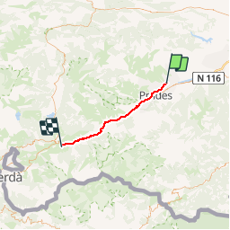

13,5 km | 17,2 km-effort


Gebruiker


Gratisgps-wandelapplicatie
 SityTrail
IGN / Geografische instituten
SityTrail World
De wereld gaat voor u open
Tocht Stappen van 42 km beschikbaar op Occitanië, Pyrénées-Orientales, Eus. Deze tocht wordt voorgesteld door crijack.
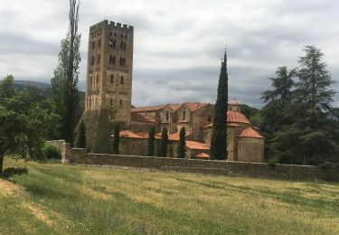
Balade au départ de Eus un des plus beaux villages de France, visite du fort Liberia à Villefranche de Conflent puis trajet en train jaune jusqu'à Planès ou possibilité d'aller jusqu'à Mont Louis et sa citadelle de Vauban


Stappen

Mountainbike


sport

Stappen
Stappen
Stappen

Stappen

Stappen
Stappen