


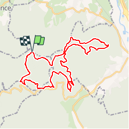


28 km | 37 km-effort


Gebruiker


Gratisgps-wandelapplicatie
 SityTrail
IGN / Geografische instituten
SityTrail World
De wereld gaat voor u open
Tocht Stappen van 19,2 km beschikbaar op Grand Est, Vogezen, Saint-Michel-sur-Meurthe. Deze tocht wordt voorgesteld door DanielROLLET.
24 avril 2016 Marie et moi
Rando organisée par l'association de Gaston et Geneviève au dessus de Saint Michel sur Meurthe
Départ 9h50 retour 15h35
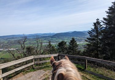
Attention les têtes à la Roche du Bihay
Paardrijden
Mountainbike

Stappen

Te voet
Mountainbike

Stappen
Stappen

Stappen

Stappen