


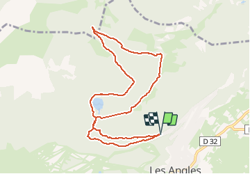

13,9 km | 19,1 km-effort


Gebruiker


Gratisgps-wandelapplicatie
 SityTrail
IGN / Geografische instituten
SityTrail World
De wereld gaat voor u open
Tocht Sneeuwschoenen van 10,8 km beschikbaar op Occitanië, Pyrénées-Orientales, Les Angles. Deze tocht wordt voorgesteld door jpipacific.
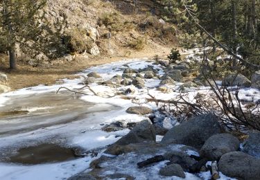
Ballade qui alterne bois lac et points de vue. Mieux de faire la première boucle dans l'autre sens car depuis le lac la montée est rude.

Sneeuwschoenen

Stappen

Stappen

Stappen

Stappen

Sneeuwschoenen
Stappen


sport
Stappen