![](/images/other/stat-length.png)
10. Wandeling op niet-verharde weg aan het begin van het dorp Remagne
La Grande Forêt de Saint-Hubert
Randonnées de la Grande Forêt de Saint-Hubert GUIDE+
![Lengte](/images/other/stat-length.png)
![Max. hoogte](https://static1.geolcdn.com/siteimages/upload/files/1508320355ic_sort_altitude_max_24dp.png)
![Positief hoogteverschil](https://static1.geolcdn.com/siteimages/upload/files/1508320355ic_sort_den_pos_24dp.png)
![Km-Effort](/images/other/stat-length.png)
![Min. hoogte](https://static1.geolcdn.com/siteimages/upload/files/1508320355ic_sort_altitude_min_24dp.png)
![Negatief hoogteverschil](https://static1.geolcdn.com/siteimages/upload/files/1508320355ic_sort_den_neg_24dp.png)
![Boucle](https://static1.geolcdn.com/siteimages/upload/files/16400158638029165_repeat_loop_refresh_sync_direction_icon.png)
![Stappen](https://static1.geolcdn.com/sitytour/trail-icons/101.png)
1h22
Moeilijkheid : Gemakkelijk
![Scan deze QR-code om de tocht te openen in de SityTrail-applicatie](https://capi.geolives.com/qq0zvz2zws4bq2lad0pu/sitytour/trails/534689/qr.png?size=200)
Gratisgps-wandelapplicatie
Over ons
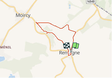
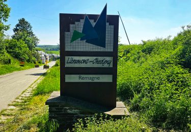
Tocht Stappen van 5,1 km beschikbaar op Wallonië, Luxemburg, Libramont-Chevigny. Deze tocht wordt voorgesteld door La Grande Forêt de Saint-Hubert.
Beschrijving
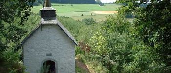
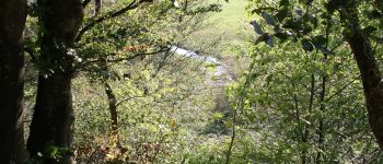
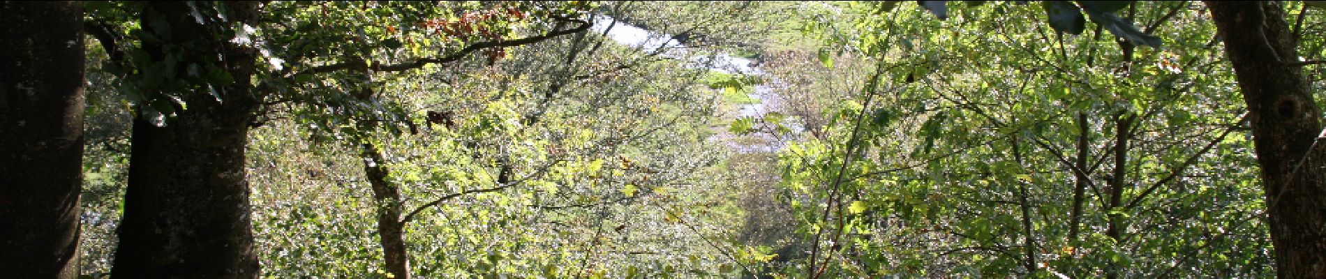
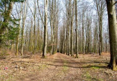
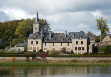
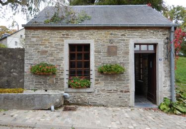
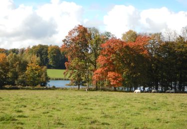
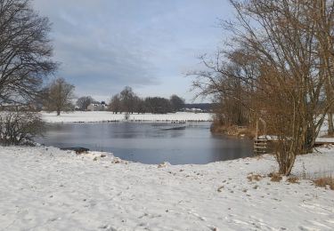
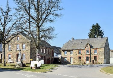
Vertrek aan de zaal “Les Grévis” in Remagne. Ook al kent deze wandeling enkele hellingen, ze is toch toegankelijk voor iedereen door de korte afstand (toegankelijk met een kinderwagen die geschikt is voor alle terreinen). De wandeling biedt enkele leuke ontdekkingen zoals een fabelachtig zicht op de Ourthe en op het Ardense platteland. Daarnaast kunt u ook de “Chapelle Notre Dame” (“Kapel van Onze-Lieve-Vrouw”) en de bijhorende legende ontdekken (informatiebord langs de weg naar beneden).
Plaatsbepaling
Opmerkingen
Wandeltochten in de omgeving
![Tocht Te voet Libramont-Chevigny - Remagne étang gpx - Photo](https://media.geolcdn.com/t/375/260/3080e017-533e-4cf8-b53e-b0ec65706ba5.jpg&format=jpg&maxdim=2)
![Te voet Te voet](https://static1.geolcdn.com/sitytour/trail-icons/100.png)
Te voet
![](/images/other/stat-length.png)
![](https://static1.geolcdn.com/siteimages/upload/files/16400158638029165_repeat_loop_refresh_sync_direction_icon.png)
![Stappen Stappen](https://static1.geolcdn.com/sitytour/trail-icons/101.png)
Stappen
![](/images/other/stat-length.png)
![](https://static1.geolcdn.com/siteimages/upload/files/16400158638029165_repeat_loop_refresh_sync_direction_icon.png)
![Stappen Stappen](https://static1.geolcdn.com/sitytour/trail-icons/101.png)
Stappen
![](/images/other/stat-length.png)
![](https://static1.geolcdn.com/siteimages/upload/files/16400158638029165_repeat_loop_refresh_sync_direction_icon.png)
![Tocht Stappen Sainte-Ode - Beauplateau - Wandeling](https://media.geolcdn.com/t/375/260/ext.jpg?maxdim=2&url=https%3A%2F%2Fservices.sitytrail.com%2FGeolivesWS%2FDownloadMedia.ashx%3FTrailID%3D334523%26Media%3D18a8c2b6-d141-493c-b9d2-49dc585d80d8.JPG)
![Stappen Stappen](https://static1.geolcdn.com/sitytour/trail-icons/101.png)
Stappen
![](/images/other/stat-length.png)
![](https://static1.geolcdn.com/siteimages/upload/files/16400158638029165_repeat_loop_refresh_sync_direction_icon.png)
![Stappen Stappen](https://static1.geolcdn.com/sitytour/trail-icons/101.png)
Stappen
![](/images/other/stat-length.png)
![](https://static1.geolcdn.com/siteimages/upload/files/16400158638029165_repeat_loop_refresh_sync_direction_icon.png)
![Tocht Stappen Sainte-Ode - Beauplateau - Le sentier du Coprin (GTA 4) - Photo](https://media.geolcdn.com/t/375/260/ext.jpg?maxdim=2&url=https%3A%2F%2Fservices.sitytrail.com%2FGeolivesWS%2FDownloadMedia.ashx%3FTrailID%3D334529%26Media%3D1279e9c3-3916-4d33-8e39-244a46eb0999.png)
![Stappen Stappen](https://static1.geolcdn.com/sitytour/trail-icons/101.png)
Stappen
![](/images/other/stat-length.png)
![](https://static1.geolcdn.com/siteimages/upload/files/16400158638029165_repeat_loop_refresh_sync_direction_icon.png)
![Tocht Stappen Libramont-Chevigny - Balade à Remagne - Libramont-Chevigny - Photo](https://media.geolcdn.com/t/375/260/a6a3a05a-cfa6-4d41-954c-e8742128f20e.jpg&format=jpg&maxdim=2)
![Stappen Stappen](https://static1.geolcdn.com/sitytour/trail-icons/101.png)
Stappen
![](/images/other/stat-length.png)
![](https://static1.geolcdn.com/siteimages/upload/files/16400158638029165_repeat_loop_refresh_sync_direction_icon.png)
![Tocht Stappen Libramont-Chevigny - Marche ADEPS 10km100 à Freux - Photo](https://media.geolcdn.com/t/375/260/856e17c2-f351-4db9-b388-6e3687fc49b6.jpg&format=jpg&maxdim=2)
![Stappen Stappen](https://static1.geolcdn.com/sitytour/trail-icons/101.png)
Stappen
![](/images/other/stat-length.png)
![](https://static1.geolcdn.com/siteimages/upload/files/16400158638029165_repeat_loop_refresh_sync_direction_icon.png)
![Tocht Te voet Sainte-Ode - 2. Le sentier du Cèpe de Bordeaux - Photo](https://media.geolcdn.com/t/375/260/ef2c7c30-09aa-4b3d-9065-55ec6e8ad57e.jpeg&format=jpg&maxdim=2)
![Te voet Te voet](https://static1.geolcdn.com/sitytour/trail-icons/100.png)
Te voet
![](/images/other/stat-length.png)
![](https://static1.geolcdn.com/siteimages/upload/files/16400158638029165_repeat_loop_refresh_sync_direction_icon.png)