


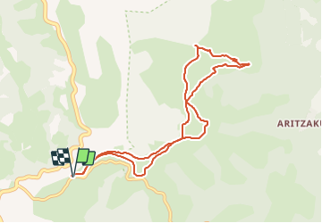


15,7 km | 25 km-effort

Gebruiker


Gratisgps-wandelapplicatie
 SityTrail
IGN / Geografische instituten
SityTrail World
De wereld gaat voor u open
Tocht Stappen van 9,7 km beschikbaar op Navarra - Nafarroa, Onbekend, Baztan. Deze tocht wordt voorgesteld door DECHAMPD.
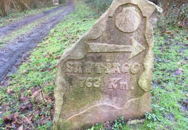
départ d'Urrizti à 1,5km du col D'OTSONDO, en suivant les crêtes jusqu'à Lizartzu et ses tunnels, en passant par sols et sommets Kaskolarrutu, Antsestegiko, Antestegi, Burchako, Lizartzuka. en empruntant "Nopoleolen Bidea". nombreux monuments mégalithiques et nécropoles
secteur à éviter pendant la chasse à la palombe
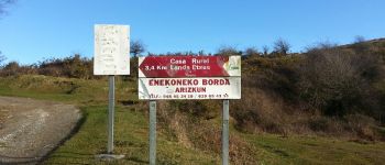
 - Photo 1")
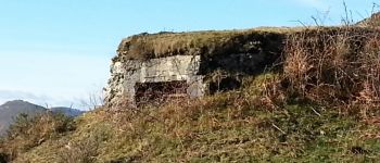
 - Photo 2")
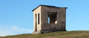
 - Photo 3")

Stappen
Te voet
Te voet
Te voet
Stappen

Stappen
Stappen
Stappen
Te voet