![](/images/other/stat-length.png)
![Tocht Stappen Nandrin - NANDRIN - Promenade de Yernée - Photo](https://media.geolcdn.com/t/1900/400/ext.pjpeg?maxdim=2&url=https%3A%2F%2Fservices.sitytrail.com%2FGeolivesWS%2FDownloadMedia.ashx%3FTrailID%3D517623%26Media%3D7ab957a9-1257-4946-923e-041eda79bd03.jpg)
NANDRIN - Promenade de Yernée
henrineupre
Gebruiker
![Lengte](/images/other/stat-length.png)
Lengte
9,1 km
![Max. hoogte](https://static1.geolcdn.com/siteimages/upload/files/1508320355ic_sort_altitude_max_24dp.png)
Max. hoogte
244 m
![Positief hoogteverschil](https://static1.geolcdn.com/siteimages/upload/files/1508320355ic_sort_den_pos_24dp.png)
Positief hoogteverschil
192 m
![Km-Effort](/images/other/stat-length.png)
Km-Effort
11,6 km
![Min. hoogte](https://static1.geolcdn.com/siteimages/upload/files/1508320355ic_sort_altitude_min_24dp.png)
Min. hoogte
101 m
![Negatief hoogteverschil](https://static1.geolcdn.com/siteimages/upload/files/1508320355ic_sort_den_neg_24dp.png)
Negatief hoogteverschil
195 m
![Boucle](https://static1.geolcdn.com/siteimages/upload/files/16400158638029165_repeat_loop_refresh_sync_direction_icon.png)
Boucle
Ja
![Markering](https://services.sitytrail.com/GeolivesWS/DownloadMedia.ashx?TrailID=517623&Media=balise.png)
Markering
Datum van aanmaak :
2017-03-17 00:00:00.0
Laatste wijziging :
2017-03-17 00:00:00.0
![Stappen](https://static1.geolcdn.com/sitytour/trail-icons/101.png)
2h30
Moeilijkheid : Medium
![Scan deze QR-code om de tocht te openen in de SityTrail-applicatie](https://capi.geolives.com/qq0zvz2zws4bq2lad0pu/sitytour/trails/517623/qr.png?size=200)
Gratisgps-wandelapplicatie
Over ons
Tocht Stappen van 9,1 km beschikbaar op Wallonië, Luik, Nandrin. Deze tocht wordt voorgesteld door henrineupre.
Beschrijving
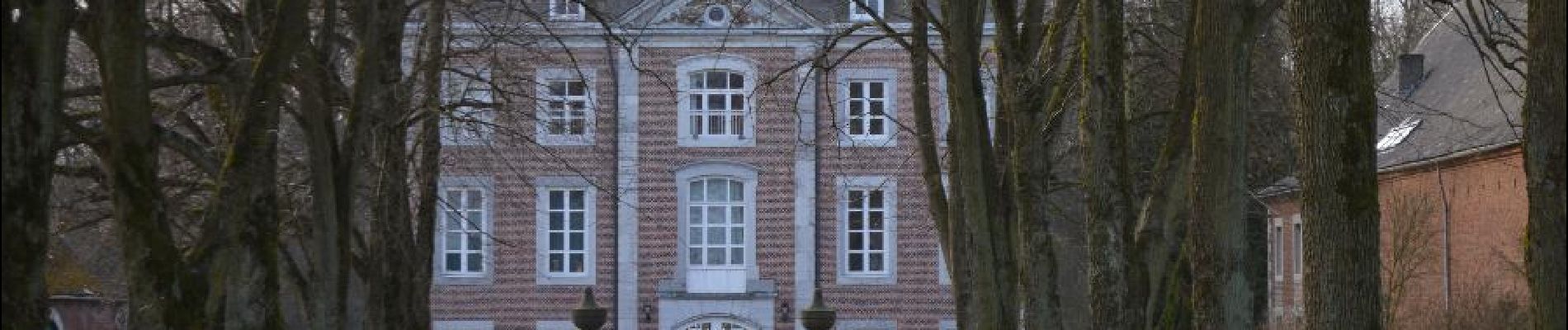
Le village en déclivité s’étire le long de la route d’Ombret, qui le traverse pour rejoindre la vallée, pour peu, on se croirait en Ardennes.
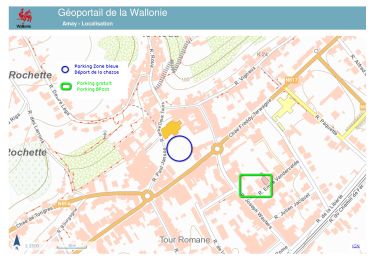
BALISE: losange rouge
Plaatsbepaling
Land:
Belgium
Regio :
Wallonië
Departement/Provincie :
Luik
Gemeente :
Nandrin
Locatie:
Yernée-Fraineux
Vertrek:(Dec)
Vertrek:(UTM)
668807 ; 5600048 (31U) N.
Opmerkingen
Wandeltochten in de omgeving
![Tocht Stappen Modave - Rausa GR 575 bis - Photo](https://media.geolcdn.com/t/375/260/ext.jpg?maxdim=2&url=https%3A%2F%2Fstatic1.geolcdn.com%2Fsiteimages%2Fupload%2Ffiles%2F1553511878bg_sport_marche.png)
![Stappen Stappen](https://static1.geolcdn.com/sitytour/trail-icons/101.png)
Rausa GR 575 bis
Stappen
Gemakkelijk
(12)
Modave,
Wallonië,
Luik,
Belgium
![](/images/other/stat-length.png)
6 km | 7,7 km-effort
1h 38min
![](https://static1.geolcdn.com/siteimages/upload/files/16400158638029165_repeat_loop_refresh_sync_direction_icon.png)
Ja
![Tocht Stappen Amay - marche adeps jehay 10km 2024 - Photo](https://media.geolcdn.com/t/375/260/04b81805-d462-4e76-9141-5bf7a46a778a.jpg&format=jpg&maxdim=2)
![Stappen Stappen](https://static1.geolcdn.com/sitytour/trail-icons/101.png)
marche adeps jehay 10km 2024
Stappen
Medium
(1)
Amay,
Wallonië,
Luik,
Belgium
![](/images/other/stat-length.png)
9,8 km | 11,8 km-effort
2h 20min
![](https://static1.geolcdn.com/siteimages/upload/files/16400158638029165_repeat_loop_refresh_sync_direction_icon.png)
Ja
![Tocht Stappen Nandrin - Villers le temple . st jean sart . clemaude - Photo](https://media.geolcdn.com/t/375/260/c7438fda-ad3c-4a12-91ed-f3aabfc6b7ce.jpg&format=jpg&maxdim=2)
![Stappen Stappen](https://static1.geolcdn.com/sitytour/trail-icons/101.png)
Villers le temple . st jean sart . clemaude
Stappen
Heel gemakkelijk
(1)
Nandrin,
Wallonië,
Luik,
Belgium
![](/images/other/stat-length.png)
7,9 km | 10,4 km-effort
2h 12min
![](https://static1.geolcdn.com/siteimages/upload/files/16400158638029165_repeat_loop_refresh_sync_direction_icon.png)
Ja
![Tocht Stappen Modave - MODAVE - Froide Fontaine - Photo](https://media.geolcdn.com/t/375/260/ext.jpg?maxdim=2&url=https%3A%2F%2Fservices.sitytrail.com%2FGeolivesWS%2FDownloadMedia.ashx%3FTrailID%3D163540%26Media%3Da9dfd4e0-07be-4695-be31-23a02d75fa1f.jpg)
![Stappen Stappen](https://static1.geolcdn.com/sitytour/trail-icons/101.png)
MODAVE - Froide Fontaine
Stappen
Medium
(2)
Modave,
Wallonië,
Luik,
Belgium
![](/images/other/stat-length.png)
8,6 km | 10,6 km-effort
2h 14min
![](https://static1.geolcdn.com/siteimages/upload/files/16400158638029165_repeat_loop_refresh_sync_direction_icon.png)
Ja
![Tocht Mountainbike Amay - casse gueul - Photo](https://media.geolcdn.com/t/375/260/ext.jpg?maxdim=2&url=https%3A%2F%2Fservices.sitytrail.com%2FGeolivesWS%2FDownloadMedia.ashx%3FTrailID%3D285464%26Media%3Dfix__20140511121633.jpg)
![Mountainbike Mountainbike](https://static1.geolcdn.com/sitytour/trail-icons/202.png)
casse gueul
Mountainbike
Moeilijk
(1)
Amay,
Wallonië,
Luik,
Belgium
![](/images/other/stat-length.png)
27 km | 33 km-effort
2h 21min
![](https://static1.geolcdn.com/siteimages/upload/files/16400158638029165_repeat_loop_refresh_sync_direction_icon.png)
Neen
![Tocht Stappen Nandrin - promenade de la rochette : villers le temple - grand fond d'oxhe - villers le temple - Photo](https://media.geolcdn.com/t/375/260/6a65eaf0-07ca-4e09-ab79-c1ffba2fba6b.jpg&format=jpg&maxdim=2)
![Stappen Stappen](https://static1.geolcdn.com/sitytour/trail-icons/101.png)
promenade de la rochette : villers le temple - grand fond d'oxhe - villers le...
Stappen
Medium
(1)
Nandrin,
Wallonië,
Luik,
Belgium
![](/images/other/stat-length.png)
10 km | 13,3 km-effort
2h 47min
![](https://static1.geolcdn.com/siteimages/upload/files/16400158638029165_repeat_loop_refresh_sync_direction_icon.png)
Ja
![Tocht Stappen Modave - Stree reco 21 12 - Photo](https://media.geolcdn.com/t/375/260/ext.jpg?maxdim=2&url=https%3A%2F%2Fstatic1.geolcdn.com%2Fsiteimages%2Fupload%2Ffiles%2F1553511878bg_sport_marche.png)
![Stappen Stappen](https://static1.geolcdn.com/sitytour/trail-icons/101.png)
Stree reco 21 12
Stappen
Medium
(2)
Modave,
Wallonië,
Luik,
Belgium
![](/images/other/stat-length.png)
7,6 km | 9,3 km-effort
1h 55min
![](https://static1.geolcdn.com/siteimages/upload/files/16400158638029165_repeat_loop_refresh_sync_direction_icon.png)
Ja
![Tocht Stappen Amay - 20230726 - TOTEMUS Amay - 6.1 Km - Photo](https://media.geolcdn.com/t/375/260/4112cd7d-32fc-4690-94e7-6dc07eacc03d.jpeg&format=jpg&maxdim=2)
![Stappen Stappen](https://static1.geolcdn.com/sitytour/trail-icons/101.png)
20230726 - TOTEMUS Amay - 6.1 Km
Stappen
Medium
Amay,
Wallonië,
Luik,
Belgium
![](/images/other/stat-length.png)
6,1 km | 6,6 km-effort
1h 42min
![](https://static1.geolcdn.com/siteimages/upload/files/16400158638029165_repeat_loop_refresh_sync_direction_icon.png)
Ja
![Tocht Te voet Amay - Promenade d'Ombret - Photo](https://media.geolcdn.com/t/375/260/bbfa7314-541b-4540-af6f-869e2bd08b94.jpeg&format=jpg&maxdim=2)
![Te voet Te voet](https://static1.geolcdn.com/sitytour/trail-icons/100.png)
Promenade d'Ombret
Te voet
Gemakkelijk
Amay,
Wallonië,
Luik,
Belgium
![](/images/other/stat-length.png)
8 km | 10,1 km-effort
2h 18min
![](https://static1.geolcdn.com/siteimages/upload/files/16400158638029165_repeat_loop_refresh_sync_direction_icon.png)
Ja