![](/images/other/stat-length.png)
![Tocht Stappen Maringues - maringues - Photo](https://media.geolcdn.com/t/1900/400/ext.pjpeg?maxdim=2&url=https%3A%2F%2Fstatic1.geolcdn.com%2Fsiteimages%2Fupload%2Ffiles%2F1553511878bg_sport_marche.png)
maringues
guy63
Gebruiker
![Lengte](/images/other/stat-length.png)
![Max. hoogte](https://static1.geolcdn.com/siteimages/upload/files/1508320355ic_sort_altitude_max_24dp.png)
![Positief hoogteverschil](https://static1.geolcdn.com/siteimages/upload/files/1508320355ic_sort_den_pos_24dp.png)
![Km-Effort](/images/other/stat-length.png)
![Min. hoogte](https://static1.geolcdn.com/siteimages/upload/files/1508320355ic_sort_altitude_min_24dp.png)
![Negatief hoogteverschil](https://static1.geolcdn.com/siteimages/upload/files/1508320355ic_sort_den_neg_24dp.png)
![Boucle](https://static1.geolcdn.com/siteimages/upload/files/16400158638029165_repeat_loop_refresh_sync_direction_icon.png)
![Stappen](https://static1.geolcdn.com/sitytour/trail-icons/101.png)
4h24
Moeilijkheid : Medium
![Scan deze QR-code om de tocht te openen in de SityTrail-applicatie](https://capi.geolives.com/qq0zvz2zws4bq2lad0pu/sitytour/trails/509496/qr.png?size=200)
Gratisgps-wandelapplicatie
Over ons
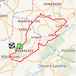
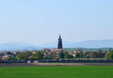
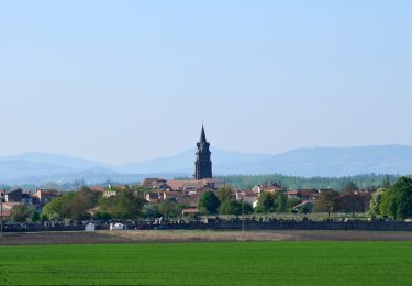
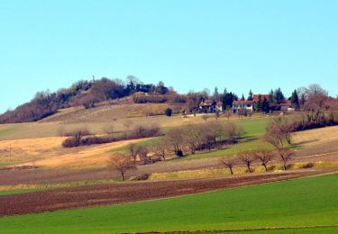
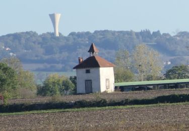
Tocht Stappen van 17,7 km beschikbaar op Auvergne-Rhône-Alpes, Puy-de-Dôme, Maringues. Deze tocht wordt voorgesteld door guy63.
Beschrijving
Départ parking Terrain des Sports point GPS Longitude : 3° 20' 8.8' E Latitude : 45° 55' 29.9' N. en traversant la ville prendre le temps de regarder les anciennes bâtisses en pierre de Volvic, le marché couvert, sur le parvis de l’Eglise la superbe vue sur la chaine des puys. Bon chemin partie boisée, l’autre longeant les pâturages et cour d’eau. En montant la bute de Montgacon allez à la vierge une vue à 360° sur tous les monts de la région. Vous êtes sur la plaine de la Limagne, respectez la nature ne pas sortir des chemins.
Plaatsbepaling
Opmerkingen
Wandeltochten in de omgeving
![Tocht Te voet Maringues - La Butte de Montgacon - circuit court - Photo](https://media.geolcdn.com/t/375/260/ab4843d0-b44d-4ab7-8595-840f5a55ca60.jpeg&format=jpg&maxdim=2)
![Te voet Te voet](https://static1.geolcdn.com/sitytour/trail-icons/100.png)
Te voet
![](/images/other/stat-length.png)
![](https://static1.geolcdn.com/siteimages/upload/files/16400158638029165_repeat_loop_refresh_sync_direction_icon.png)
![Tocht Te voet Luzillat - La Butte de Montgacon - Photo](https://media.geolcdn.com/t/375/260/dae0ac9a-ba68-464f-a0a3-8b55925d12f4.jpeg&format=jpg&maxdim=2)
![Te voet Te voet](https://static1.geolcdn.com/sitytour/trail-icons/100.png)
Te voet
![](/images/other/stat-length.png)
![](https://static1.geolcdn.com/siteimages/upload/files/16400158638029165_repeat_loop_refresh_sync_direction_icon.png)
![Tocht Te voet Vinzelles - Entre Crevant et Laveine - Photo](https://media.geolcdn.com/t/375/260/dd947ee4-d5c1-4bf1-b419-c5f2be4d1510.jpeg&format=jpg&maxdim=2)
![Te voet Te voet](https://static1.geolcdn.com/sitytour/trail-icons/100.png)
Te voet
![](/images/other/stat-length.png)
![](https://static1.geolcdn.com/siteimages/upload/files/16400158638029165_repeat_loop_refresh_sync_direction_icon.png)
![Stappen Stappen](https://static1.geolcdn.com/sitytour/trail-icons/101.png)
Stappen
![](/images/other/stat-length.png)
![](https://static1.geolcdn.com/siteimages/upload/files/16400158638029165_repeat_loop_refresh_sync_direction_icon.png)
![Tocht Stappen Maringues - Maringues_Butte_Montgacon - Photo](https://media.geolcdn.com/t/375/260/fef1ecfc-3d14-4465-b9c8-110655272baa.jpg&format=jpg&maxdim=2)
![Stappen Stappen](https://static1.geolcdn.com/sitytour/trail-icons/101.png)
Stappen
![](/images/other/stat-length.png)
![](https://static1.geolcdn.com/siteimages/upload/files/16400158638029165_repeat_loop_refresh_sync_direction_icon.png)
![Tocht Stappen Crevant-Laveine - [Itinéraire] Entre Crevant et Laveine - Photo](https://media.geolcdn.com/t/375/260/6fa182a0-77c3-4ab4-a1f7-73c600d86e47.png&format=jpg&maxdim=2)
![Stappen Stappen](https://static1.geolcdn.com/sitytour/trail-icons/101.png)
Stappen
![](/images/other/stat-length.png)
![](https://static1.geolcdn.com/siteimages/upload/files/16400158638029165_repeat_loop_refresh_sync_direction_icon.png)
![Stappen Stappen](https://static1.geolcdn.com/sitytour/trail-icons/101.png)
Stappen
![](/images/other/stat-length.png)
![](https://static1.geolcdn.com/siteimages/upload/files/16400158638029165_repeat_loop_refresh_sync_direction_icon.png)
![Tocht Stappen Crevant-Laveine - crevant Laveine par les chemins - Photo](https://media.geolcdn.com/t/375/260/65c9ac11-9bc3-49c0-96c9-fc6caab54fb2.jpg&format=jpg&maxdim=2)
![Stappen Stappen](https://static1.geolcdn.com/sitytour/trail-icons/101.png)
Stappen
![](/images/other/stat-length.png)
![](https://static1.geolcdn.com/siteimages/upload/files/16400158638029165_repeat_loop_refresh_sync_direction_icon.png)
![Tocht Stappen Saint-Laure - 2022-10-25 Saint Laure - Photo](https://media.geolcdn.com/t/375/260/c8f90e77-25e2-4769-a5e7-90ee0c50591a.png&format=jpg&maxdim=2)
![Stappen Stappen](https://static1.geolcdn.com/sitytour/trail-icons/101.png)
Stappen
![](/images/other/stat-length.png)
![](https://static1.geolcdn.com/siteimages/upload/files/16400158638029165_repeat_loop_refresh_sync_direction_icon.png)