![](/images/other/stat-length.png)
![Tocht Stappen Luzillat - Luzillat - Photo](https://media.geolcdn.com/t/1900/400/ext.pjpeg?maxdim=2&url=https%3A%2F%2Fstatic1.geolcdn.com%2Fsiteimages%2Fupload%2Ffiles%2F1553511878bg_sport_marche.png)
Luzillat
guy63
Gebruiker
![Lengte](/images/other/stat-length.png)
![Max. hoogte](https://static1.geolcdn.com/siteimages/upload/files/1508320355ic_sort_altitude_max_24dp.png)
![Positief hoogteverschil](https://static1.geolcdn.com/siteimages/upload/files/1508320355ic_sort_den_pos_24dp.png)
![Km-Effort](/images/other/stat-length.png)
![Min. hoogte](https://static1.geolcdn.com/siteimages/upload/files/1508320355ic_sort_altitude_min_24dp.png)
![Negatief hoogteverschil](https://static1.geolcdn.com/siteimages/upload/files/1508320355ic_sort_den_neg_24dp.png)
![Boucle](https://static1.geolcdn.com/siteimages/upload/files/16400158638029165_repeat_loop_refresh_sync_direction_icon.png)
![Stappen](https://static1.geolcdn.com/sitytour/trail-icons/101.png)
3h53
Moeilijkheid : Gemakkelijk
![Scan deze QR-code om de tocht te openen in de SityTrail-applicatie](https://capi.geolives.com/qq0zvz2zws4bq2lad0pu/sitytour/trails/508130/qr.png?size=200)
Gratisgps-wandelapplicatie
Over ons
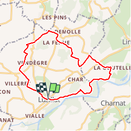
Tocht Stappen van 15,6 km beschikbaar op Auvergne-Rhône-Alpes, Puy-de-Dôme, Luzillat. Deze tocht wordt voorgesteld door guy63.
Beschrijving
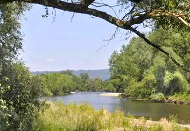
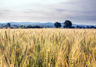
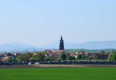
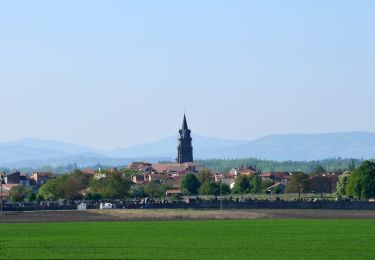
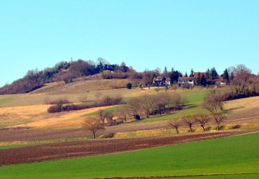
Luzillat (63350) proche de MaringuesDépart parking de la mairie point GPS : Longitude 03° 23' 17.6' E : Latitude 45° 56' 46.2' N : Bon chemin longeant les pâturages et cultures céréalière. Respectez la nature ne pas sortir des chemins, en arrivant sur le plateau avant le village de Demolles vous avez la vue sur la chaine du Livradois Forez et le domaine royal de Randan, regardez la carte bien des sites à découvrir. Bonne rando. Respectez la nature rapportez vos déchets avec vous. Bonne rando.
Plaatsbepaling
Opmerkingen
Wandeltochten in de omgeving
![Tocht Te voet Maringues - La Butte de Montgacon - circuit court - Photo](https://media.geolcdn.com/t/375/260/ab4843d0-b44d-4ab7-8595-840f5a55ca60.jpeg&format=jpg&maxdim=2)
![Te voet Te voet](https://static1.geolcdn.com/sitytour/trail-icons/100.png)
Te voet
![](/images/other/stat-length.png)
![](https://static1.geolcdn.com/siteimages/upload/files/16400158638029165_repeat_loop_refresh_sync_direction_icon.png)
![Tocht Te voet Luzillat - La Butte de Montgacon - Photo](https://media.geolcdn.com/t/375/260/dae0ac9a-ba68-464f-a0a3-8b55925d12f4.jpeg&format=jpg&maxdim=2)
![Te voet Te voet](https://static1.geolcdn.com/sitytour/trail-icons/100.png)
Te voet
![](/images/other/stat-length.png)
![](https://static1.geolcdn.com/siteimages/upload/files/16400158638029165_repeat_loop_refresh_sync_direction_icon.png)
![Tocht Te voet Vinzelles - Entre Crevant et Laveine - Photo](https://media.geolcdn.com/t/375/260/dd947ee4-d5c1-4bf1-b419-c5f2be4d1510.jpeg&format=jpg&maxdim=2)
![Te voet Te voet](https://static1.geolcdn.com/sitytour/trail-icons/100.png)
Te voet
![](/images/other/stat-length.png)
![](https://static1.geolcdn.com/siteimages/upload/files/16400158638029165_repeat_loop_refresh_sync_direction_icon.png)
![Tocht Stappen Charnat - Charnat_Allier_Dore - Photo](https://media.geolcdn.com/t/375/260/b3a84eb6-99f5-4918-aef5-e43023b7bd8b.jpg&format=jpg&maxdim=2)
![Stappen Stappen](https://static1.geolcdn.com/sitytour/trail-icons/101.png)
Stappen
![](/images/other/stat-length.png)
![](https://static1.geolcdn.com/siteimages/upload/files/16400158638029165_repeat_loop_refresh_sync_direction_icon.png)
![Tocht Stappen Vinzelles - Vinzelles_Ronde_Fours - Photo](https://media.geolcdn.com/t/375/260/aa2c240c-b9d5-44e1-88ec-cb361f7fa5cf.jpg&format=jpg&maxdim=2)
![Stappen Stappen](https://static1.geolcdn.com/sitytour/trail-icons/101.png)
Stappen
![](/images/other/stat-length.png)
![](https://static1.geolcdn.com/siteimages/upload/files/16400158638029165_repeat_loop_refresh_sync_direction_icon.png)
![Stappen Stappen](https://static1.geolcdn.com/sitytour/trail-icons/101.png)
Stappen
![](/images/other/stat-length.png)
![](https://static1.geolcdn.com/siteimages/upload/files/16400158638029165_repeat_loop_refresh_sync_direction_icon.png)
![Tocht Stappen Maringues - Maringues_Butte_Montgacon - Photo](https://media.geolcdn.com/t/375/260/fef1ecfc-3d14-4465-b9c8-110655272baa.jpg&format=jpg&maxdim=2)
![Stappen Stappen](https://static1.geolcdn.com/sitytour/trail-icons/101.png)
Stappen
![](/images/other/stat-length.png)
![](https://static1.geolcdn.com/siteimages/upload/files/16400158638029165_repeat_loop_refresh_sync_direction_icon.png)
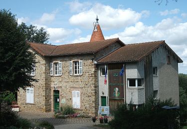
![Tocht Stappen Crevant-Laveine - [Itinéraire] Entre Crevant et Laveine - Photo](https://media.geolcdn.com/t/375/260/6fa182a0-77c3-4ab4-a1f7-73c600d86e47.png&format=jpg&maxdim=2)
![Stappen Stappen](https://static1.geolcdn.com/sitytour/trail-icons/101.png)
Stappen
![](/images/other/stat-length.png)
![](https://static1.geolcdn.com/siteimages/upload/files/16400158638029165_repeat_loop_refresh_sync_direction_icon.png)
![Stappen Stappen](https://static1.geolcdn.com/sitytour/trail-icons/101.png)
Stappen
![](/images/other/stat-length.png)
![](https://static1.geolcdn.com/siteimages/upload/files/16400158638029165_repeat_loop_refresh_sync_direction_icon.png)