![](/images/other/stat-length.png)
![Tocht Stappen Pézilla-la-Rivière - 66 CORNEILLA-LA-RIVIERE, promenade sur les hauteurs vallonnées, entre vignes et parc éolien - Photo](https://media.geolcdn.com/t/1900/400/ext.pjpeg?maxdim=2&url=https%3A%2F%2Fservices.sitytrail.com%2FGeolivesWS%2FDownloadMedia.ashx%3FTrailID%3D492847%26Media%3D20151110140148.jpg)
66 CORNEILLA-LA-RIVIERE, promenade sur les hauteurs vallonnées, entre vignes et parc éolien
jeff66
Gebruiker
![Lengte](/images/other/stat-length.png)
Lengte
8,3 km
![Max. hoogte](https://static1.geolcdn.com/siteimages/upload/files/1508320355ic_sort_altitude_max_24dp.png)
Max. hoogte
145 m
![Positief hoogteverschil](https://static1.geolcdn.com/siteimages/upload/files/1508320355ic_sort_den_pos_24dp.png)
Positief hoogteverschil
85 m
![Km-Effort](/images/other/stat-length.png)
Km-Effort
9,5 km
![Min. hoogte](https://static1.geolcdn.com/siteimages/upload/files/1508320355ic_sort_altitude_min_24dp.png)
Min. hoogte
77 m
![Negatief hoogteverschil](https://static1.geolcdn.com/siteimages/upload/files/1508320355ic_sort_den_neg_24dp.png)
Negatief hoogteverschil
85 m
![Boucle](https://static1.geolcdn.com/siteimages/upload/files/16400158638029165_repeat_loop_refresh_sync_direction_icon.png)
Boucle
Ja
Datum van aanmaak :
2015-11-12 00:00:00.0
Laatste wijziging :
2015-11-12 00:00:00.0
![Stappen](https://static1.geolcdn.com/sitytour/trail-icons/101.png)
1h31
Moeilijkheid : Medium
![Scan deze QR-code om de tocht te openen in de SityTrail-applicatie](https://capi.geolives.com/qq0zvz2zws4bq2lad0pu/sitytour/trails/492847/qr.png?size=200)
Gratisgps-wandelapplicatie
Over ons
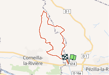
Tocht Stappen van 8,3 km beschikbaar op Occitanië, Pyrénées-Orientales, Pézilla-la-Rivière. Deze tocht wordt voorgesteld door jeff66.
Beschrijving
66 CORNEILLA-LA-RIVIERE, parking à proximité de la RD714, le long de la piste cyclable, les
Fèces, les Jassettes, les montanères, panorama sur les Alberes, le Canigou, força Réal, ravin des Mirandes, les Mirandes, Coume Ouistrouill, passage à gué
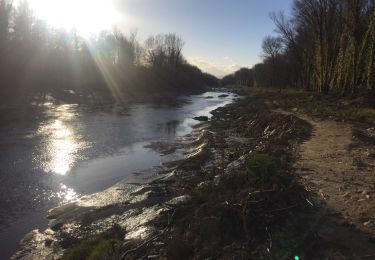
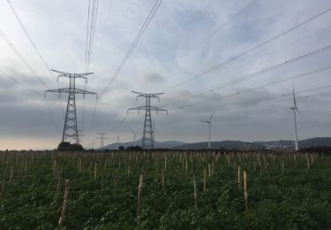
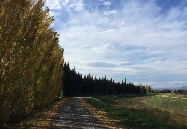
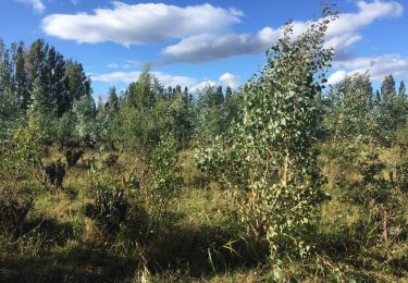
Plaatsbepaling
Land:
France
Regio :
Occitanië
Departement/Provincie :
Pyrénées-Orientales
Gemeente :
Pézilla-la-Rivière
Locatie:
Unknown
Vertrek:(Dec)
Vertrek:(UTM)
479521 ; 4727111 (31T) N.
Opmerkingen
Wandeltochten in de omgeving
![Tocht Te voet Corneilla-la-Rivière - Sentier Lambert Narach - Photo](https://media.geolcdn.com/t/375/260/60aa864b-1f67-4c4d-a42f-3e8c5d1f7ee0.jpeg&format=jpg&maxdim=2)
![Te voet Te voet](https://static1.geolcdn.com/sitytour/trail-icons/100.png)
Sentier Lambert Narach
Te voet
Gemakkelijk
Corneilla-la-Rivière,
Occitanië,
Pyrénées-Orientales,
France
![](/images/other/stat-length.png)
6,7 km | 11,4 km-effort
2h 35min
![](https://static1.geolcdn.com/siteimages/upload/files/16400158638029165_repeat_loop_refresh_sync_direction_icon.png)
Neen
![Tocht Stappen Corneilla-la-Rivière - 20240316 Corneilla la rivière - Photo](https://media.geolcdn.com/t/375/260/8c5263cf-1cc3-4271-963e-53ddcecf3643.jpg&format=jpg&maxdim=2)
![Stappen Stappen](https://static1.geolcdn.com/sitytour/trail-icons/101.png)
20240316 Corneilla la rivière
Stappen
Medium
Corneilla-la-Rivière,
Occitanië,
Pyrénées-Orientales,
France
![](/images/other/stat-length.png)
19 km | 28 km-effort
4h 31min
![](https://static1.geolcdn.com/siteimages/upload/files/16400158638029165_repeat_loop_refresh_sync_direction_icon.png)
Ja
![Tocht Lopen Saint-Féliu-d'Avall - Boucle St Feliu Amont -Ill sur Tête - Photo](https://media.geolcdn.com/t/375/260/ext.jpg?maxdim=2&url=https%3A%2F%2Fstatic1.geolcdn.com%2Fsiteimages%2Fupload%2Ffiles%2F1524743154running.jpg)
![Lopen Lopen](https://static1.geolcdn.com/sitytour/trail-icons/103.png)
Boucle St Feliu Amont -Ill sur Tête
Lopen
Medium
(1)
Saint-Féliu-d'Avall,
Occitanië,
Pyrénées-Orientales,
France
![](/images/other/stat-length.png)
23 km | 25 km-effort
2h 8min
![](https://static1.geolcdn.com/siteimages/upload/files/16400158638029165_repeat_loop_refresh_sync_direction_icon.png)
Neen
![Tocht Stappen Saint-Féliu-d'Avall - 66 ST-FELIU-D'AVALL, CORNEILLA DE LA RIVIERE, promenade autour de la Têt - Photo](https://media.geolcdn.com/t/375/260/ext.jpg?maxdim=2&url=https%3A%2F%2Fservices.sitytrail.com%2FGeolivesWS%2FDownloadMedia.ashx%3FTrailID%3D536494%26Media%3D20160310173744.jpg)
![Stappen Stappen](https://static1.geolcdn.com/sitytour/trail-icons/101.png)
66 ST-FELIU-D'AVALL, CORNEILLA DE LA RIVIERE, promenade autour de la Têt
Stappen
Gemakkelijk
Saint-Féliu-d'Avall,
Occitanië,
Pyrénées-Orientales,
France
![](/images/other/stat-length.png)
6,6 km | 7 km-effort
1h 16min
![](https://static1.geolcdn.com/siteimages/upload/files/16400158638029165_repeat_loop_refresh_sync_direction_icon.png)
Ja
![Tocht Stappen Baixas - 66 VILLENEUVE-LA-RIVIÈRE, promenade entre parcs éoliens et vignobles CALCE - Photo](https://media.geolcdn.com/t/375/260/ext.jpg?maxdim=2&url=https%3A%2F%2Fservices.sitytrail.com%2FGeolivesWS%2FDownloadMedia.ashx%3FTrailID%3D503177%26Media%3D20151215145425.jpg)
![Stappen Stappen](https://static1.geolcdn.com/sitytour/trail-icons/101.png)
66 VILLENEUVE-LA-RIVIÈRE, promenade entre parcs éoliens et vignobles CALCE
Stappen
Gemakkelijk
Baixas,
Occitanië,
Pyrénées-Orientales,
France
![](/images/other/stat-length.png)
8 km | 8,7 km-effort
1h 33min
![](https://static1.geolcdn.com/siteimages/upload/files/16400158638029165_repeat_loop_refresh_sync_direction_icon.png)
Ja
![Tocht Stappen Le Soler - 66 LE SOLER - ST FELIU D'AVALL, promenade le long du Rau du SOLER et de la rivière de CASTELNOU entre canaux et vergers - Photo](https://media.geolcdn.com/t/375/260/ext.jpg?maxdim=2&url=https%3A%2F%2Fservices.sitytrail.com%2FGeolivesWS%2FDownloadMedia.ashx%3FTrailID%3D487086%26Media%3D20151027134105.jpg)
![Stappen Stappen](https://static1.geolcdn.com/sitytour/trail-icons/101.png)
66 LE SOLER - ST FELIU D'AVALL, promenade le long du Rau du SOLER et de la ri...
Stappen
Gemakkelijk
Le Soler,
Occitanië,
Pyrénées-Orientales,
France
![](/images/other/stat-length.png)
9,8 km | 10,4 km-effort
1h 39min
![](https://static1.geolcdn.com/siteimages/upload/files/16400158638029165_repeat_loop_refresh_sync_direction_icon.png)
Ja
![Tocht Stappen Le Soler - 66 LE SOLER - TOULOUGES, village, jardins, vergers, canaux et la Basse - Photo](https://media.geolcdn.com/t/375/260/ext.jpg?maxdim=2&url=https%3A%2F%2Fservices.sitytrail.com%2FGeolivesWS%2FDownloadMedia.ashx%3FTrailID%3D484347%26Media%3D20151021151755.jpg)
![Stappen Stappen](https://static1.geolcdn.com/sitytour/trail-icons/101.png)
66 LE SOLER - TOULOUGES, village, jardins, vergers, canaux et la Basse
Stappen
Medium
Le Soler,
Occitanië,
Pyrénées-Orientales,
France
![](/images/other/stat-length.png)
13,5 km | 14,3 km-effort
2h 15min
![](https://static1.geolcdn.com/siteimages/upload/files/16400158638029165_repeat_loop_refresh_sync_direction_icon.png)
Ja
![Tocht Stappen Pézilla-la-Rivière - 66 PEZILLA-la-Riviere - VILLENEUVE-la-riviere - LE SOLER - vallée de la TÊT - Photo](https://media.geolcdn.com/t/375/260/ext.jpg?maxdim=2&url=https%3A%2F%2Fservices.sitytrail.com%2FGeolivesWS%2FDownloadMedia.ashx%3FTrailID%3D474874%26Media%3D20150923174113.jpg)
![Stappen Stappen](https://static1.geolcdn.com/sitytour/trail-icons/101.png)
66 PEZILLA-la-Riviere - VILLENEUVE-la-riviere - LE SOLER - vallée de la TÊT
Stappen
Medium
Pézilla-la-Rivière,
Occitanië,
Pyrénées-Orientales,
France
![](/images/other/stat-length.png)
15,9 km | 17,3 km-effort
2h 44min
![](https://static1.geolcdn.com/siteimages/upload/files/16400158638029165_repeat_loop_refresh_sync_direction_icon.png)
Ja
![Tocht Lopen Saint-Féliu-d'Amont - St Feliu Boucle - Photo](https://media.geolcdn.com/t/375/260/ext.jpg?maxdim=2&url=https%3A%2F%2Fstatic1.geolcdn.com%2Fsiteimages%2Fupload%2Ffiles%2F1524743154running.jpg)
![Lopen Lopen](https://static1.geolcdn.com/sitytour/trail-icons/103.png)
St Feliu Boucle
Lopen
Heel gemakkelijk
(1)
Saint-Féliu-d'Amont,
Occitanië,
Pyrénées-Orientales,
France
![](/images/other/stat-length.png)
9,8 km | 10,5 km-effort
1h 11min
![](https://static1.geolcdn.com/siteimages/upload/files/16400158638029165_repeat_loop_refresh_sync_direction_icon.png)
Ja
Passages très difficiles dans la garrigue. Balade à déconseiller....