Tocht Stappen Baixas - 66 BAIXAS à CALCE chemins à travers le vignoble - Photo

66 BAIXAS à CALCE chemins à travers le vignoble

 jeff66
jeff66

Gebruiker

© OpenStreetMap contributors
Lengte
Lengte
14,4 km
Max. hoogte
Max. hoogte
254 m
Positief hoogteverschil
251 m
Km-Effort
Km-Effort  
17,8 km
Min. hoogte
Min. hoogte
82 m
Negatief hoogteverschil
252 m
Boucle
Boucle
Ja
Datum van aanmaak :
2015-10-25 00:00:00.0
Laatste wijziging :
2015-10-25 00:00:00.0

(0 Bericht)

Stappen
Stappen
2h39
Moeilijkheid : Medium

Scan deze QR-code om de tocht te openen in de SityTrail-applicatie

Gratisgps-wandelapplicatie

Logo SityTrail SityTrail

IGN / Geografische instituten

SityTrail uit de App Store downloaden SityTrail uit Google Play downloaden

Logo SityTrail SityTrail World

De wereld gaat voor u open

SityTrail uit de App Store downloaden SityTrail uit Google Play downloaden SityTrail op Huawei AppGallery downloaden

Over ons

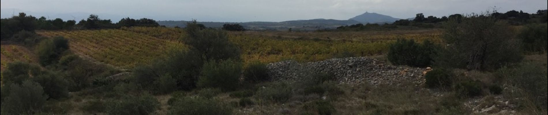
Tocht Stappen van 14,4 km beschikbaar op Occitanië, Pyrénées-Orientales, Baixas. Deze tocht wordt voorgesteld door jeff66.

Beschrijving

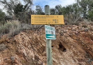
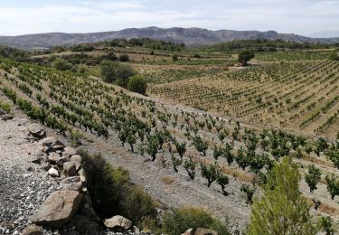
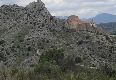
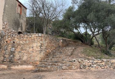
66 BAIXAS - parking de l'école, ch. de l'ermitage de Ste Catherine. Piste DFCI F146 vers CALCE, les Comes, cabane de las Coumes - CALCE, le château,  rues du château, des Pyrénées, et de l'horloge, église, bistrot de pays le presbytère, mairie, cave Coop, emprunter RD18, puis DFCI F151 en direction du domaine Gauby,
Cres d'en Cabané, terre rouge, Poux d'en Nougé, El Carner, els rives Del Carner, passage à gué pavé, traverser la RD18 et rentrer dans BAIXAS par le boulevard de la fontaine, rue Arago, place du général mde Gaulle, église, rue de la Bastille, boulevard national

Hoogteprofiel

Foto's

25 fotos in totaal. Klik op een foto om ze allemaal in de galerij weer te geven.

Plaatsbepaling

Land:
France
Regio :
Occitanië
Departement/Provincie :
Pyrénées-Orientales
Gemeente :
Baixas
Locatie:
Unknown
Vertrek:(Dec)
Vertrek:(UTM)
484357 ; 4733338 (31T) N.

Wandeltochten in de omgeving

Tocht Stappen Saint-Estève - SAINT-ESTEVE 66 - ballade dans le Vignoble de Rivesaltes  - Photo
Stappen
jeff66

Stappen

Medium
(1)
Saint-Estève, Occitanië, Pyrénées-Orientales, France
8 km | 8,8 km-effort
1h 23min
Ja
Tocht Stappen Cases-de-Pène - Hermitage de case de pène, le 11 août 2013 - Photo
Stappen
merencianoep

Stappen

Moeilijk
(2)
Cases-de-Pène, Occitanië, Pyrénées-Orientales, France
7,4 km | 11,5 km-effort
1h 55min
Ja
Tocht Stappen Baixas - baixas chapelle ste catherine - Photo
Stappen
66Gribouille83

Stappen

Moeilijk
Baixas, Occitanië, Pyrénées-Orientales, France
9,5 km | 12,9 km-effort
3h 56min
Ja
Tocht Stappen Cases-de-Pène - 2023-08-01_12h04m36_SityTrail - 3754591 - cases-de-pene-x-detour-et-retour - Photo
Stappen
ehalle8544

Stappen

Medium
Cases-de-Pène, Occitanië, Pyrénées-Orientales, France
5 km | 6,1 km-effort
1h 23min
Ja
Tocht Stappen Cases-de-Pène - 20230528 Nostradamus Seynora de Pene  - Photo
Stappen
ThonyM

Stappen

Medium
Cases-de-Pène, Occitanië, Pyrénées-Orientales, France
15,3 km | 22 km-effort
4h 5min
Ja
Tocht Stappen Cases-de-Pène - 20220419 Ermitage Cases-de-Pene - Photo
Stappen
ThonyM

Stappen

Medium
Cases-de-Pène, Occitanië, Pyrénées-Orientales, France
15,2 km | 22 km-effort
3h 42min
Ja
Tocht Stappen Baixas - Boucle Baixas Calce  - Photo
Stappen
ombrabella

Stappen

Heel gemakkelijk
Baixas, Occitanië, Pyrénées-Orientales, France
14,3 km | 18,8 km-effort
3h 41min
Ja
Tocht Stappen Baixas - 66 VILLENEUVE-LA-RIVIÈRE, promenade entre parcs éoliens et vignobles CALCE - Photo
Stappen
jeff66

Stappen

Gemakkelijk
Baixas, Occitanië, Pyrénées-Orientales, France
8 km | 8,7 km-effort
1h 33min
Ja
Tocht Stappen Saint-Estève - 66 SAINT-ESTEVE, chemin du sacré cœur Perpignan - Photo
Stappen
jeff66

Stappen

Gemakkelijk
Saint-Estève, Occitanië, Pyrénées-Orientales, France
5,6 km | 5,9 km-effort
1h 0min
Neen


Sluiten
Mijn abonnementen