


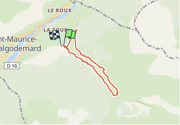

19,8 km | 46 km-effort

Gebruiker


Gratisgps-wandelapplicatie
 SityTrail
IGN / Geografische instituten
SityTrail World
De wereld gaat voor u open
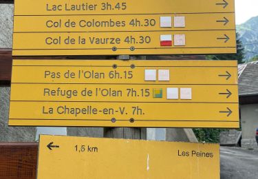
Tocht Stappen van 6,5 km beschikbaar op Provence-Alpes-Côte d'Azur, Hautes-Alpes, Saint-Maurice-en-Valgodemard. Deze tocht wordt voorgesteld door Dervalmarc.
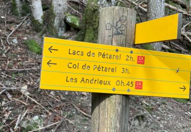
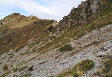
Attention versant ubac pour la descente passage en partie éboule sur le chemin du retour en plusieurs endroits.


Stappen

Stappen

Stappen
Stappen
Stappen
Stappen
Stappen
Stappen
Stappen