![](/images/other/stat-length.png)
![Tocht Stappen Massingy - CLERGEON - Photo](https://media.geolcdn.com/t/1900/400/ext.pjpeg?maxdim=2&url=https%3A%2F%2Fservices.sitytrail.com%2FGeolivesWS%2FDownloadMedia.ashx%3FTrailID%3D474185%26Media%3Dc01eb5a7-bf72-4ffc-98fa-1e923f8f3f43.jpg)
CLERGEON
HERRY
Gebruiker GUIDE
![Lengte](/images/other/stat-length.png)
![Max. hoogte](https://static1.geolcdn.com/siteimages/upload/files/1508320355ic_sort_altitude_max_24dp.png)
![Positief hoogteverschil](https://static1.geolcdn.com/siteimages/upload/files/1508320355ic_sort_den_pos_24dp.png)
![Km-Effort](/images/other/stat-length.png)
![Min. hoogte](https://static1.geolcdn.com/siteimages/upload/files/1508320355ic_sort_altitude_min_24dp.png)
![Negatief hoogteverschil](https://static1.geolcdn.com/siteimages/upload/files/1508320355ic_sort_den_neg_24dp.png)
![Boucle](https://static1.geolcdn.com/siteimages/upload/files/16400158638029165_repeat_loop_refresh_sync_direction_icon.png)
![Stappen](https://static1.geolcdn.com/sitytour/trail-icons/101.png)
4h41
Moeilijkheid : Gemakkelijk
![Scan deze QR-code om de tocht te openen in de SityTrail-applicatie](https://capi.geolives.com/qq0zvz2zws4bq2lad0pu/sitytour/trails/474185/qr.png?size=200)
Gratisgps-wandelapplicatie
Over ons
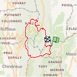
Tocht Stappen van 14,6 km beschikbaar op Auvergne-Rhône-Alpes, Haute-Savoie, Massingy. Deze tocht wordt voorgesteld door HERRY.
Beschrijving
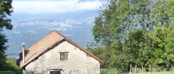
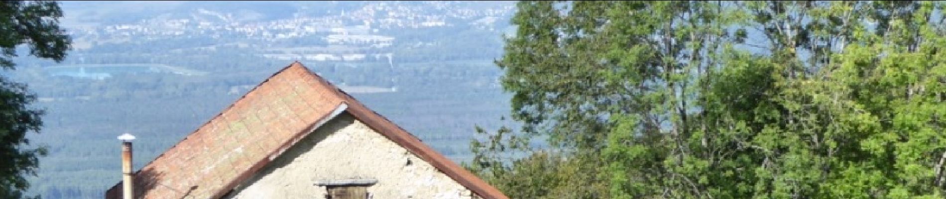
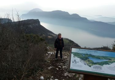
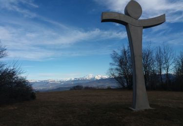
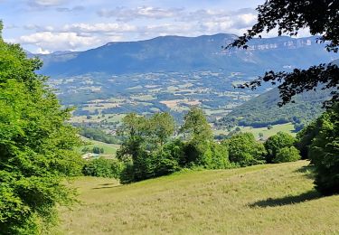
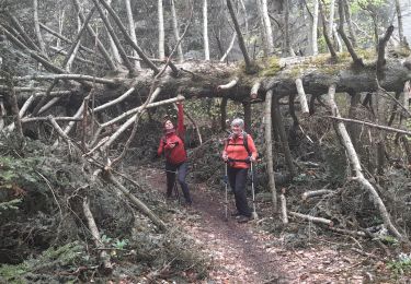
Jolie Rando avec bonne signalétique.Se garer en haut de Pringy un peu avant les dernières maisons ( parking aménagé). Monter jusqu'au Point1 ,ensuite il faut suivre la route jusqu'à la bifurcation Point2.Rejoindre le hameau de Rojut et n'oubliez pas de vous arrêter au four à Pain.Suivre ensuite la direction croix du clergeon pour admirer le Mont-Blanc et les autres massifs. Redescendre pour rejoindre le col du clergeon. Suivre un moment la route puis prendre le chemin (Point3) qui nous ramène au point de départ
Plaatsbepaling
Opmerkingen
Wandeltochten in de omgeving
![Tocht Stappen Chindrieux - Sur les Pas des Huguenots - Chindrieux - Serrières en Chautagne - Photo](https://media.geolcdn.com/t/375/260/ext.jpg?maxdim=2&url=https%3A%2F%2Fservices.sitytrail.com%2FGeolivesWS%2FDownloadMedia.ashx%3FTrailID%3D129664%26Media%3D13193_3.jpg)
![Stappen Stappen](https://static1.geolcdn.com/sitytour/trail-icons/101.png)
Stappen
![](/images/other/stat-length.png)
![](https://static1.geolcdn.com/siteimages/upload/files/16400158638029165_repeat_loop_refresh_sync_direction_icon.png)
![Tocht Stappen Entrelacs - SAPENAY / CLERGEON: GRANDE CUVE - Photo](https://media.geolcdn.com/t/375/260/81ea709e-f7b9-477c-93c3-923ab4e12c63.jpg&format=jpg&maxdim=2)
![Stappen Stappen](https://static1.geolcdn.com/sitytour/trail-icons/101.png)
Stappen
![](/images/other/stat-length.png)
![](https://static1.geolcdn.com/siteimages/upload/files/16400158638029165_repeat_loop_refresh_sync_direction_icon.png)
![Tocht Stappen Chindrieux - SAPENAY / CLERGEON: COL DU SAPENAY - ROJUX - GRANDE CUVE - MONTCLERGEON - Photo](https://media.geolcdn.com/t/375/260/ec0fabdb-a998-4b52-ac46-d11021fde1e5.jpg&format=jpg&maxdim=2)
![Stappen Stappen](https://static1.geolcdn.com/sitytour/trail-icons/101.png)
Stappen
![](/images/other/stat-length.png)
![](https://static1.geolcdn.com/siteimages/upload/files/16400158638029165_repeat_loop_refresh_sync_direction_icon.png)
![Tocht Stappen Entrelacs - SAPENAY: MONTAGNE DE CESSENS - Photo](https://media.geolcdn.com/t/375/260/cae53790-ce06-4ff8-a857-f0d1206d4970.jpg&format=jpg&maxdim=2)
![Stappen Stappen](https://static1.geolcdn.com/sitytour/trail-icons/101.png)
Stappen
![](/images/other/stat-length.png)
![](https://static1.geolcdn.com/siteimages/upload/files/16400158638029165_repeat_loop_refresh_sync_direction_icon.png)
![Tocht Stappen Chindrieux - SAPENAY / CLERGEON: COL DU SAPENAY - MONTCLERGEON PAR LE SENTIER DES VACHES (en live) - Photo](https://media.geolcdn.com/t/375/260/3c03cb4b-fb8a-4c79-83a1-ad8f3ccbc05c.jpg&format=jpg&maxdim=2)
![Stappen Stappen](https://static1.geolcdn.com/sitytour/trail-icons/101.png)
Stappen
![](/images/other/stat-length.png)
![](https://static1.geolcdn.com/siteimages/upload/files/16400158638029165_repeat_loop_refresh_sync_direction_icon.png)
![Tocht Stappen Entrelacs - SAPENAY / CLERGEON: COL DU SAPENAY - GRANDE CUVE directissime - Photo](https://media.geolcdn.com/t/375/260/410c440e-545c-4327-974f-255c4304a936.jpg&format=jpg&maxdim=2)
![Stappen Stappen](https://static1.geolcdn.com/sitytour/trail-icons/101.png)
Stappen
![](/images/other/stat-length.png)
![](https://static1.geolcdn.com/siteimages/upload/files/16400158638029165_repeat_loop_refresh_sync_direction_icon.png)
![Tocht Stappen Ruffieux - Montclergeon - Photo](https://media.geolcdn.com/t/375/260/ext.jpg?maxdim=2&url=https%3A%2F%2Fstatic1.geolcdn.com%2Fsiteimages%2Fupload%2Ffiles%2F1553511878bg_sport_marche.png)
![Stappen Stappen](https://static1.geolcdn.com/sitytour/trail-icons/101.png)
Stappen
![](/images/other/stat-length.png)
![](https://static1.geolcdn.com/siteimages/upload/files/16400158638029165_repeat_loop_refresh_sync_direction_icon.png)
![Tocht Stappen Entrelacs - cessens tours cesar - Photo](https://media.geolcdn.com/t/375/260/421e76c6-fc99-47f3-bba3-d048c29662e0.jpg&format=jpg&maxdim=2)
![Stappen Stappen](https://static1.geolcdn.com/sitytour/trail-icons/101.png)
Stappen
![](/images/other/stat-length.png)
![](https://static1.geolcdn.com/siteimages/upload/files/16400158638029165_repeat_loop_refresh_sync_direction_icon.png)
![Tocht Stappen Chindrieux - SAPENAY - CLERGEON - GRANDE CUVE - GROS FOUG : 22 km - Photo](https://media.geolcdn.com/t/375/260/c64dae54-babd-4a7d-a295-709ed3aa140e.jpg&format=jpg&maxdim=2)
![Stappen Stappen](https://static1.geolcdn.com/sitytour/trail-icons/101.png)
Stappen
![](/images/other/stat-length.png)
![](https://static1.geolcdn.com/siteimages/upload/files/16400158638029165_repeat_loop_refresh_sync_direction_icon.png)