Tocht Mountainbike Leubringhen - Terre des deux caps variante VTT 2 - Photo

Terre des deux caps variante VTT 2

 Baltykatt
Baltykatt

Gebruiker

© OpenStreetMap contributors
Lengte
Lengte
36 km
Max. hoogte
Max. hoogte
138 m
Positief hoogteverschil
478 m
Km-Effort
Km-Effort  
42 km
Min. hoogte
Min. hoogte
17 m
Negatief hoogteverschil
472 m
Boucle
Boucle
Ja
Datum van aanmaak :
2015-09-04 00:00:00.0
Laatste wijziging :
2015-09-04 00:00:00.0

(1 Bericht)

Mountainbike
Mountainbike
2h50
Moeilijkheid : Medium

Scan deze QR-code om de tocht te openen in de SityTrail-applicatie

Gratisgps-wandelapplicatie

Logo SityTrail SityTrail

IGN / Geografische instituten

SityTrail uit de App Store downloaden SityTrail uit Google Play downloaden

Logo SityTrail SityTrail World

De wereld gaat voor u open

SityTrail uit de App Store downloaden SityTrail uit Google Play downloaden SityTrail op Huawei AppGallery downloaden

Over ons

Tocht Mountainbike van 36 km beschikbaar op Hauts-de-France, Pas-de-Calais, Leubringhen. Deze tocht wordt voorgesteld door Baltykatt.

Beschrijving

Départ Leubringhen.

Hoogteprofiel

Plaatsbepaling

Land:
France
Regio :
Hauts-de-France
Departement/Provincie :
Pas-de-Calais
Gemeente :
Leubringhen
Locatie:
Unknown
Vertrek:(Dec)
Vertrek:(UTM)
410029 ; 5634885 (31U) N.

Opmerkingen

Gelieve in te loggen om een commentaar of een beoordeling achter te laten


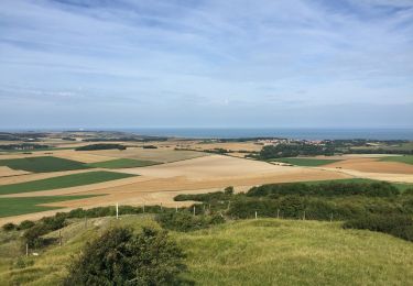
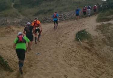
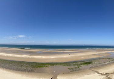
Vue magnifique sur le site des deux caps et les côtes anglaises.Difficile pour le dénivelé.


Wandeltochten in de omgeving

Tocht Stappen Witzand - Wissant-Mont de Couple- retour par la plage - Photo
Stappen
Vagabond gaumardennais

Stappen

Moeilijk
(1)
Witzand, Hauts-de-France, Pas-de-Calais, France
14,3 km | 0 m-effort
2h 53min
Ja
Tocht Stappen Witzand - Le Fartz - Photo
Stappen
terminio

Stappen

Heel gemakkelijk
(1)
Witzand, Hauts-de-France, Pas-de-Calais, France
5,5 km | 6,2 km-effort
1h 29min
Ja
Tocht Stappen Tardinghen - Sentier du Fartz - Waissant - Photo
Stappen
tracegps

Stappen

Gemakkelijk
(1)
Tardinghen, Hauts-de-France, Pas-de-Calais, France
5,1 km | 5,8 km-effort
1h 30min
Ja
Tocht Stappen Witzand - Le Site des 2 Caps - Le Sentier du Phartz et de la Dune d'Aval - Photo
Stappen
GUIDE
Desrumaux

Stappen

Gemakkelijk
(3)
Witzand, Hauts-de-France, Pas-de-Calais, France
7,4 km | 8,3 km-effort
1h 50min
Ja
Tocht Stappen Witzand - 20240719 - TOTEMUS Wissant - 4.9 Km - Photo
Stappen
GUIDE
pierreh01

Stappen

Gemakkelijk
Witzand, Hauts-de-France, Pas-de-Calais, France
4,9 km | 5,6 km-effort
2h 26min
Ja
Tocht Stappen Witzand - Le sentier du Fartz - Photo
Stappen
GUIDE
mumu.larandonneuse

Stappen

Medium
Witzand, Hauts-de-France, Pas-de-Calais, France
5,5 km | 6,2 km-effort
1h 28min
Ja
Tocht Lopen Witzand - trail de la côte d'opale  - Photo
Lopen
jacquespier

Lopen

Heel gemakkelijk
(1)
Witzand, Hauts-de-France, Pas-de-Calais, France
46 km | 54 km-effort
6h 11min
Neen
Tocht Stappen Witzand - Wissant Cap Gris Nez Batterie Todt 23 km - Photo
Stappen
GUIDE
rvapeldo

Stappen

Medium
Witzand, Hauts-de-France, Pas-de-Calais, France
23 km | 26 km-effort
6h 11min
Neen
Tocht Stappen Witzand - Les caps blanc nez: le petit et le grand - Photo
Stappen
philippe.vdv

Stappen

Moeilijk
Witzand, Hauts-de-France, Pas-de-Calais, France
14 km | 16,2 km-effort
3h 41min
Ja


Sluiten
Mijn abonnementen