![](/images/other/stat-length.png)
![Tocht Stappen Albussac - Les cascades de Murel - Photo](https://media.geolcdn.com/t/1900/400/ext.pjpeg?maxdim=2&url=https%3A%2F%2Fstatic1.geolcdn.com%2Fsiteimages%2Fupload%2Ffiles%2F1553511878bg_sport_marche.png)
Les cascades de Murel
grageot
Gebruiker
![Lengte](/images/other/stat-length.png)
Lengte
8,1 km
![Max. hoogte](https://static1.geolcdn.com/siteimages/upload/files/1508320355ic_sort_altitude_max_24dp.png)
Max. hoogte
420 m
![Positief hoogteverschil](https://static1.geolcdn.com/siteimages/upload/files/1508320355ic_sort_den_pos_24dp.png)
Positief hoogteverschil
244 m
![Km-Effort](/images/other/stat-length.png)
Km-Effort
11,3 km
![Min. hoogte](https://static1.geolcdn.com/siteimages/upload/files/1508320355ic_sort_altitude_min_24dp.png)
Min. hoogte
266 m
![Negatief hoogteverschil](https://static1.geolcdn.com/siteimages/upload/files/1508320355ic_sort_den_neg_24dp.png)
Negatief hoogteverschil
245 m
![Boucle](https://static1.geolcdn.com/siteimages/upload/files/16400158638029165_repeat_loop_refresh_sync_direction_icon.png)
Boucle
Ja
Datum van aanmaak :
2015-09-03 00:00:00.0
Laatste wijziging :
2015-09-03 00:00:00.0
![Stappen](https://static1.geolcdn.com/sitytour/trail-icons/101.png)
2h30
Moeilijkheid : Medium
![Scan deze QR-code om de tocht te openen in de SityTrail-applicatie](https://capi.geolives.com/qq0zvz2zws4bq2lad0pu/sitytour/trails/467664/qr.png?size=200)
Gratisgps-wandelapplicatie
Over ons
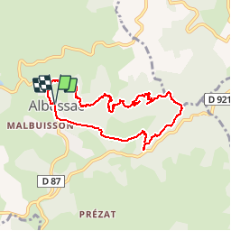
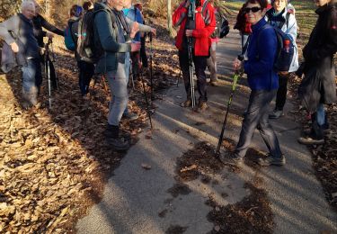
Tocht Stappen van 8,1 km beschikbaar op Nieuw-Aquitanië, Corrèze, Albussac. Deze tocht wordt voorgesteld door grageot.
Beschrijving
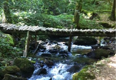
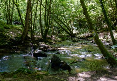
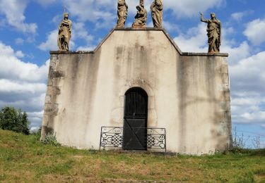
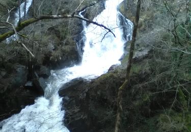
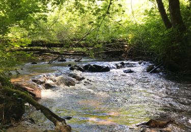
les 2 gorges au départ d Albussac - le parcours 14 de l'asso "Bol d'Air" d'Argentat -une belle balade aux fond des gorges. Bien balisé.
Plaatsbepaling
Land:
France
Regio :
Nieuw-Aquitanië
Departement/Provincie :
Corrèze
Gemeente :
Albussac
Locatie:
Unknown
Vertrek:(Dec)
Vertrek:(UTM)
408433 ; 4999128 (31T) N.
Opmerkingen
Wandeltochten in de omgeving
![Tocht Stappen Albussac - Les 3 Cascades de Murel - Photo](https://media.geolcdn.com/t/375/260/ext.jpg?maxdim=2&url=https%3A%2F%2Fservices.sitytrail.com%2FGeolivesWS%2FDownloadMedia.ashx%3FTrailID%3D143559%26Media%3D20120803102704.jpg)
![Stappen Stappen](https://static1.geolcdn.com/sitytour/trail-icons/101.png)
Les 3 Cascades de Murel
Stappen
Medium
(6)
Albussac,
Nieuw-Aquitanië,
Corrèze,
France
![](/images/other/stat-length.png)
9,5 km | 13,1 km-effort
3h 26min
![](https://static1.geolcdn.com/siteimages/upload/files/16400158638029165_repeat_loop_refresh_sync_direction_icon.png)
Ja
![Tocht Lopen Albussac - Albussac - Saint-Chamant - Forges - Photo](https://media.geolcdn.com/t/375/260/ext.jpg?maxdim=2&url=https%3A%2F%2Fstatic1.geolcdn.com%2Fsiteimages%2Fupload%2Ffiles%2F1524743154running.jpg)
![Lopen Lopen](https://static1.geolcdn.com/sitytour/trail-icons/103.png)
Albussac - Saint-Chamant - Forges
Lopen
Medium
(1)
Albussac,
Nieuw-Aquitanië,
Corrèze,
France
![](/images/other/stat-length.png)
22 km | 31 km-effort
Onbekend
![](https://static1.geolcdn.com/siteimages/upload/files/16400158638029165_repeat_loop_refresh_sync_direction_icon.png)
Ja
![Tocht Stappen Albussac - cascades de murel - Photo](https://media.geolcdn.com/t/375/260/98ac58dd-d3c6-439b-aa7c-906dba7ca9b5.jpg&format=jpg&maxdim=2)
![Stappen Stappen](https://static1.geolcdn.com/sitytour/trail-icons/101.png)
cascades de murel
Stappen
Gemakkelijk
Albussac,
Nieuw-Aquitanië,
Corrèze,
France
![](/images/other/stat-length.png)
3,8 km | 5,9 km-effort
1h 50min
![](https://static1.geolcdn.com/siteimages/upload/files/16400158638029165_repeat_loop_refresh_sync_direction_icon.png)
Ja
![Tocht Stappen Forgès - Fred forges - Photo](https://media.geolcdn.com/t/375/260/54ce3406-8658-4891-814e-b83b5038c967.jpg&format=jpg&maxdim=2)
![Stappen Stappen](https://static1.geolcdn.com/sitytour/trail-icons/101.png)
Fred forges
Stappen
Moeilijk
Forgès,
Nieuw-Aquitanië,
Corrèze,
France
![](/images/other/stat-length.png)
10,7 km | 15,8 km-effort
3h 36min
![](https://static1.geolcdn.com/siteimages/upload/files/16400158638029165_repeat_loop_refresh_sync_direction_icon.png)
Ja
![Tocht Stappen Ménoire - menoir 2 - Photo](https://media.geolcdn.com/t/375/260/3eec4932-8ad6-49f8-89d5-a2c1696554cb.jpg&format=jpg&maxdim=2)
![Stappen Stappen](https://static1.geolcdn.com/sitytour/trail-icons/101.png)
menoir 2
Stappen
Moeilijk
Ménoire,
Nieuw-Aquitanië,
Corrèze,
France
![](/images/other/stat-length.png)
11,3 km | 14,8 km-effort
3h 18min
![](https://static1.geolcdn.com/siteimages/upload/files/16400158638029165_repeat_loop_refresh_sync_direction_icon.png)
Ja
![Tocht Te voet Forgès - La cascade de Murel - Photo](https://media.geolcdn.com/t/375/260/682f60eb-768e-409c-8df4-2823a9c63699.jpg&format=jpg&maxdim=2)
![Te voet Te voet](https://static1.geolcdn.com/sitytour/trail-icons/100.png)
La cascade de Murel
Te voet
Moeilijk
Forgès,
Nieuw-Aquitanië,
Corrèze,
France
![](/images/other/stat-length.png)
9,8 km | 13,4 km-effort
3h 0min
![](https://static1.geolcdn.com/siteimages/upload/files/16400158638029165_repeat_loop_refresh_sync_direction_icon.png)
Ja
![Tocht Stappen Albussac - Cascades de Murel - Photo](https://media.geolcdn.com/t/375/260/9de5ec32-1db2-4dfc-be1d-8a7c2b28803f.jpg&format=jpg&maxdim=2)
![Stappen Stappen](https://static1.geolcdn.com/sitytour/trail-icons/101.png)
Cascades de Murel
Stappen
Medium
Albussac,
Nieuw-Aquitanië,
Corrèze,
France
![](/images/other/stat-length.png)
8,3 km | 11,5 km-effort
3h 3min
![](https://static1.geolcdn.com/siteimages/upload/files/16400158638029165_repeat_loop_refresh_sync_direction_icon.png)
Ja
![Tocht Stappen Neuville - Neuville---Puy-Brezou---VTT-2 - Photo](https://media.geolcdn.com/t/375/260/ext.jpg?maxdim=2&url=https%3A%2F%2Fstatic1.geolcdn.com%2Fsiteimages%2Fupload%2Ffiles%2F1553511878bg_sport_marche.png)
![Stappen Stappen](https://static1.geolcdn.com/sitytour/trail-icons/101.png)
Neuville---Puy-Brezou---VTT-2
Stappen
Moeilijk
Neuville,
Nieuw-Aquitanië,
Corrèze,
France
![](/images/other/stat-length.png)
11 km | 14,2 km-effort
3h 13min
![](https://static1.geolcdn.com/siteimages/upload/files/16400158638029165_repeat_loop_refresh_sync_direction_icon.png)
Ja
![Tocht Stappen Albussac - t265473269_cascades de murel - Photo](https://media.geolcdn.com/t/375/260/ext.jpg?maxdim=2&url=https%3A%2F%2Fstatic1.geolcdn.com%2Fsiteimages%2Fupload%2Ffiles%2F1553511878bg_sport_marche.png)
![Stappen Stappen](https://static1.geolcdn.com/sitytour/trail-icons/101.png)
t265473269_cascades de murel
Stappen
Moeilijk
Albussac,
Nieuw-Aquitanië,
Corrèze,
France
![](/images/other/stat-length.png)
10,1 km | 14,4 km-effort
3h 16min
![](https://static1.geolcdn.com/siteimages/upload/files/16400158638029165_repeat_loop_refresh_sync_direction_icon.png)
Ja