Tocht Stappen Formiguères - Vallée de la Lladure(Formiguères) - Photo

Vallée de la Lladure(Formiguères)

 Machaon6
Machaon6

Gebruiker

© OpenStreetMap contributors
Lengte
Lengte
15,7 km
Max. hoogte
Max. hoogte
1873 m
Positief hoogteverschil
331 m
Km-Effort
Km-Effort  
20 km
Min. hoogte
Min. hoogte
1589 m
Negatief hoogteverschil
332 m
Boucle
Boucle
Ja
Datum van aanmaak :
2015-08-24 00:00:00.0
Laatste wijziging :
2015-08-24 00:00:00.0

(0 Bericht)

Stappen
Stappen
4h19
Moeilijkheid : Medium

Scan deze QR-code om de tocht te openen in de SityTrail-applicatie

Gratisgps-wandelapplicatie

Logo SityTrail SityTrail

IGN / Geografische instituten

SityTrail uit de App Store downloaden SityTrail uit Google Play downloaden

Logo SityTrail SityTrail World

De wereld gaat voor u open

SityTrail uit de App Store downloaden SityTrail uit Google Play downloaden SityTrail op Huawei AppGallery downloaden

Over ons

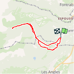
Tocht Stappen van 15,7 km beschikbaar op Occitanië, Pyrénées-Orientales, Formiguères. Deze tocht wordt voorgesteld door Machaon6.

Beschrijving

Vallée jusqu'à "La Bassete"par le refuge(non gardé)de la Lladure

Hoogteprofiel

Plaatsbepaling

Land:
France
Regio :
Occitanië
Departement/Provincie :
Pyrénées-Orientales
Gemeente :
Formiguères
Locatie:
Unknown
Vertrek:(Dec)
Vertrek:(UTM)
424893 ; 4717692 (31T) N.

Wandeltochten in de omgeving

Tocht Sneeuwschoenen Les Angles - Lac d Aude -Refuge Bernardi les Angles - Photo
Sneeuwschoenen
MarieFrancoise

Sneeuwschoenen

Medium
(1)
Les Angles, Occitanië, Pyrénées-Orientales, France
13,9 km | 19,1 km-effort
5h 44min
Ja
Tocht Sneeuwschoenen Réal - madres - Photo
Sneeuwschoenen
mongo

Sneeuwschoenen

Moeilijk
(1)
Réal, Occitanië, Pyrénées-Orientales, France
13,1 km | 26 km-effort
6h 48min
Ja
Tocht Stappen Les Angles - lac d'Aude  - Photo
Stappen
GUIDE
nadinebondoux

Stappen

Medium
Les Angles, Occitanië, Pyrénées-Orientales, France
13,8 km | 0 m-effort
5h 57min
Ja
Tocht Stappen Les Angles - Lac d'Aude en boucle - Photo
Stappen
GUIDE
nadinebondoux

Stappen

Medium
Les Angles, Occitanië, Pyrénées-Orientales, France
13,8 km | 19,9 km-effort
6h 8min
Ja
Tocht Stappen Les Angles - les Angles - Photo
Stappen
GUIDE
nadinebondoux

Stappen

Moeilijk
Les Angles, Occitanië, Pyrénées-Orientales, France
14,5 km | 20 km-effort
4h 58min
Neen
Tocht Stappen Formiguères - Les Camporells par la Lladure  - Photo
Stappen
jcmartin

Stappen

Medium
(1)
Formiguères, Occitanië, Pyrénées-Orientales, France
15,1 km | 24 km-effort
5h 7min
Ja
Tocht Sneeuwschoenen Les Angles - lac d aude - Photo
Sneeuwschoenen
xav34830

Sneeuwschoenen

Heel gemakkelijk
(2)
Les Angles, Occitanië, Pyrénées-Orientales, France
14,5 km | 20 km-effort
Onbekend
Ja
Tocht Stappen Les Angles - boucle de la Balmette par le mont Llaret et le roc d'aude - Photo
Stappen
Axelloceane

Stappen

Medium
(2)
Les Angles, Occitanië, Pyrénées-Orientales, France
17,2 km | 28 km-effort
Onbekend
Ja
Tocht sport Formiguères - 20240728 Station Formiguères - Camporeils - Photo
sport
ThonyM

sport

Heel gemakkelijk
Formiguères, Occitanië, Pyrénées-Orientales, France
16 km | 27 km-effort
Onbekend
Ja


Sluiten
Mijn abonnementen