


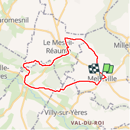

9,3 km | 12,2 km-effort


Gebruiker


Gratisgps-wandelapplicatie
 SityTrail
IGN / Geografische instituten
SityTrail World
De wereld gaat voor u open
Tocht Stappen van 12,6 km beschikbaar op Normandië, Seine-Maritime, Melleville. Deze tocht wordt voorgesteld door Brindille.
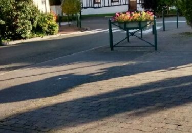
Départ de la place de l'église de Melleville, laisser l'église derrière et traverser la place en direction de la petite route qui mène à Millebosc


Te voet

Stappen
Stappen

Stappen

Stappen
Stappen

Paard

Mountainbike

Stappen