


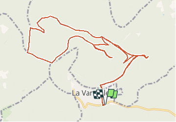

18,4 km | 27 km-effort


Gebruiker


Gratisgps-wandelapplicatie
 SityTrail
IGN / Geografische instituten
SityTrail World
De wereld gaat voor u open
Tocht Paard van 14,4 km beschikbaar op Grand Est, Bas-Rhin, La Vancelle. Deze tocht wordt voorgesteld door cavaliersdurieds.
Départ La Vancelle
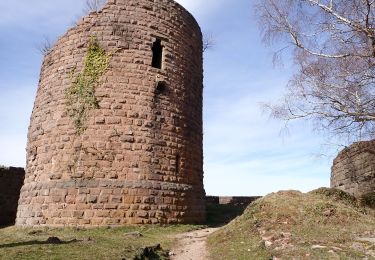
Arrivé au château du Frankenbourg
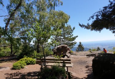
Passage au rocher du Coucou
Passage à la roche des Fées
et au Rondes Roches

Mountainbike

Stappen

Stappen
Stappen
Stappen

Stappen

Stappen
Stappen
Stappen