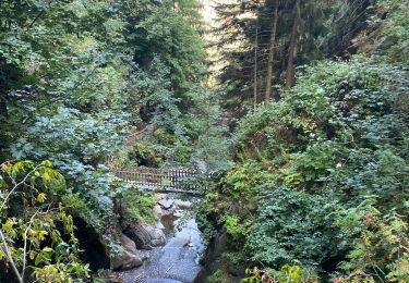
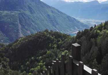
Tocht Stappen Dorénaz -  - Photo
 labrune
labrune

Gebruiker

© OpenStreetMap contributors
Lengte
Lengte
13,4 km
Max. hoogte
Max. hoogte
2450 m
Positief hoogteverschil
1086 m
Km-Effort
Km-Effort  
28 km
Min. hoogte
Min. hoogte
1545 m
Negatief hoogteverschil
1093 m
Boucle
Boucle
Ja
Datum van aanmaak :
2014-12-10 00:00:00.0
Laatste wijziging :
2014-12-10 00:00:00.0

(0 Bericht)

Stappen
Stappen
5h30
Moeilijkheid : Onbekend

Scan deze QR-code om de tocht te openen in de SityTrail-applicatie

Gratisgps-wandelapplicatie

Logo SityTrail SityTrail

IGN / Geografische instituten

SityTrail uit de App Store downloaden SityTrail uit Google Play downloaden

Logo SityTrail SityTrail World

De wereld gaat voor u open

SityTrail uit de App Store downloaden SityTrail uit Google Play downloaden SityTrail op Huawei AppGallery downloaden

Over ons

Tocht Stappen van 13,4 km beschikbaar op Valais/Wallis, Saint-Maurice, Dorénaz. Deze tocht wordt voorgesteld door labrune.

Beschrijving

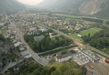
Laisser la voiture dans le virage, point :  571196 / 111798  , 100 m plus loin il y a un panneau interdiction de circuler.
Direction Sud, 120 m (1554) monter direction Au d''Alesse - cabane du Scex Carro - point 2214 tourner à droite - le Diabley - cabane du Demècre - lac supérieur de Fully - cabane de Sorniot - Portail de Fully - Au d''Alesse - redescendu par la route en passant à côté des anciennes mines.
5h30  de marche effective

Hoogteprofiel

POI's

POI Dorénaz - Point 2214  - Photo
labrune
DORÉNAZ 
POI Fully - Cabane du Demècre - Photo
labrune
POI Fully - Cabane de Sorniot - Photo
labrune
POI Dorénaz - Portail de Fully - Photo
labrune
POI Dorénaz - Cabane Scex Carro - Photo
labrune
POI Dorénaz - poi_231773 - Photo
labrune
DORÉNAZ 
POI Dorénaz - poi_252405 - Photo
labrune
DORÉNAZ 

Plaatsbepaling

Land:
Switzerland
Regio :
Valais/Wallis
Departement/Provincie :
Saint-Maurice
Gemeente :
Dorénaz
Locatie:
Unknown
Vertrek:(Dec)
Vertrek:(UTM)
350654 ; 5113314 (32T) N.

Wandeltochten in de omgeving

Tocht Te voet Martigny - Géoglyphe de Grande Tête - Photo
Te voet
GUIDE+

Te voet

Gemakkelijk
Martigny, Valais/Wallis, Martigny, Switzerland
3,8 km | 4,5 km-effort
1h 0min
Neen
Tocht Te voet Evionnaz - Chemin pédestre, région Martigny - Photo
Te voet
GUIDE+

Te voet

Gemakkelijk
Evionnaz, Valais/Wallis, Saint-Maurice, Switzerland
14,3 km | 17,1 km-effort
3h 52min
Neen
Tocht Te voet Salvan - Tour du Vallon de Van - Photo
Te voet
GUIDE+

Te voet

Gemakkelijk
Salvan, Valais/Wallis, Saint-Maurice, Switzerland
6,7 km | 11,3 km-effort
2h 34min
Ja
Tocht Stappen Dorénaz - le Diabley  - Photo
Stappen
reneperrin

Stappen

Medium
Dorénaz, Valais/Wallis, Saint-Maurice, Switzerland
13,3 km | 31 km-effort
4h 36min
Ja
Tocht Stappen Salvan - Les gorges à Martigny - Photo
Stappen
thierry.berthouze

Stappen

Moeilijk
Salvan, Valais/Wallis, Saint-Maurice, Switzerland
10,5 km | 17,7 km-effort
2h 34min
Neen
Tocht Stappen Salvan - Sentier Nature - Rochers du Soir - Photo
Stappen
GUIDE+

Stappen

Heel gemakkelijk
Salvan, Valais/Wallis, Saint-Maurice, Switzerland
3,6 km | 6 km-effort
Onbekend
Ja
Tocht Stappen Salvan - Gorges du Dailley - marmites glacières 23.05.17 - Photo
Stappen
duamerg

Stappen

Medium
Salvan, Valais/Wallis, Saint-Maurice, Switzerland
8,1 km | 14,8 km-effort
3h 9min
Ja
Tocht Stappen Dorénaz - Sex Carro - Photo
Stappen
jipi2

Stappen

Medium
Dorénaz, Valais/Wallis, Saint-Maurice, Switzerland
9,5 km | 24 km-effort
4h 50min
Ja
Tocht Lopen Fully - fully - Photo
Lopen
mikaelerouzic

Lopen

Zeer moeilijk
Fully, Valais/Wallis, Martigny, Switzerland
7,4 km | 21 km-effort
1h 47min
Ja


Sluiten
Mijn abonnementen