


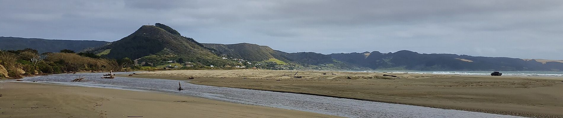
Te Araroa - 01 Northland - b Ahipara to Puketi Recreation Centre, Waiare Rd

SityTrail - itinéraires balisés pédestres
Tous les sentiers balisés d’Europe GUIDE+
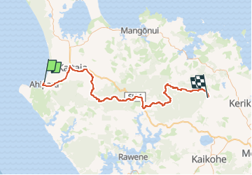

Lengte
106 km

Max. hoogte
735 m

Positief hoogteverschil
2611 m
Km-Effort
139 km

Min. hoogte
4 m

Negatief hoogteverschil
2267 m
Boucle
Neen

Markering
Datum van aanmaak :
2025-02-07 19:23:17.528
Laatste wijziging :
2025-02-07 19:23:17.528
31h39
Moeilijkheid : Zeer moeilijk

Gratisgps-wandelapplicatie
 SityTrail
IGN / Geografische instituten
SityTrail World
De wereld gaat voor u open
Over ons
Tocht Te voet van 106 km beschikbaar op Northland, Far North District, Te Hiku Community. Deze tocht wordt voorgesteld door SityTrail - itinéraires balisés pédestres.
Beschrijving
Foto's


Plaatsbepaling
Land:
New Zealand
Regio :
Northland
Departement/Provincie :
Far North District
Gemeente :
Te Hiku Community
Locatie:
Unknown
Vertrek:(Dec)
Vertrek:(UTM)
696462 ; 6107212 (59H) Z.
Opmerkingen
Wandeltochten in de omgeving